Cluster · Almaty
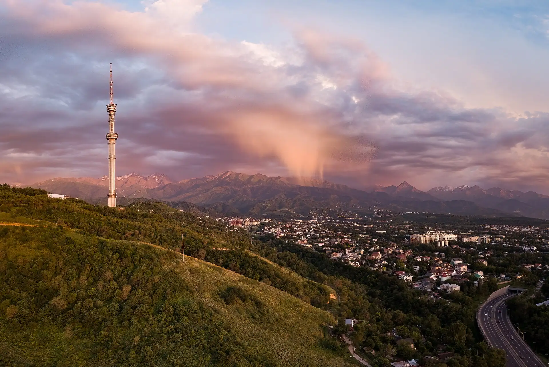
Kök Tobe hill
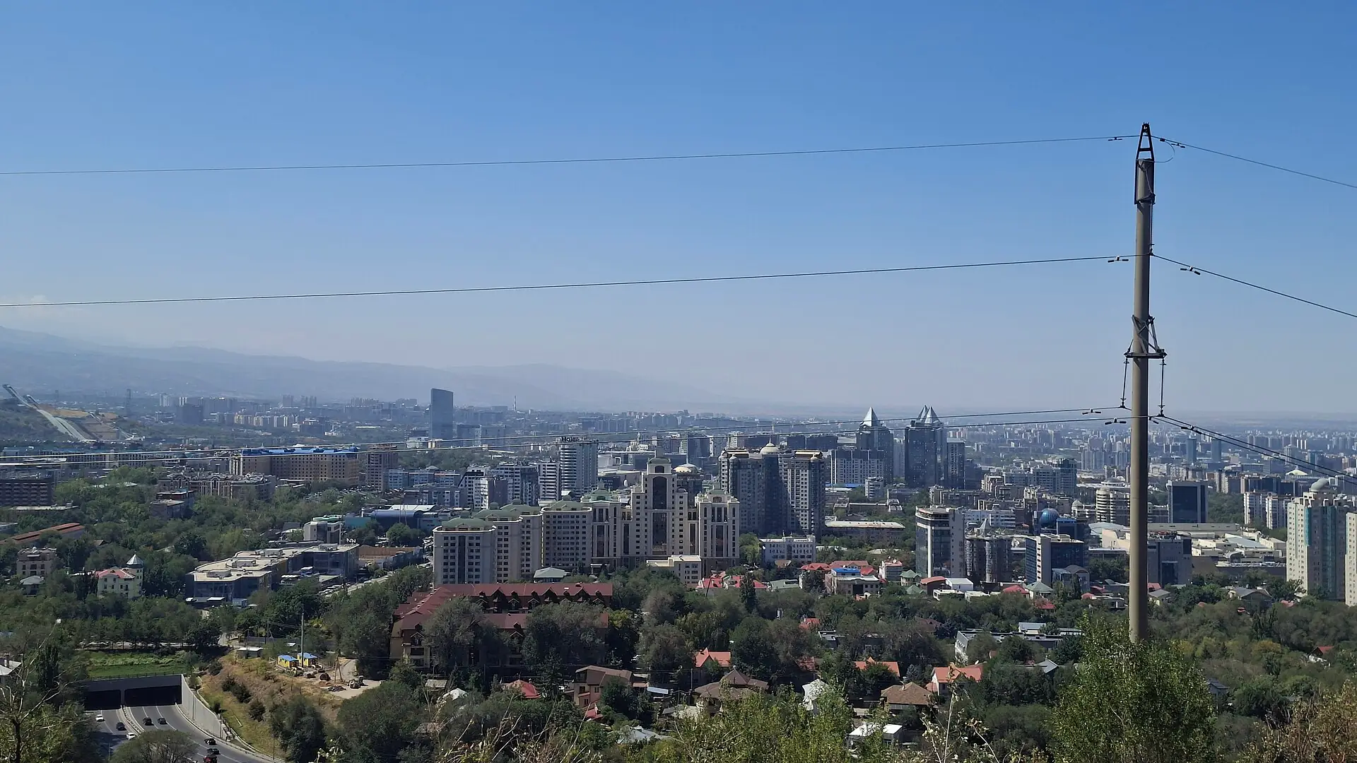
Sunset cluster: cable car up Kök Tobe, view over the city, then walk down the paved path or take the car back; check wind, and the cable car stops in bad weather.
Key facts
- 28″ bags
- forbidden
- Time budget
- half
- Rescue coverage
- 100% ≤7′
- max p90 5.2′
- Places
- 1
Rules in force · 8Land borders between Central Asian states open and shut w…Pavements in the centre are uneven and icy in winter
- Central Asia ↗Keep every hotel registration slip or its e-registration record until you leave Uzbekistan and Tajikistan; border officers can ask for proof of where you slept and fine gaps.
- Central Asia ↗Land borders between Central Asian states open and shut with politics and demarcation deals; confirm the exact post is open to foreigners the week you cross.
- Kazakhstan ↗Visa-free entry applies to many nationalities, usually up to 30 days; check your own passport on the official government portal before you book, and keep your entry record.
- Kazakhstan ↗Use a ride-hailing app (Yandex Go or inDrive) or the airport rank; do not accept unmarked cars offered in the arrivals hall.
- Kazakhstan ↗Some mountain areas near the Kyrgyz and Chinese borders need a border-zone permit; ask your driver or the park office before you go.
- Almaty Region ↗Check the mountain forecast and the road status on the morning of any mountain trip; cable cars, lake roads and passes close in storms and snow.
- Almaty ↗From November to March pavements are icy: wear shoes with grip, and take a ride-hailed car rather than the hill paths after dark.
- Almaty ↗Pavements in the centre are uneven and icy in winter: large suitcases go from the car to the door, never on a walk.
More
Map to the centre
Add your hotel to get directions from it. · stays in this browser; shared with the pocket card.
Walking weather, next 5 days
Loading forecast…
Forecast: Open-Meteo (CC BY 4.0), model data for this point.
Plan
How the ground walks, and what is here
Bound and physics
The Kök Tobe summit park and the cable car base station on the city side.
- Slope
- steep
- Stairs
- Many steps on the walking path
- Shade
- low
- Surface
- paved park, steep paths
- Sleep here or visit
- visit
On the ground
Where to rest, how to leave, where to sleep nearby
Rescue anchors
A rescue anchor is a spot where you can stop and recover if the walk goes wrong: a bench, a café, a toilet. Every letter on the map is one anchor, and each has a card below. We check that any point in the cluster is within about 7 minutes’ walk of one, so you are never far from somewhere to sit down.
Lettered circles: rescue anchors (green works in any conditions, amber only on hot days). Dashed outline: the cluster. Red dots: spots more than 7 min from any anchor. Drag to move; click the map, then scroll to zoom.
Summit café terrace
Place to sit · Food & drink · Toilet · works in any conditions
Cable car top station
Shelter from rain · Place to sit · Toilet · works in any conditions
Summit park benches
Place to sit · works in any conditions
Cable car base station
Shelter from rain · Toilet · works in any conditions
Summit souvenir arcade
Shelter from rain · Food & drink · works in any conditions
Path midpoint viewpoint benches
Place to sit · works in any conditions
100% of the cluster is within 7 min of an anchor in any conditions (slowest walker, worst cell 5.2 min) · 100% on hot days
Nodes in this cluster
- Go for sunset on a clear day: cable car up, an hour at the top, then the cable car or a ride-hailed car down; check the operating status and wind before you leave the hotel.
Edges out
| To | How | p50 | Climb |
|---|---|---|---|
| Panfilov Park & Zenkov Cathedral | Car north-west | ~15 min | flat |
| Republic Square & museum | Car west | ~12 min | flat |
Red lines here
- Do not walk the cable car route in ice or heavy rain; use the car.
Deep dive
Around this cluster
Straight-line distance; walk time adds 30% for streets.
- ClusterRepublic Square & museumnearest point: Museum garden benches2.1 km · 34 min walk
- PlaceCentral State Museum2.5 km · 41 min walk
- Sleep areaRepublic Square / Abay (south-centre)2.6 km · 42 min walk
- ClusterPanfilov Park & Zenkov Cathedral3.2 km · 53 min walk
- Sleep areaPanfilov / Zhibek Zholy (centre)3.4 km · 54 min walk
- PlacePanfilov Park3.7 km · 59 min walk