Cluster · Mata-Utu
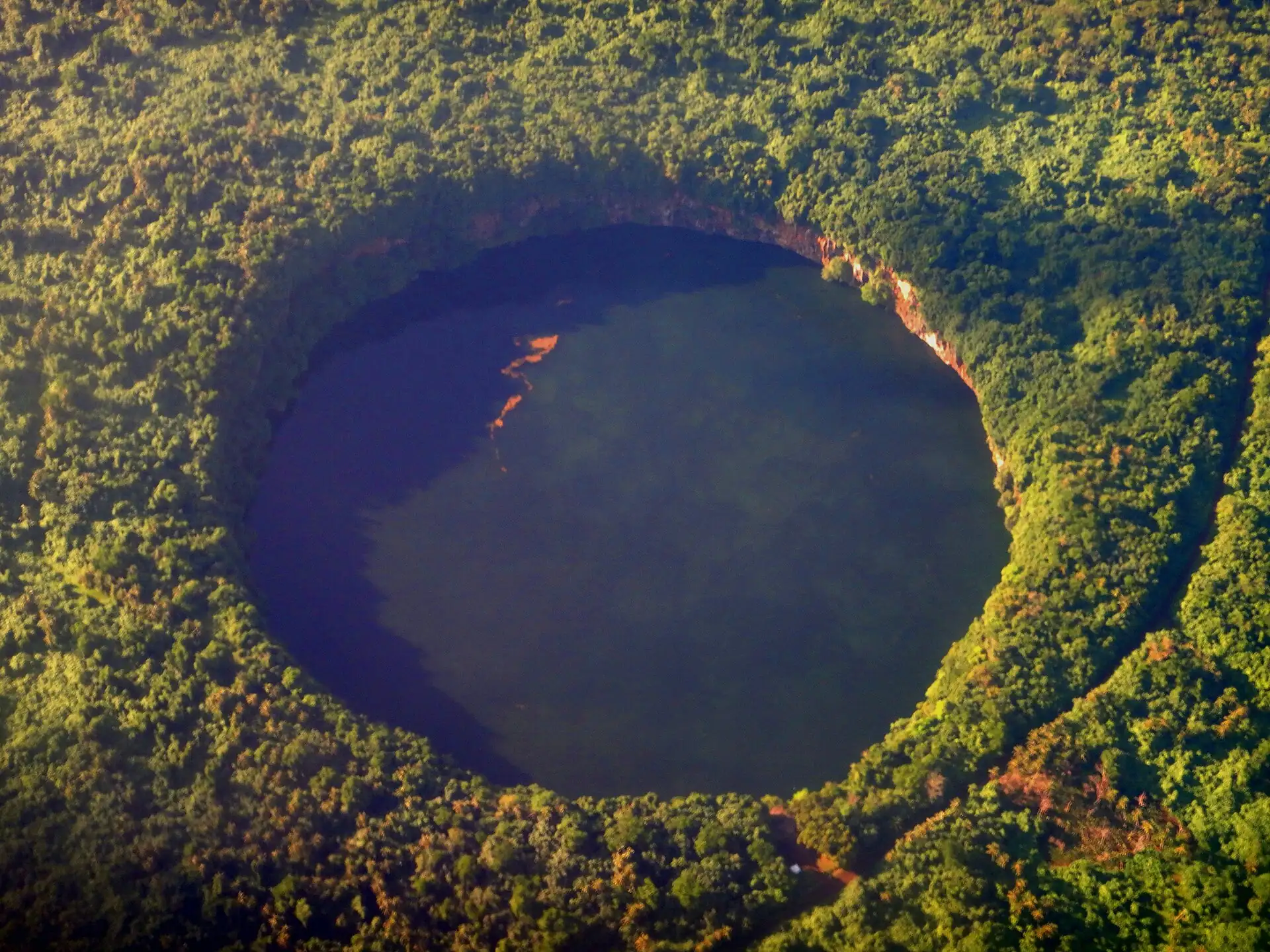
Lake Lalolalo crater
Half-day cluster by car: a deep crater lake south-west of the town; go in the morning and bring water, there is nothing to buy.
Key facts
- 28″ bags
- forbidden
- Time budget
- half
- Rescue coverage
- 100% ≤7′
- max p90 5.5′
- Places
- 2
Rules in force · 8No taxi rank
- Oceania ↗Oceania's island states guard their farms and reefs at the border: tick 'yes' on the arrival card for any food, plant, animal product, soil or used outdoor gear, and let the officer decide.
- Oceania ↗Across the tropical South Pacific, cyclones are possible from November to April: choose insurance that covers weather delays and keep one spare night before a long-haul departure.
- Polynesia ↗In much of Polynesia Sunday is kept for church and family: expect shops, tours and some flights to stop, and dress and behave quietly in villages.
- Wallis and Futuna ↗Entry rules are set by France but separately from Schengen: EU citizens enter freely, other passports should check the French government's rules for Wallis and Futuna, and an onward ticket is required.
- Wallis and Futuna ↗Land belongs to families and customary chiefs: ask before visiting sites, beaches or islets, and respect the kings and their villages.
- Wallis (Uvea) ↗Land belongs to families and customary chiefs: ask before visiting sites, beaches or islets.
- Mata-Utu ↗No taxi rank: bags go from the pre-booked car to the door, never on a walk.
- Mata-Utu ↗Sunday is for Mass and family: almost everything is shut, so buy food on Saturday.
More
Map to the centre
Add your hotel to get directions from it. · stays in this browser; shared with the pocket card.
Walking weather, next 5 days
Loading forecast…
Forecast: Open-Meteo (CC BY 4.0), model data for this point.
Plan
How the ground walks, and what is here
Bound and physics
The crater rim and the track to it (approximate box).
- Slope
- steep
- Stairs
- Rough steps at the rim
- Shade
- medium
- Surface
- track, grass and rough rock
- Sleep here or visit
- visit
On the ground
Where to rest, how to leave, where to sleep nearby
Rescue anchors
A rescue anchor is a spot where you can stop and recover if the walk goes wrong: a bench, a café, a toilet. Every letter on the map is one anchor, and each has a card below. We check that any point in the cluster is within about 7 minutes’ walk of one, so you are never far from somewhere to sit down.
Lettered circles: rescue anchors (green works in any conditions, amber only on hot days). Dashed outline: the cluster. Red dots: spots more than 7 min from any anchor. Drag to move; click the map, then scroll to zoom.
A - Track end parking (field-verify)
Place to sit · Shelter from rain · works in any conditions
B - Rim viewpoint (field-verify)
Place to sit · works in any conditions
C - Track shade (field-verify)
Place to sit · Food & drink · works in any conditions
D - Rim path west (field-verify)
Place to sit · works in any conditions
E - Rim path east (field-verify)
Place to sit · Shelter from rain · works in any conditions
F - Track junction (field-verify)
Food & drink · works in any conditions
100% of the cluster is within 7 min of an anchor in any conditions (slowest walker, worst cell 5.5 min) · 100% on hot days
Nodes in this cluster
- Go by car in the morning: the rim is the view, the walls are steep, and the lake is not for swimming.
- The stone ramparts of a Tongan-era fortress in the south of Wallis: go by car in the morning with your driver, ask permission at the site, and stay on the paths.
Edges out
| To | How | p50 | Climb |
|---|---|---|---|
| Cathedral and royal palace | Car north-east | ~15 min | flat |
Red lines here
- Do not swim in or climb down to the lake: the crater walls are steep and rescue is far.
- Ask the village before you visit: the site is on customary land.
Deep dive
Around this cluster
Straight-line distance; walk time adds 30% for streets.