Cluster · Monrovia
Ducor hill
Short viewpoint stop on the ridge west of the centre, in the morning with a driver.
Key facts
- 28″ bags
- forbidden
- Time budget
- 90m
- Rescue coverage
- 100% ≤7′
- max p90 4.2′
- Places
- 1
- 1 sleep area in reach
Rules in force · 9Nine African countries on this site have no trip line bec…Carry an original yellow fever vaccination certificate on…After dark, use a driver arranged by your hotel, door to …
- Africa ↗When a route touches a yellow-fever country — even a transit of 12 hours or more — keep the original yellow card (ICVP) in your hand luggage; health desks and airlines can refuse boarding or entry without it.
- Africa ↗Nine African countries on this site have no trip line because governments advise against travel; several others have no-go regions. Read your government's advice for every country on the route before paying deposits.
- West Africa ↗Carry an original yellow fever vaccination certificate on any West African trip: several countries on the coast road demand it of every arrival, and the rest demand it after you have passed through a neighbour.
- West Africa ↗Cross land borders and drive between cities in daylight only; plan each crossing as a full travel day with cash for fees and passport copies for checkpoints.
- Liberia ↗Check visa and entry rules for your passport on official Liberian government sources; many nationalities need a visa before travel.
- Liberia ↗Check the yellow-fever vaccination certificate rules for Liberia before you fly.
- Monrovia area ↗Plan road trips for the dry season (about November–April); the rainy season is very wet and roads flood.
- Monrovia ↗After dark, use a driver arranged by your hotel, door to door; do not walk between clusters and keep valuables out of sight.
- Monrovia ↗Book an airport pickup against your flight number before you fly; do not count on finding a licensed taxi late at night.
More
Map to the centre
Add your hotel to get directions from it. · stays in this browser; shared with the pocket card.
Walking weather, next 5 days
Loading forecast…
Forecast: Open-Meteo (CC BY 4.0), model data for this point.
Plan
How the ground walks, and what is here
Bound and physics
The hill road around the former Ducor hotel.
- Slope
- steep
- Stairs
- Few
- Shade
- low
- Surface
- paved road, uneven verge
- Sleep here or visit
- visit
On the ground
Where to rest, how to leave, where to sleep nearby
Rescue anchors
A rescue anchor is a spot where you can stop and recover if the walk goes wrong: a bench, a café, a toilet. Every letter on the map is one anchor, and each has a card below. We check that any point in the cluster is within about 7 minutes’ walk of one, so you are never far from somewhere to sit down.
Lettered circles: rescue anchors (green works in any conditions, amber only on hot days). Dashed outline: the cluster. Red dots: spots more than 7 min from any anchor. Drag to move; click the map, then scroll to zoom.
Ducor hill roadside
Place to sit · Food & drink · works in any conditions
north-west block: shop or café row with seating
Place to sit · works in any conditions
north block: shop or café row with seating
Food & drink · Place to sit · works in any conditions
north-east block: shop or café row with seating
ac · Food & drink · Place to sit · works in any conditions
west block: shop or café row with seating
Place to sit · works in any conditions
east block: shop or café row with seating
Food & drink · ac · works in any conditions
south-west block: shop or café row with seating
Place to sit · Food & drink · works in any conditions
south block: shop or café row with seating
Place to sit · works in any conditions
south-east block: shop or café row with seating
Food & drink · Place to sit · works in any conditions
100% of the cluster is within 7 min of an anchor in any conditions (slowest walker, worst cell 4.2 min) · 100% on hot days
Nodes in this cluster
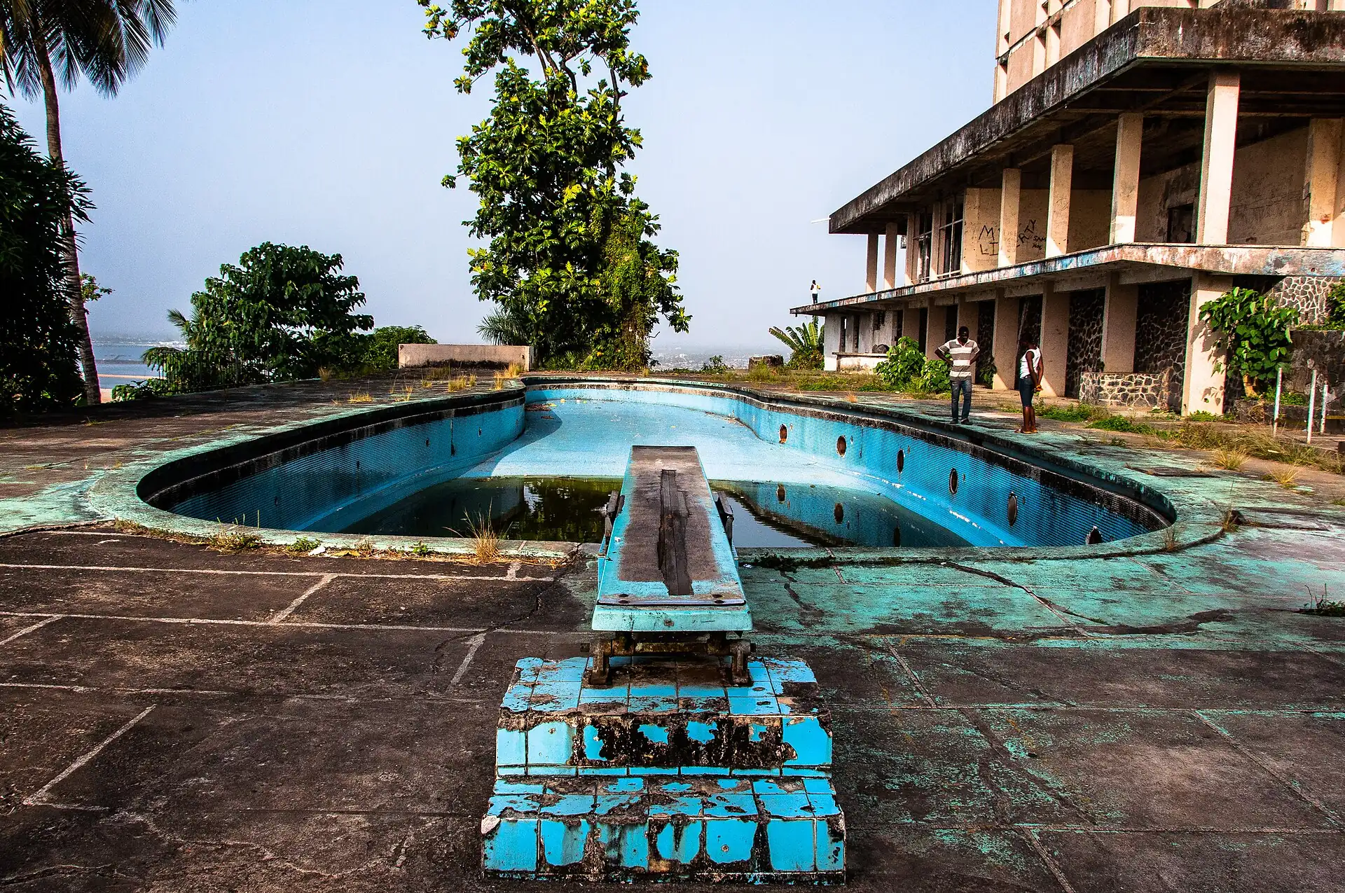
- The ruined former luxury hotel on the ridge, with views over the city and the sea: a short stop from the road, in the morning with a driver; do not go inside.
Edges out
| To | How | p50 | Climb |
|---|---|---|---|
| Mamba Point | Car south | ~8 min | flat |
Sleep within reach
- Mamba Point — 15–25 min
Red lines here
- The ruin is derelict: view it from outside and do not enter.
Deep dive
Around this cluster
Straight-line distance; walk time adds 30% for streets.