Cluster · Nicosia
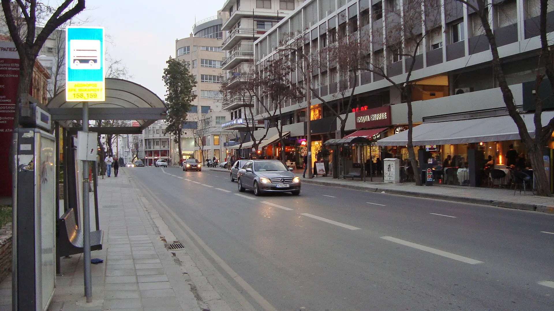
Makarios Avenue & Stasikratous
Late-afternoon cluster: shops, cafés and bakeries on the new-town edge just south of Eleftheria Square; flat, air-conditioned inside.
Key facts
- 28″ bags
- ok
- Time budget
- 90m
- Rescue coverage
- 100% ≤7′
- max p90 5.2′
- Places
- 0
- 1 sleep area in reach
Rules in force · 6Old-town lanes have cobbles and steps
- Cyprus ↗Cyprus is in the EU but not in the Schengen area: a Schengen visa is not valid; check the entry rules for your nationality.
- Cyprus ↗Crossing the Green Line: carry your passport, cross only at the official points, and do not photograph the buffer zone or soldiers. Check that your hire-car insurance covers the north.
- Cyprus ↗Traffic drives on the left; hire-car roundabouts and junctions take practice.
- Nicosia District ↗Plan every leg outside Nicosia by car, transfer or scheduled bus; distances are short, but buses are infrequent.
- Nicosia ↗Old-town lanes have cobbles and steps: large suitcases go from the car to the door, never on a walk.
- Nicosia ↗Carry your passport to cross the Green Line; the crossing at Ledra Street is on foot, and questions about hire cars or photography go to the officers at the point.
More
Map to the centre
Add your hotel to get directions from it. · stays in this browser; shared with the pocket card.
Walking weather, next 5 days
Loading forecast…
Forecast: Open-Meteo (CC BY 4.0), model data for this point.
Plan
How the ground walks, and what is here
Bound and physics
Makarios Avenue and the streets around Stasikratous, south of the old town.
- Slope
- flat
- Stairs
- None
- Shade
- medium
- Surface
- paved avenues
- Sleep here or visit
- both
Eat and drink here
A neighbourhood bakery breakfast: a warm flaouna, a cheese pie or a koulouri and a coffee before the museum; go before 09:30 for the fresh tray. No single venue is named until verified.A neighbourhood bakery breakfast: a warm flaouna, a cheese pie or a koulouri and a coffee before the museum; go before 9:30 AM for the fresh tray. No single venue is named until verified.
On the ground
Where to rest, how to leave, where to sleep nearby
Rescue anchors
A rescue anchor is a spot where you can stop and recover if the walk goes wrong: a bench, a café, a toilet. Every letter on the map is one anchor, and each has a card below. We check that any point in the cluster is within about 7 minutes’ walk of one, so you are never far from somewhere to sit down.
Lettered circles: rescue anchors (green works in any conditions, amber only on hot days). Dashed outline: the cluster. Red dots: spots more than 7 min from any anchor. Drag to move; click the map, then scroll to zoom.
Makarios Avenue café row
Place to sit · Food & drink · ac · works in any conditions
south-west block: café seating
Place to sit · Food & drink · works in any conditions
south-east block: shop and café
Place to sit · Food & drink · ac · works in any conditions
west block: shop and café
Place to sit · Food & drink · ac · works in any conditions
east block: café seating
Place to sit · Food & drink · works in any conditions
north-west block: shop and café
Place to sit · Food & drink · ac · works in any conditions
north-east block: convenience store
Food & drink · ac · works in any conditions
100% of the cluster is within 7 min of an anchor in any conditions (slowest walker, worst cell 5.2 min) · 100% on hot days
Nodes in this cluster
No place pages yet
Edges out
| To | How | p50 | Climb |
|---|---|---|---|
| Ledra Street & Laiki Geitonia | Walk north | ~10 min | flat |
Sleep within reach
- Makarios Avenue — 3–6 min
Red lines here
- Cross at the lights; traffic drives on the left.
Deep dive
Around this cluster
Straight-line distance; walk time adds 30% for streets.
- Sleep areaMakarios Avenue20 m · 1 min walk
- EatBakery: flaounes, koulouri and cheese pies430 m · 7 min walk
- ClusterLedra Street & Laiki Geitonia470 m · 8 min walk
- EatCypriot coffee and loukoumades café650 m · 11 min walk
- Sleep areaOld Town (Laiki Geitonia)730 m · 12 min walk
- PlaceLedra Observatory730 m · 12 min walk