Cluster · Seoul
Hongdae & Yeonnam-dong
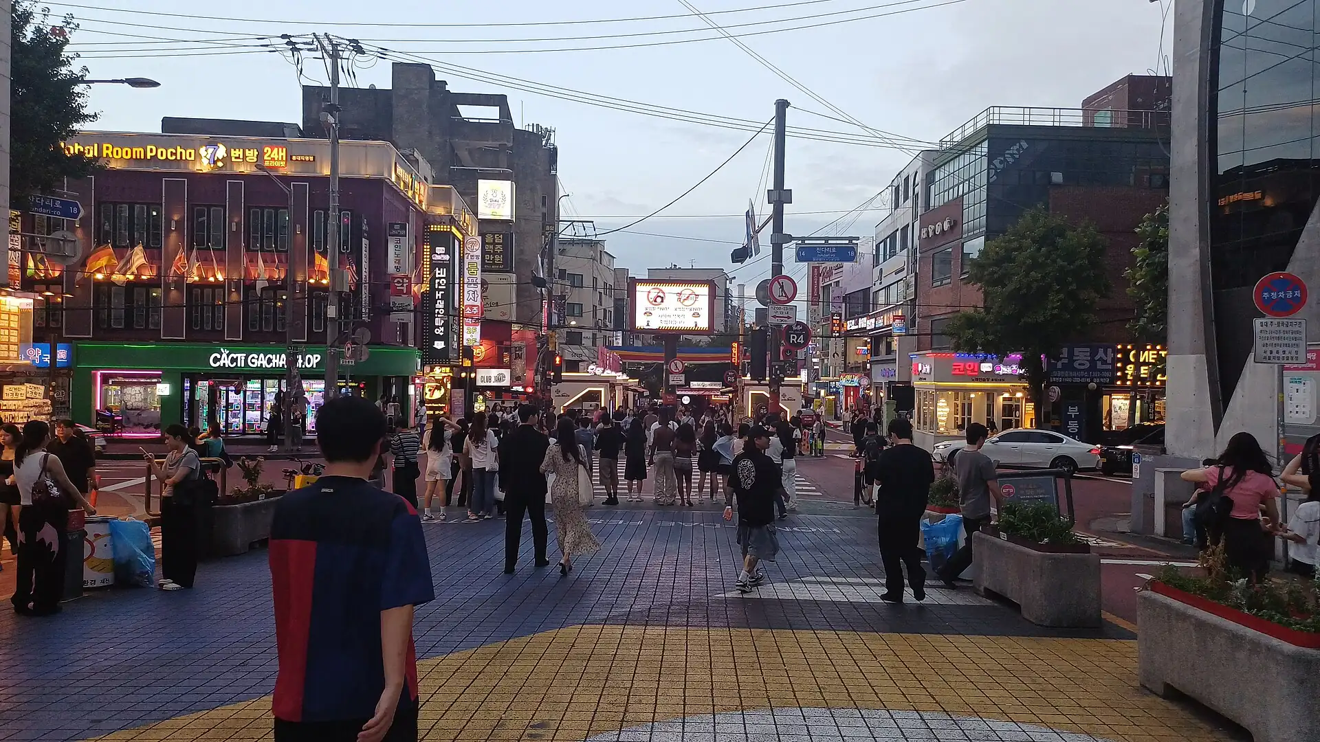
Afternoon and night cluster: cafés on Yeonnam-dong, the walking street and buskers after 18:00; flat, and on the AREX line to the airport.Afternoon and night cluster: cafés on Yeonnam-dong, the walking street and buskers after 6:00 PM; flat, and on the AREX line to the airport.
Key facts
- 28″ bags
- painful
- Time budget
- half
- Rescue coverage
- 91% ≤7′
- max p90 7′
- Places
- 0
- 1 sleep area in reach
Rules in force · 8Bukchon and many guesthouse lanes are steep
- East Asia ↗Every border in East Asia is a full international border, Hong Kong and Macau included: an entry permission for one never covers the next.
- East Asia ↗Ferries between Korea, Japan and China cancel in rough seas and typhoons; keep a flight or a spare day behind every sea leg.
- South Korea ↗Check K-ETA and visa status on the official sites before you fly; the list of nationalities exempted from registering online changes year by year.
- South Korea ↗Google Maps gives poor walking and driving directions in Korea; use Naver Map or Kakao Map for routes.
- South Korea ↗Buy a T-money card (or use a phone-based transit pass) for subway and buses; it also pays at convenience stores and many taxis.
- Seoul Capital Area ↗Dec–Feb in the capital area is dry and very cold (−10 to 3°C): pack a windproof layer and warm socks.
- Seoul ↗Bukchon and many guesthouse lanes are steep: large suitcases go from the car or subway exit straight to the door.
- Seoul ↗The subway stops around midnight; after that use taxis and check the last train in your map app.
More
Map to the centre
Add your hotel to get directions from it. · stays in this browser; shared with the pocket card.
Walking weather, next 5 days
Loading forecast…
Forecast: Open-Meteo (CC BY 4.0), model data for this point.
Plan
How the ground walks, and what is here
Bound and physics
Hongik Univ. Station, the walking street and the Gyeongui Line Forest Park, not the whole Mapo district.
- Slope
- flat
- Stairs
- Few
- Shade
- low
- Surface
- paved streets
- Sleep here or visit
- both
On the ground
Where to rest, how to leave, where to sleep nearby
Rescue anchors
A rescue anchor is a spot where you can stop and recover if the walk goes wrong: a bench, a café, a toilet. Every letter on the map is one anchor, and each has a card below. We check that any point in the cluster is within about 7 minutes’ walk of one, so you are never far from somewhere to sit down.
Lettered circles: rescue anchors (green works in any conditions, amber only on hot days). Dashed outline: the cluster. Red dots: spots more than 7 min from any anchor. Drag to move; click the map, then scroll to zoom.
Hongik Univ. Station exit (AC, WC)
ac · Toilet · Place to sit · works in any conditions
Hongdae Walking Street benches
Place to sit · Food & drink · works in any conditions
Eoulmadang-ro corner café
Place to sit · Food & drink · works in any conditions
Hongdae Park benches
Place to sit · works in any conditions
Wausan-ro café
Place to sit · Food & drink · works in any conditions
Convenience store south-east (AC, field-verify)
Food & drink · ac · works in any conditions
AREX platform side (AC, WC)
ac · Toilet · works in any conditions
Yeonnam-dong park entrance benches
Place to sit · works in any conditions
91% of the cluster is within 7 min of an anchor in any conditions (slowest walker, worst cell 11.2 min) · 91% on hot days
Nodes in this cluster
No place pages yet
Edges out
| To | How | p50 | Climb |
|---|---|---|---|
| Myeongdong & Namdaemun | AREX or subway east | ~20 min | flat |
| Gyeongbokgung & Gwanghwamun | Subway north-east | ~30 min | flat |
Sleep within reach
- Hongdae — 3–6 min
Red lines here
- Late-night streets are loud; keep bags with you in crowded bars and clubs.
Deep dive
Around this cluster
Straight-line distance; walk time adds 30% for streets.
- Sleep areaHongdae70 m · 1 min walk
- EatTosokchon Samgyetang4.8 km · ride, not a walk
- ClusterGyeongbokgung & Gwanghwamunnearest point: Gyeongbokgung Station concourse (AC, WC)4.9 km · ride, not a walk
- ClusterMyeongdong & Namdaemun5.2 km · ride, not a walk
- PlaceGyeongbokgung Palace5.3 km · ride, not a walk
- Sleep areaMyeongdong5.5 km · ride, not a walk