Cluster · St George's
The Carenage
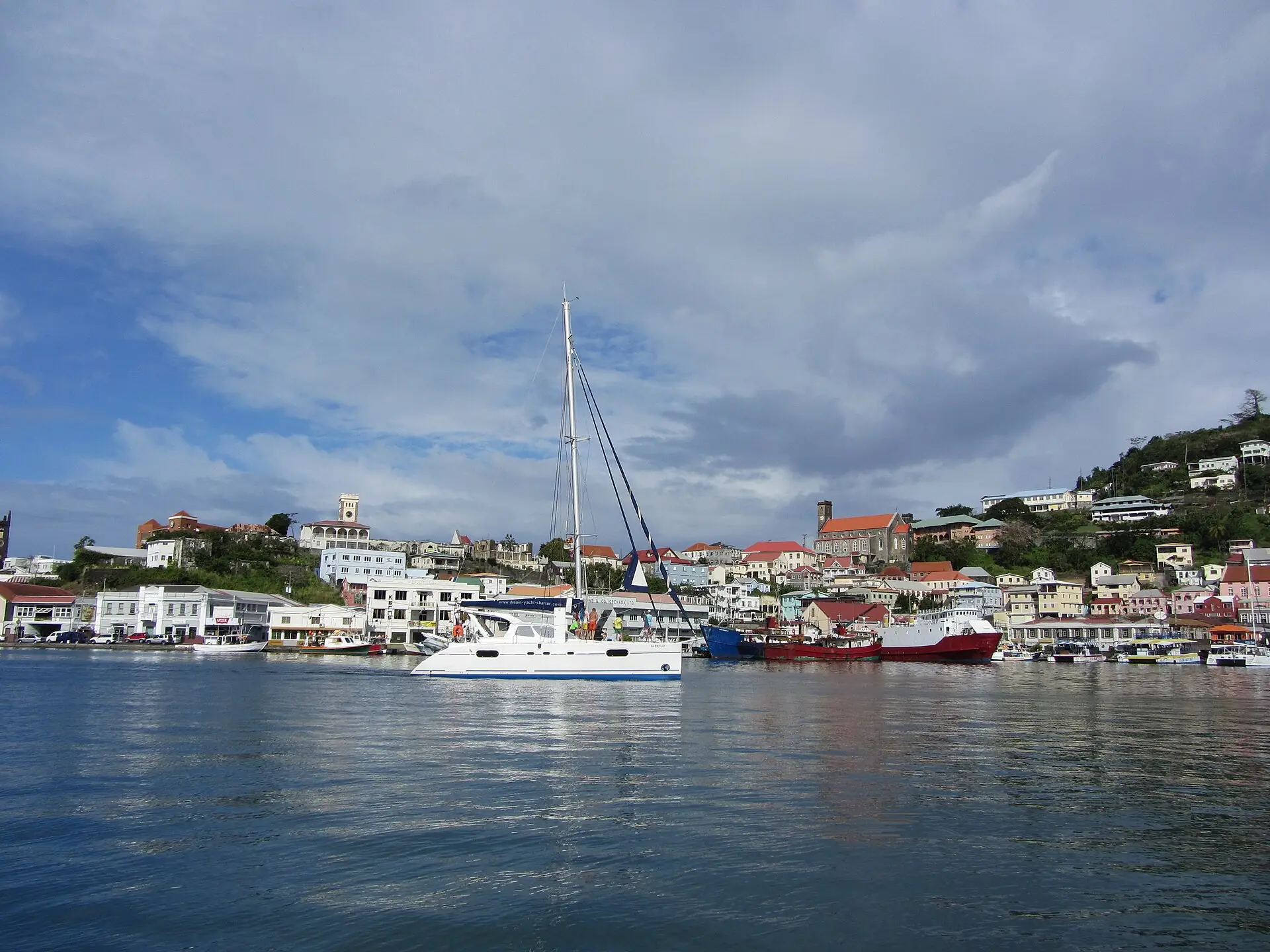
Harbour cluster: the horseshoe of the Carenage, the waterfront restaurants and the ferry landing; go in the morning, when the light is soft and the streets are cooler.
Key facts
- 28″ bags
- painful
- Time budget
- 90m
- Rescue coverage
- 100% ≤7′
- max p90 5.2′
- Places
- 2
- 1 sleep area in reach
Rules in force · 9Several islands (Turks and Caicos above all, also the Bah…Hurricane season runs June to November, with the peak fro…
- Caribbean ↗Several islands (Turks and Caicos above all, also the Bahamas and Jamaica) jail visitors for a single stray bullet or cartridge in their luggage; empty every bag and pocket before you pack.
- Caribbean ↗From August to October keep a free last day before your flight home and check the national hurricane centre daily; airports close when a named storm approaches.
- Caribbean ↗Wearing camouflage clothing is illegal for civilians in several islands, including Barbados, Antigua, Saint Lucia, Saint Vincent, Grenada, Dominica, Trinidad and Tobago and Jamaica; leave it at home, children's clothes included.
- Grenada ↗Check entry rules for your passport on official Grenada government sources before you fly.
- Grenada ↗Camouflage-pattern clothing is illegal for civilians: leave it at home.
- Grenada ↗Carriacou and Petite Martinique are still rebuilding after Hurricane Beryl (2024): confirm your accommodation and the ferry before you go.
- Grand Anse and St George's ↗Storms can close the airport and ports for days: check the forecast and your insurance from June to November.
- St George's ↗Hurricane season runs June to November, with the peak from August to October: buy flexible fares and insurance that covers storm cancellations, and avoid a tight connection home.
- St George's ↗Camouflage clothing is illegal for civilians in Grenada: leave it at home.
More
Map to the centre
Add your hotel to get directions from it. · stays in this browser; shared with the pocket card.
Walking weather, next 5 days
Loading forecast…
Forecast: Open-Meteo (CC BY 4.0), model data for this point.
Plan
How the ground walks, and what is here
Bound and physics
The Carenage road, the harbour edge and the shop frontages; the steep streets uphill are not part of the visit.
- Slope
- flat on the waterfront, steep uphill
- Stairs
- Steps between levels
- Shade
- low
- Surface
- paved harbour road
- Sleep here or visit
- visit
Eat and drink here
A shaded café on the Carenage for coffee, a sandwich or a light lunch (EC$20–50): a heat and rain break; choose one with a covered terrace (confirm locally).
Harbour-front lunch on the Carenage: go at 12:00–13:00, sit in the shade, and ask about the catch of the day.Harbour-front lunch on the Carenage: go at 12:00 PM–1:00 PM, sit in the shade, and ask about the catch of the day.
On the ground
Where to rest, how to leave, where to sleep nearby
Rescue anchors
A rescue anchor is a spot where you can stop and recover if the walk goes wrong: a bench, a café, a toilet. Every letter on the map is one anchor, and each has a card below. We check that any point in the cluster is within about 7 minutes’ walk of one, so you are never far from somewhere to sit down.
Lettered circles: rescue anchors (green works in any conditions, amber only on hot days). Dashed outline: the cluster. Red dots: spots more than 7 min from any anchor. Drag to move; click the map, then scroll to zoom.
Seating near the Carenage
Place to sit · works in any conditions
Shelter or covered doorway
Shelter from rain · Place to sit · works in any conditions
Toilets near the Carenage
Shelter from rain · Toilet · works in any conditions
Café or shop
Food & drink · Place to sit · Toilet · works in any conditions
Benches or waterfront rail
Place to sit · works in any conditions
Kiosk or minimarket
Food & drink · works in any conditions
100% of the cluster is within 7 min of an anchor in any conditions (slowest walker, worst cell 5.2 min) · 100% on hot days
Nodes in this cluster
- The horseshoe harbour road with old warehouses, restaurants and boats: the easiest first walk; go at 08:00–09:30 before the heat and the ships.The horseshoe harbour road with old warehouses, restaurants and boats: the easiest first walk; go at 8:00 AM–9:30 AM before the heat and the ships.
- A short 1895 tunnel through the ridge between the Carenage and the Esplanade: a free 10-minute walk between the two waterfronts; there is traffic, so hold hands.
Edges out
| To | How | p50 | Climb |
|---|---|---|---|
| Market Square and the Esplanade | Short taxi or walk | ~9 min | flat |
| Fort George Hill | Short taxi or walk | ~14 min | flat |
Sleep within reach
- The Carenage (harbour town) — 2–5 min
Red lines here
- Watch traffic on the narrow harbour road; keep bags in front of you in crowds.
Deep dive
Around this cluster
Straight-line distance; walk time adds 30% for streets.
- Sleep areaThe Carenage (harbour town)60 m · 1 min walk
- EatThe Nutmeg (Carenage)90 m · 1 min walk
- PlaceThe Carenage harbour walk110 m · 2 min walk
- EatWaterfront café, the Carenage (confirm locally)150 m · 2 min walk
- ClusterMarket Square and the Esplanade290 m · 5 min walk
- PlaceSendall Tunnel300 m · 5 min walk