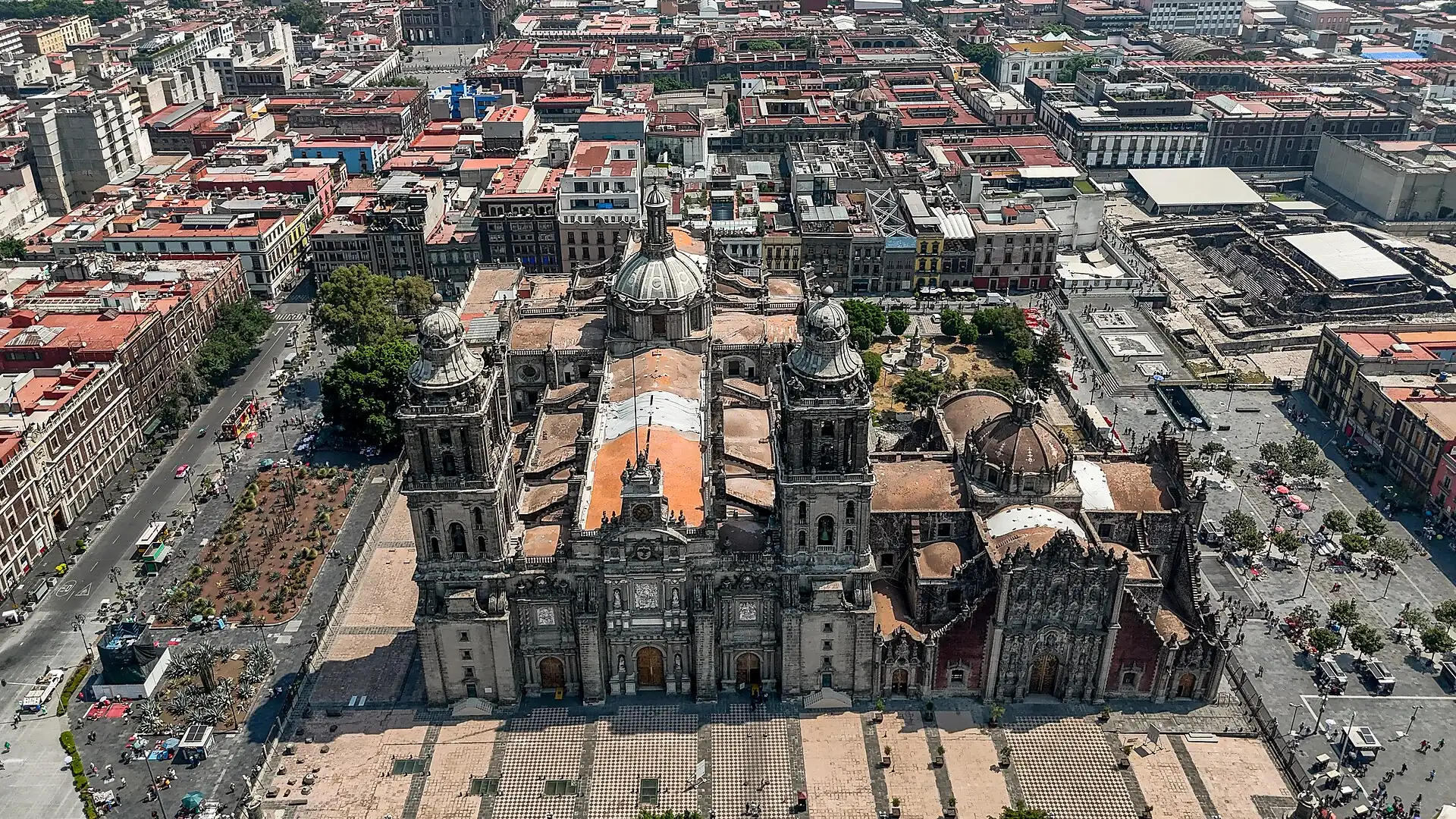
Mexico City
Ciudad de México
Code ME · 4 walking zones
Mexico City is a morning-and-lunch city at altitude: do the Centro and the museums before 14:00, eat a long lunch, and take an app car between neighbourhoods.Mexico City is a morning-and-lunch city at altitude: do the Centro and the museums before 2:00 PM, eat a long lunch, and take an app car between neighbourhoods.
Our quick read of Mexico City, scored 1–5 (friction is out of 100). Cash need: how often you still need notes. Heat risk: how hot days get. Stroller: how easy wheels are. Friction: overall effort for a first visit. Desk judgements, so check before relying on them.
- Local time
- --:--
- Weather
- forecast below
- Currency
- MXN
- Best months
- Jan · Feb · Mar · Oct · Nov · Dec
- Airports
- Mexico City (MEX) · Felipe Ángeles (NLU)
Walking zones: the 4 areas this guide plans a day around. Each is a district you can cover on foot, so you do one zone per half-day and ride the train between them. The code (ME 01, ME 02…) is just the zone's number on the Mexico City line; the line under each name says how bags fare there and how much time it needs.
Map of Mexico City
Use the switches to show or hide each kind of pin. A switch that is on shows its pins on the map; tap it again to hide them. "Show only" keeps just the pins that match (for example, places that fit a suitcase). Tap any pin for its name and a link to its page.
- Where to sleep
- Places
- Eat
- Walking clusters
- Rest stops
From the airport Mexico City (MEX) to your bed · Felipe Ángeles (NLU) to your bed
Tap a pin for its card. Places without their own coordinates are shown by their walking cluster.
Why Mexico City
Mexico City is huge, at about 2,240 m, and spread over neighbourhoods a taxi ride apart. The trips that work pick one bed, do one cluster per half-day, and put a seated lunch in the middle. Four clusters cover a first visit: the Centro Histórico, Alameda and Bellas Artes, Roma Norte, and Chapultepec. Teotihuacán, Puebla and Xochimilco are day trips from the same bed.
See first
- 1
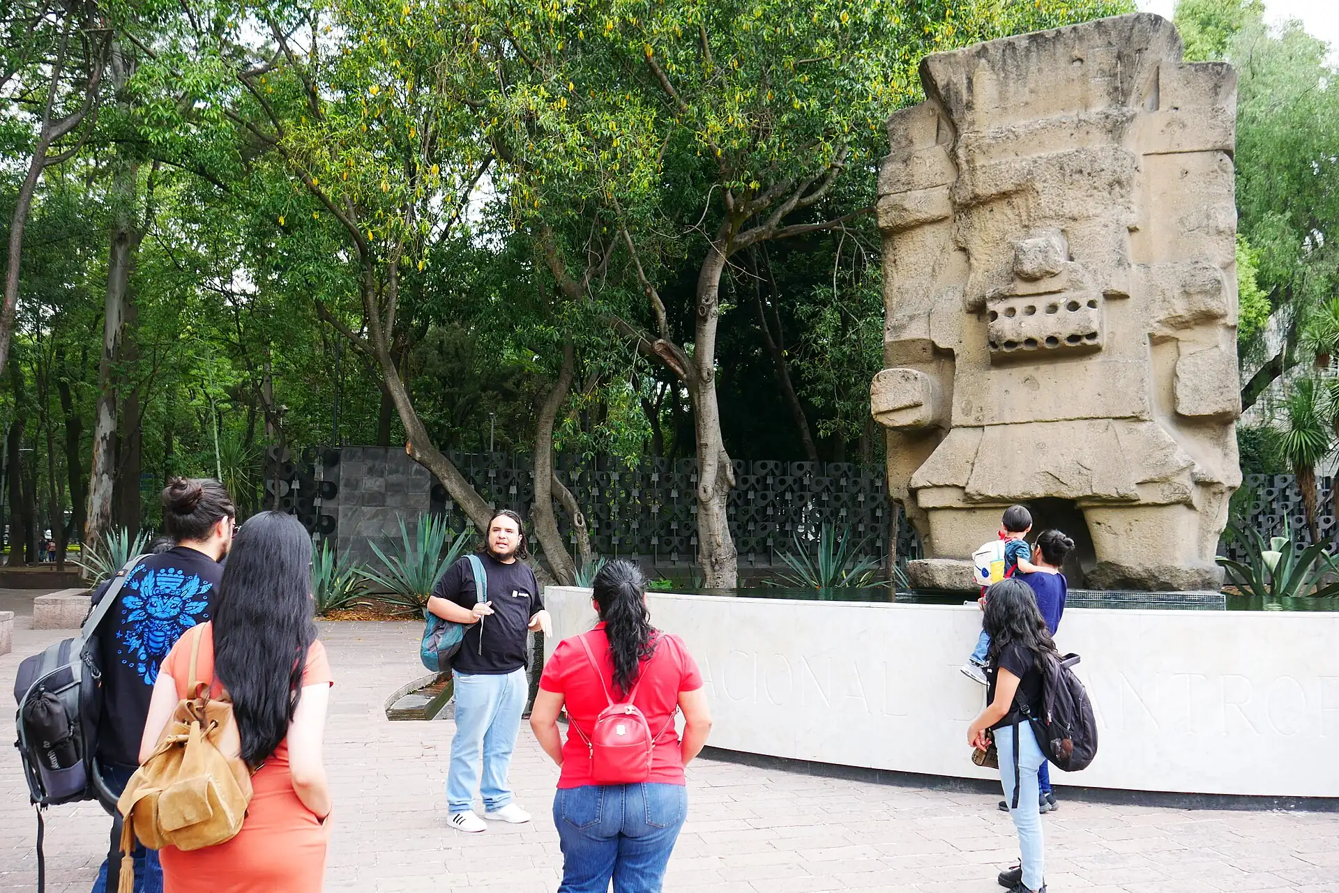 Museo Nacional de Antropología · 2.5–3 h
- 2
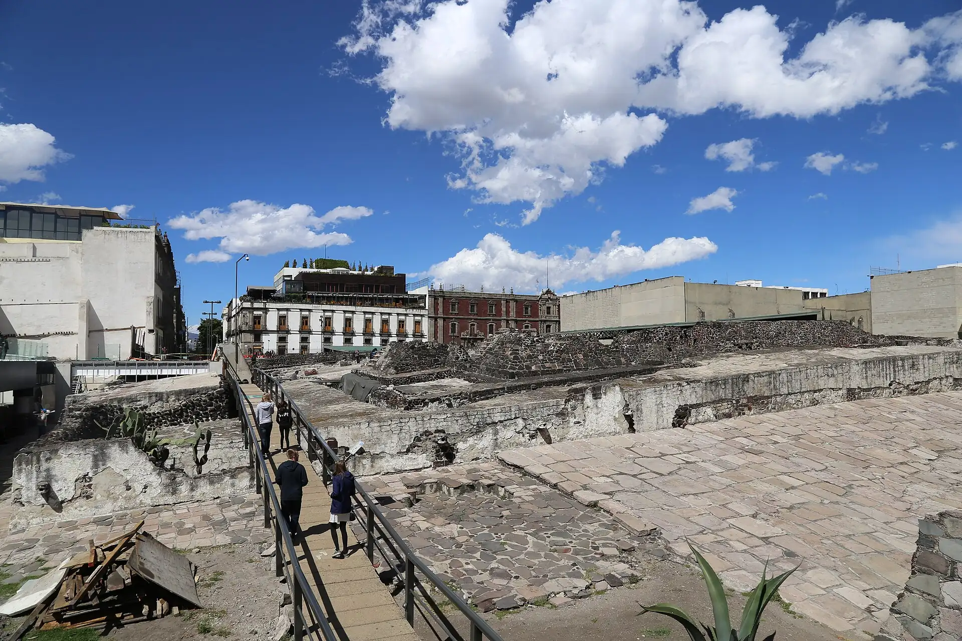 Templo Mayor and its museum · 1.5–2 h
- 3Zócalo and Metropolitan Cathedral · 45–60 min
- 4
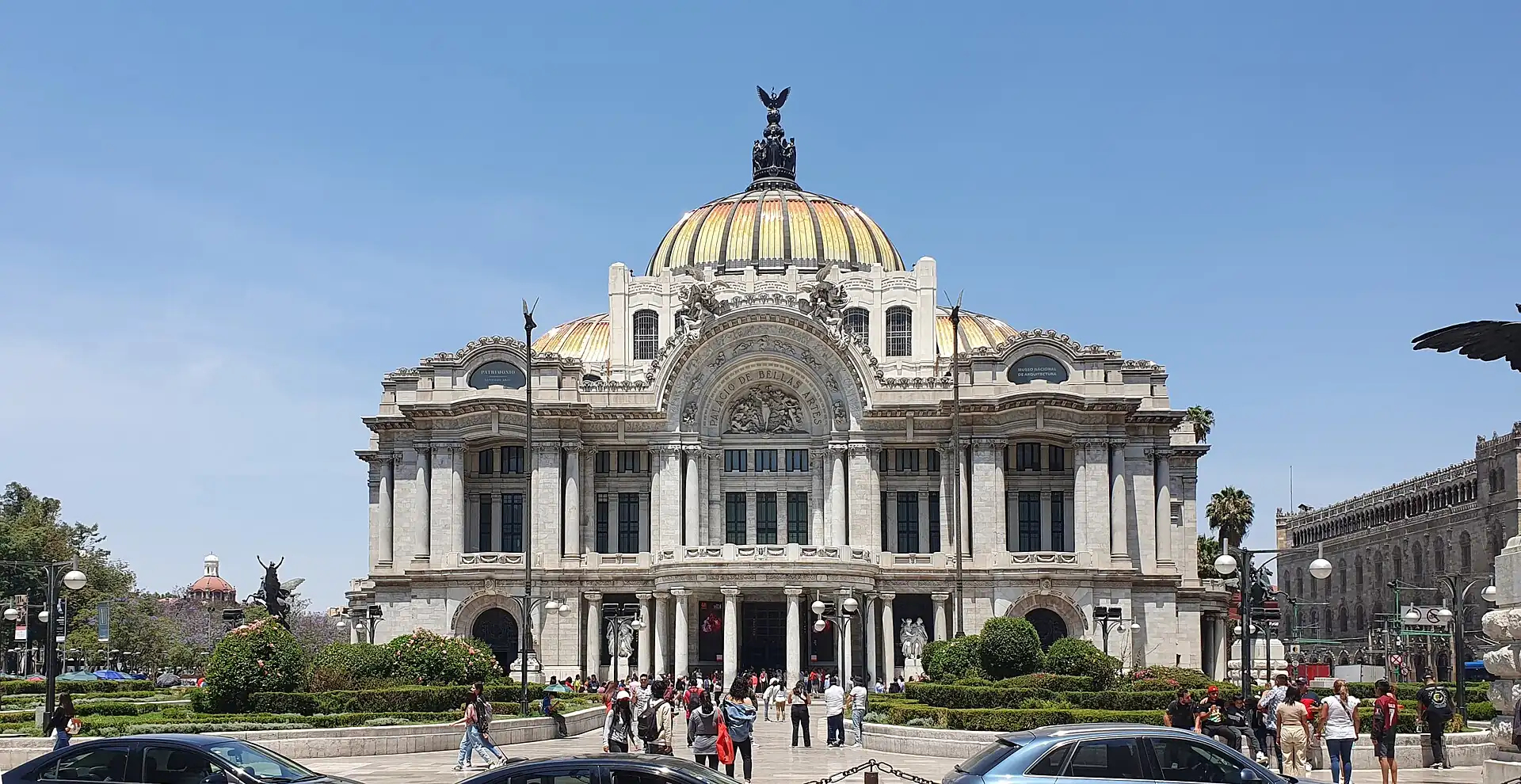 Palacio de Bellas Artes · 1–1.5 h
- 5
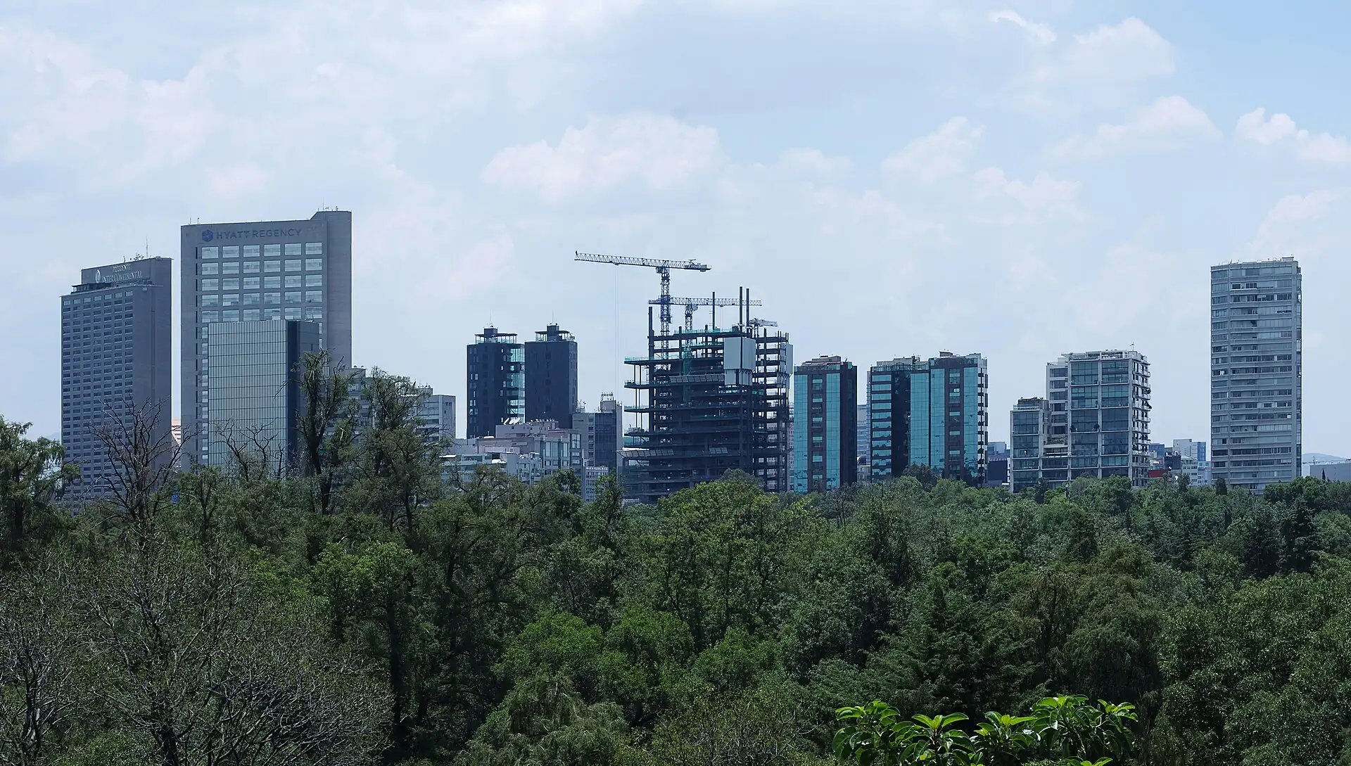 Chapultepec Castle · 1.5 h
Fits
- Museum and food trips
- Short city breaks with day trips
- Travellers who take app cars
Does not fit
- Walk-everywhere travellers
- People sensitive to altitude
- Strollers and wheelchairs on broken pavements
How long
- 2 daysCentro Histórico morning + Chapultepec museum
- 3 daysFour clusters, one per half-day, with a seated lunch
- 5 daysFour clusters + Teotihuacán day trip + one slow day
Good for
- First timers
- Foodies
- Budget
- Couples
- Families
- Luxury
About Mexico City
Mexico City sits on the bed of an old lake at about 2,240 m. Before the Spanish, the island city of Tenochtitlan was the capital of the Mexica (Aztec) and one of the largest cities in the world. Hernán Cortés and his allies conquered it in 1521, drained much of the lake over the centuries, and built the colonial city on the ruins. The Zócalo, the Metropolitan Cathedral and the streets of the Centro Histórico follow that colonial plan, and the Templo Mayor was found under the modern city in 1978.
Good to know
- The Centro Histórico is the old core; Roma and Condesa are the trendy neighbourhoods to the south-west, and Reforma is the boulevard between them.
- The city's tourism office runs information points in the Centro and at the airport; hotel desks and museum ticket offices are practical first stops.
- The Locatel line answers city questions in Spanish (check the number before you rely on it).
Go deeper 11 min read · 7 chapters
Mexico City is a capital built on a drained lake, on top of an older capital, in a valley that shakes. This deep dive follows how Tenochtitlan became the seat of New Spain and then of modern Mexico, how the soft ground and the water shaped the city, how its neighbourhoods layered up, what its museums and murals say about the country, what the city eats, and how the calendar of festivals shapes an ordinary week. It is a long read for a huge city, so use it to choose where to go first.
1History1 min
The Mexica, often called the Aztecs, founded Tenochtitlan on an island in Lake Texcoco, traditionally in 1325. Their city grew into the capital of a powerful alliance and, by the early 16th century, was one of the largest cities in the world. Causeways linked the island to the shore, canals carried goods, and raised farming plots called chinampas fed the population. At its centre stood the Templo Mayor, the sacred precinct that mirrored the cosmos.
Spanish forces under Hernán Cortés arrived in 1519 and, with the help of many indigenous allies who resented Mexica rule, besieged the city. It fell in August 1521. The Spanish built their capital on its ruins, using the old stones, and the city became the seat of New Spain. The Metropolitan Cathedral was begun in 1573 and finished in stages until 1813. The lake was gradually drained over the centuries, changing the city's ground for good.
Mexican independence was proclaimed from the town of Dolores in 1810 and secured in 1821, and Mexico City became the national capital. It saw invasion by the United States in 1847, when cadets defended Chapultepec, and the brief reign of Emperor Maximilian in the 1860s. Under Porfirio Díaz, from 1876 to 1911, the city gained grand boulevards and buildings such as the Palacio de Bellas Artes. The Revolution of 1910 to 1920 reshaped the country, and its stories still fill murals and museums.
The 20th century brought rapid growth, the 1968 Olympic Games and the tragedy of the Tlatelolco massacre days before them, the earthquake of 1985 and, in 2017, another quake on the same date. In 2016 the Federal District was officially renamed Ciudad de México, and residents, called chilangos, still argue about what to call themselves. The city today holds more than 20 million people in its wider region.
- Tenochtitlan founded (traditional date)
- 1325
- Fall of Tenochtitlan
- 1521
- Independence secured
- 1821
- Templo Mayor rediscovered
- 1978
- Renamed Ciudad de México
- 2016
2The lake, the water and the soft ground1 min
Mexico City sits in a closed basin at about 2,240 m. The valley once held a chain of lakes, and Tenochtitlan was an island city that used causeways and chinampas to manage the water. After the conquest, the Spanish saw the lake as a threat, because floods repeatedly damaged the city, and they built drainage channels and tunnels to send the water out of the basin. Over four centuries the lakes shrank and the lakebed became streets.
The result is ground that is soft and uneven. Many parts of the city sit on clay that compresses as groundwater is pumped out, and in some districts the ground sinks by tens of centimetres a year. You can see the effect in tilted buildings, uneven pavements and the cathedral, which has needed decades of engineering to stay upright. Water supply is a related challenge: the city brings in water from distant systems, and shortages and leaks are common.
Xochimilco, in the south, is a fragment of the old system. Its canals and chinampas survive, and the area is listed by UNESCO together with the historic centre. Visitors know it for colourful boats called trajineras, but it is also a working farming landscape and a place where the old lakes are still visible. If you go, prefer a weekday and agree the price and length of the boat ride in advance.
The soft ground also makes the city vulnerable to earthquakes. The seismic waves from distant quakes are amplified by the old lakebed, which is why the 1985 and 2017 events did so much damage far from the epicentres. Since then the city has invested in an early-warning siren system, stricter building rules and regular drills. As a visitor, know your hotel's exits, follow instructions if a siren sounds and do not be surprised by a drill.
- Altitude
- About 2,240 m
- Basin type
- Closed lake basin, drained over centuries
- UNESCO listing
- Historic Centre and Xochimilco, 1987
- Big earthquakes
- 1985 and 2017
3Neighbourhood stories2 min
Mexico City is best read as a set of neighbourhoods, called colonias, each with its own history. The Centro Histórico is the colonial and Aztec core: the Zócalo, the cathedral, the National Palace with its Rivera murals, old shops, cantinas and dozens of small museums. It is busy by day and much quieter in the evening, especially on Sundays.
West of the Centro, the Alameda is a park that dates to the 16th century, and Bellas Artes stands at its edge. Paseo de la Reforma, modelled on Paris boulevards and laid out under Emperor Maximilian, runs south-west to Chapultepec, lined with monuments such as the Angel of Independence. The great park of Chapultepec has been a sacred and royal space for centuries and now holds museums, a lake, a zoo and a castle.
South of Reforma lie Roma and Condesa, which were developed as elegant suburbs in the early 20th century. Roma is a grid of tree-lined streets with Art Nouveau and Neoclassical houses, and it was badly shaken in 1985 and 2017. Condesa's oval Avenida Amsterdam follows the line of an old horse-racing track. Both neighbourhoods are now known for cafés, bookshops, bars and restaurants, and they are the easiest places to walk and linger.
Further out, Polanco offers upscale dining and museums, and Coyoacán and San Ángel keep the feel of old villages, with plazas, markets and the house where Frida Kahlo lived. The lesson for a visitor is to choose one district per half-day. Distances are large, traffic is heavy, and the best days are those that stay in one or two neighbourhoods, with a long lunch in the middle. Give the driver a colonia and a landmark as well as a street, and rely on an app car after dark. A good rule of thumb is to walk within a colonia and ride between them, and to leave the evening for the neighbourhood where you sleep, when the streets are lit and the cafés are full.
- Colonia
- A neighbourhood; addresses use street, number and colonia
- Reforma
- Boulevard laid out in the 1860s
- Condesa
- Its oval avenue follows an old racetrack
- Best base for walking
- Roma Norte and Condesa
4Museums and murals2 min
Few cities have as many museums, and the best ones tell the story of Mexico in stone, paint and objects. The Museo Nacional de Antropología, which opened in 1964 in Chapultepec Park, holds the great collections of pre-Hispanic Mexico: the Mexica halls with the Sun Stone, the Maya, Oaxaca and Olmec galleries, and an ethnography floor on living peoples. Its huge courtyard and umbrella fountain are part of the experience. Give it at least two hours.
The Templo Mayor museum shows what lay under the modern street. Workers digging for a power cable in 1978 uncovered a great carved disc of the goddess Coyolxauhqui, and the excavation that followed exposed the temple precinct of the Aztec capital. The museum displays offerings brought to the temple from across the empire, and the ruins let you see how successive temples were built over earlier ones.
Mural painting is the city's signature art. After the Revolution, the government commissioned artists to paint public walls, and Diego Rivera, José Clemente Orozco and David Alfaro Siqueiros made huge works about history, labour and identity. Many are in the Palacio de Bellas Artes and in the National Palace, and more are at the Museo Mural Diego Rivera near the Alameda and around the university campus. Visit with an open mind: the murals are political, sometimes ironic and often dramatic.
The Castillo de Chapultepec, on its hill, is a different kind of museum. Begun in the late 18th century, it was a military academy and the residence of Emperor Maximilian before it became the National Museum of History. Its terraces give one of the city's best views. Check opening days before you go: most national museums close on Mondays, and hours and prices change. Bring your passport or another photo ID if a museum asks for it, carry small notes for entry fees and cloakroom tips, and expect bag checks at the larger buildings.
- Anthropology museum opened
- 1964
- Templo Mayor discovered
- 1978
- Great muralists
- Rivera, Orozco and Siqueiros
- Usual closing day
- Monday
5Food history2 min
Mexico City's food starts with corn. Long before the Spanish, people here treated dried maize with lime in a process called nixtamalisation, ground it into masa and made tortillas, tamales and atole. Beans, squash, chiles, tomatoes and cacao were staples, and street sellers were already feeding the crowds of Tenochtitlan's markets. UNESCO recognised traditional Mexican cuisine as intangible cultural heritage in 2010.
The Spanish brought pigs, cattle, dairy, wheat and sugar, and the cuisine became a mix. Pork gave carnitas and chorizo, wheat gave the bread and pastries of the panaderías, and sugar and chocolate gave sweets and drinks. Later waves of migrants also left marks: tacos al pastor, carved from a spit and topped with pineapple, are widely traced to Lebanese immigrants in the 20th century, who adapted the shawarma. The result is a cuisine that is both very old and constantly changing.
A day of eating in the city follows a rhythm. Breakfast might be chilaquiles, tamales with atole or sweet bread with hot chocolate. The main meal, la comida, comes from about 14:00 to 17:00 and can be a set lunch of soup, a main and a drink, or a long table conversation that stretches into the afternoon. Tacos are the everyday snack at any hour, with suadero, campechano, pastor and tripe among the favourites. Dinner is late and often light.
Drinks matter too. Pulque, a fermented agave drink, is older than the Aztec empire and is served in traditional pulquerías. Mezcal and tequila come from agave too, and Mexican beer, often with lime and salt, is the everyday choice. Coffee culture has grown quickly in Roma and Condesa. If you are cautious about your stomach, choose busy places where the food is cooked to order, drink purified water and take a day to adjust to altitude before diving in.
- Staple
- Corn, prepared as tortillas, tamales and atole
- Main meal
- La comida, from about 14:00La comida, from about 2:00 PM
- UNESCO cuisine listing
- 2010
- Iconic snack
- Tacos, including al pastor and suadero
6Festivals and the calendar2 min
The calendar drives the city. The two biggest civic dates are Independence Day, when on the night of 15 September the president rings a bell and shouts the Grito from the National Palace to a Zócalo packed with people, and the Day of the Dead, on 1 and 2 November. On the second, families build altars called ofrendas with photographs, food, candles and orange marigolds, and they visit cemeteries. UNESCO listed the indigenous festival of the dead in 2008.
Day of the Dead is not Halloween, and it is not sad. It is a celebration of remembered people, and offerings include pan de muerto, sugar skulls and favourite dishes of the dead. In recent years the city has added a large parade, popularised by a film scene, and altars appear in squares and museums from late October. Coyoacán and the Centro are busy, and villages such as Mixquic hold candlelit vigils. Visit with respect: do not treat cemeteries as photo sets, and ask before photographing.
Other dates matter as well. Holy Week in March or April brings processions, and the passion play in Iztapalapa draws huge crowds. The Pride march in late June is one of the largest in Latin America. On 12 December, millions of pilgrims travel to the Basilica of Guadalupe. From 16 to 24 December, the posadas re-enact the search for lodging with songs and piñatas. Each of these can fill hotels, close streets and change how you plan the day.
Practically, check the calendar before you book. Around 15 September, the Zócalo is closed to visitors for days. During Day of the Dead, hotels and tours book out early. On public holidays, museums may change hours and shops may close. If your dates fall on one of these, treat it as a chance to see something special and plan a flexible day with an app-car ride in reserve.
- The Grito
- Night of 15 September at the Zócalo
- Day of the Dead
- 1 and 2 November
- Pilgrimage to Guadalupe
- 12 December
- Posadas
- 16 to 24 December
7Visiting well2 min
Mexico City rewards a slow start. On the first day, altitude can bring a headache and breathlessness, so keep the plan light: a morning walk, a long lunch, an early night. Drink purified water, use sunscreen and carry a warm layer, since mornings and evenings are cool all year. From June to September, expect afternoon storms and do outdoor sights in the morning.
Move sensibly. Use app cars or a hotel taxi between districts and after dark, and avoid hailing street cabs. The Metro is cheap and fast but crowded at rush hour, and pickpockets work the platforms, so keep bags in front. Keep phones out of hand on the street, use ATMs inside banks and never carry more cash than you need. If a stranger spills something on you or offers unrequested help, decline and keep walking.
Be a good guest. Greet people with buenos días or buenas tardes, learn a few phrases and tip 10 to 15 per cent in restaurants unless a service charge is added. Ask before photographing people and follow the rules at museums and churches. Respect the ways people remember the dead, and remember that many neighbourhoods have residents who live with noise, tourists and rising rents. Spend money at local shops, markets and small restaurants.
Finally, choose depth over breadth. A day with one museum, a long lunch, a walk in Roma and a mezcal in the evening will teach you more than a checklist. If you have extra days, add Teotihuacán, Coyoacán or Xochimilco. Book popular tickets ahead, keep Mondays in mind, and leave room for a wrong turn. In a city this large, the unplanned hour is often the one you remember. Keep a small notebook or a phone note of the places you liked, since the names of streets and stalls slip away quickly, and you may want to return on another trip.
- First-day tip
- Keep it light at altitude
- Transport rule
- App car or hotel taxi after dark
- Tipping
- 10 to 15 per cent in restaurants
- Rainy season
- June to September, afternoons
Read, watch, wordsReading · Watching · Glossary · Sources
Reading
- The Labyrinth of Solitude — Octavio PazA classic essay collection on Mexican identity, history and character, by a Nobel-winning poet.
- The Broken Spears — Miguel León-PortillaAccounts of the conquest of Tenochtitlan drawn from Nahua sources, giving the Aztec perspective.
- Down and Delirious in Mexico City — Daniel HernandezA young journalist's portrait of the capital's neighbourhoods, music and street life.
Watching
- Roma — Alfonso Cuarón, 2018A black-and-white film set in the Roma neighbourhood in 1970 and 1971, following a domestic worker and her employers.
- Amores perros — Alejandro González Iñárritu, 2000Three linked stories set in a crash in Mexico City; a raw view of class and city life.
- Coco — Pixar, 2017An animated family film about the Day of the Dead, useful as an introduction to the tradition.
Glossary
| Term | Local | Meaning |
|---|---|---|
| Colonia | Colonia | A neighbourhood; addresses give the street, number and colonia. |
| Zócalo | Zócalo | The main square of the city, officially Plaza de la Constitución. |
| Chilango | Chilango | A resident of Mexico City, used affectionately by residents. |
| Chinampa | Chinampa | A raised farming plot in a lake or canal, still used in Xochimilco. |
| Comida | Comida | The main midday meal, from about 14:00.The main midday meal, from about 2:00 PM. |
| Sobremesa | Sobremesa | Lingering at the table after a meal to talk. |
| Ofrenda | Ofrenda | An altar with photographs, food and flowers for the Day of the Dead. |
| Cempasúchil | Cempasúchil | The orange marigold used on Day of the Dead altars. |
| Trajinera | Trajinera | A colourful flat-bottomed boat used in Xochimilco. |
| Propina | Propina | A tip. |
| Pulque | Pulque | A fermented drink made from the sap of the agave plant. |
Read for this deep dive
- Wikipedia — Mexico City ↗
- UNESCO — Historic Centre of Mexico City and Xochimilco ↗
- INAH — National Institute of Anthropology and History ↗
- Visit Mexico ↗
Background reading only: the text above is written by Voykit, not copied from these pages.
Rules in force · 8Crossing between the US, Canada and Mexico by land needs …Cannabis is legal in Canada and in many US states, but ta…
- North America ↗Crossing between the US, Canada and Mexico by land needs your passport even on a day trip; rental cars need the company's written permission to cross, and most US and Canadian rental insurance stops at the Mexican border.
- North America ↗Cannabis is legal in Canada and in many US states, but taking any amount across the US, Canadian or Mexican border is a federal crime — including edibles and vapes.
- North America ↗The busiest US and Canadian national parks need timed-entry, campsite or lodge reservations in summer; release dates are months ahead.
- Mexico ↗Check entry rules for your passport with Mexico's National Migration Institute (INM) or your nearest Mexican consulate; keep proof of your entry (stamp or digital record) until you leave.
- Mexico ↗Security advice differs by state: some governments advise against travel to parts of several states. Check your own government's advice for each region on your route.
- Mexico ↗Do not drink tap water; use bottled or filtered water and ice from reliable places.
- Mexico ↗Foreign visitors to Quintana Roo (Cancún, Playa del Carmen, Tulum, Bacalar, Holbox) pay the state VISITAX online at visitax.gob.mx only; lookalike sites add fees.
- Mexico City and central highlands ↗Day trips from the capital start early: go by an early bus or booked driver, and be back before the evening traffic.
Entry rules depend on your passport. Full visa guide
Emergency numbers for Mexico City911 ▾
- Police, fire and ambulance911
- Tourist assistance (check)Ask your hotel
Tap a number to call from your phone. These are the numbers listed in this guide; a row marked check has not been verified.
Planning is the full guide. I'm here keeps what is open and the cheat card.
Right now
Checking the weather…
Working out what is open near you…
What is open nowclock, closures, places open
Now in Mexico City
Local time in Mexico City
--:--
Loads in your browser · America/Mexico_City
This month
Month verdict appears here.
Closed today
See the weekly grid below.
If today is a closure day: Do the Centro or a museum before 14:00, take a long lunch, use an app car between neighbourhoods and rest at altitude on day one; storms come in the afternoon from June to September.
Weekly closures come from our place pages; public holidays, marches and events (notably around 15 September) can add closures not shown here. Check the day before.
Cheat cardthe pocket version
Cheat card
The essentials on one card: save it as an image for your phone, share it, or print it.
Mexico City
Ciudad de México
- Money
- Keep MXN 500 in small notes for tips, snacks and site taxis; use ATMs inside banks or malls and choose to be charged in…
- SIM
- Telcel, AT&T and Movistar sell SIMs and eSIMs at branded shops and at the airport; bring your passport for registration.
- Ride app
- Uber · DiDi and Cabify
- Emergency
- 911 police, fire and ambulance · Ask your hotel Tourist assistance (check)
- Plugs
- Sockets A/B. US/Canada (A/B): fits · UK/Ireland (G): adapter · Australia/NZ (I): adapter. 127 V: UK and AU 230 V-only devices need a converter; most chargers are dual-voltage.
Top 5
- Museo Nacional de Antropología
- Templo Mayor and its museum
- Zócalo and Metropolitan Cathedral
- Palacio de Bellas Artes
- Chapultepec Castle
EssentialsQuick answers, what things cost and how to get around
Essentials
Quick answers, what things cost and how to get around
Quick answers
The questions people ask first about Mexico City, one line each. Tap a card for the full answer.
- Cash or card?Cards work in hotels, malls, museums with a ticket office and most sit-down restaurants; cash (pesos) for taquerías, markets, street food…
- SIM or eSIMTelcel, AT&T and Movistar sell SIMs and eSIMs at branded shops and at the airport; bring your passport for registration.
- Ride-hailing appUber · DiDi and Cabify.
- Tap waterDo not drink tap water.
- TippingcheckAbout 10–15% in sit-down restaurants (check whether a service charge is already on the bill); MXN 20–50 (≈ US$2–3) for a porter or guide; round up a taxi fare…
- Plugs & powerSockets A/B. US/Canada (A/B): fits · UK/Ireland (G): adapter · Australia/NZ (I): adapter. 127 V: UK and AU 230 V-only devices need a converter; most chargers are dual-voltage.
Show all 14 answers
- Safe at night?Take more care after dark in Centro Histórico, Alameda and Bellas Artes, Chapultepec and more.
- What to wearDress modestly; no flash; keep quiet and do not photograph people at prayer.
- Emergency numberscheck911 police, fire and ambulance · Ask your hotel Tourist assistance (check)
- Your embassycheckUS, UK, Canada embassies listed with addresses (check before you go).
- Sundays & holidaysWeekly closures come from our place pages; public holidays, marches and events (notably around 15 September) can add closures not shown here.
- Late at nightNo formal curfew; bars and clubs run late, and many close by about 02:00–03:00.No formal curfew; bars and clubs run late, and many close by about 2:00 AM–3:00 AM.
- Rainy-day planJune to September storms usually arrive in the afternoon: do outdoor stops in the morning and keep a museum for the afternoon.
- Landing lateMEX: authorised taxi or app car to the door runs all night.
Cost cheat-sheetwhat everyday things cost
Cost cheat-sheet
Typical prices for the everyday things, as ranges. Change the currency right here; the local price stays first.
2026 desk estimate · check
- CoffeeCoffee (café or hotel)MXN 45–90 (≈ US$3–5)
- Sit-down mealSit-down restaurant main courseMXN 200–450 (≈ US$11–25)
- Street or quick mealTacos at a stand, eachMXN 20–45 (≈ US$2–3)
- BeerBeer or mezcal, barMXN 60–150 (≈ US$4–9)
- Taxi, about 5 km (3 mi)Taxi, about 3 mi (5 km)App car or taxi across the centreMXN 70–180 (≈ US$4–10)
- Metro or bus rideMetro ride (flat fare, check)MXN 5 (≈ under US$1)
- SIM or eSIM, a weekTourist SIM, about a weekMXN 100–350 (≈ US$6–19)
- Museum or sight ticketMuseum entryMost close on Mondays.MXN 90–130 (≈ US$5–8)
- Budget bedHostel bed, a night, per personMX$300 (≈ US$17)
- Mid-range bedHotel double room, a night, per roomMX$2,000 (≈ US$110)
- High-end bedHotel double room, a night, per roomMX$4,500 (≈ US$250)
A day, not counting the bed: Budget MX$900 (≈ US$50) · Mid MX$2,000 (≈ US$110) · High MX$5,000 (≈ US$300)
Local prices, with USD next to them (rates 2026-09 (approximate); change it in the header). Ranges are desk estimates: check locally. Every price and the budget calculator →
Source: Prices in Mexico City
Draft
Written from desk research. Not yet compared with the official source.
No official source is recorded for this figure.
Prices are 2026 desk estimates, not yet compared with an official source. Check on the day.
Not checked in the last 12 months (no check date on file).
DecideWho it suits, the trade-offs and when to go
Decide
Who it suits, the trade-offs and when to go
Best months at a glance
The guide's verdict for each month
Jan
Best
21°C (70°F)70°F (21°C)
Feb
Best
23°C (73°F)73°F (23°C)
Mar
Best
25°C (77°F)77°F (25°C)
Apr
Care
26°C (79°F)79°F (26°C)
May
Care
26°C (79°F)79°F (26°C)
Jun
Care
24°C (75°F)75°F (24°C)
Jul
Care
23°C (73°F)73°F (23°C)
Aug
Care
23°C (73°F)73°F (23°C)
Sep
Care
22°C (72°F)72°F (22°C)
Oct
Best
22°C (72°F)72°F (22°C)
Nov
Best
21°C (70°F)70°F (21°C)
Dec
Best
20°C (68°F)68°F (20°C)
Best: Oct–Mar. Mixed: Apr–Sep. Month by month →
Warmest Apr (26°C (79°F)79°F (26°C)), coolest Jan (6°C (43°F)43°F (6°C) low), wettest Jul (19 rain days), driest Jan (2). Averages, not a forecast.
Mexico City across the year
Best-looking months for Mexico City: Jan, Feb, Mar.
| Measure | Jan | Feb | Mar | Apr | May | Jun | Jul | Aug | Sep | Oct | Nov | Dec |
|---|---|---|---|---|---|---|---|---|---|---|---|---|
| Weather | Great (good) | Great (good) | Great (good) | Mixed (care) | Mixed (care) | Mixed (care) | Mixed (care) | Mixed (care) | Mixed (care) | Good (good) | Great (good) | Good (good) |
| Crowds | High (care) | High (care) | High (care) | High (care) | Medium (ok) | Low (good) | Medium (ok) | Medium (ok) | Low (good) | Low (good) | High (care) | High (care) |
| Prices | High (care) | High (care) | High (care) | High (care) | Medium (ok) | Low (good) | Medium (ok) | Medium (ok) | Low (good) | Low (good) | High (care) | High (care) |
| Events | 2 events (ok) | 2 events (ok) | 4 events (care) | 3 events (care) | None listed (ok) | 2 events (ok) | 2 events (care) | 1 event (ok) | 2 events (ok) | 3 events (care) | 4 events (care) | 4 events (care) |
Green is good news, amber needs planning, red is a month to avoid; dashed grey with a question mark means our data does not say. Open the year heatmap →
Not checked in the last 12 months (no check date on file).
Source: Months, temperatures and crowds
Draft
Written from desk research. Not yet compared with the official source.
Monthly highs, rain and crowd levels are climate averages and desk estimates for the city, not a forecast.
Understand the cityUnderstand · Districts
Orientation & districts
Mexico City is huge. The Centro Histórico is the historic core; the Alameda and Bellas Artes area sits just west; Paseo de la Reforma runs south-west from there past the Angel of Independence to Chapultepec; Roma Norte and Condesa lie south of Reforma; Polanco and Coyoacán are further out. Distances are big and traffic is heavy: think in terms of one district per half-day.
Addresses use street, number and colonia: give the driver the colonia and a landmark, and use the app's pin.
Shaded shapes: walking areas (click one). Black pins: sleep areas. Grey dots: places. Round badges: arrivals. Click the map to turn on scroll-wheel zoom.
Hover, tap or tab to an area to see what it is like. Pins are sleep areas; arrows at the edge point to the airport.
Off the map: Felipe Ángeles International Airport (NLU) (75–120 min by the usual route).
Not drawn yet (no coordinates in this guide): Polanco, Coyoacán and San Ángel, Xochimilco. They are in the neighbourhood cards below.
Where’s what, as a list:
- Centro Histórico: Colonial core with cathedral, Templo Mayor, pedestrian streets and many old restaurants; busy by day and quiet on Sunday evenings. Suits: First mornings, the Zócalo and museums, old cafés. Price band $$.
- Alameda and Bellas Artes: The Alameda park, Bellas Artes and the streets around Eje Central; walkable from Centro. Suits: Art, architecture and a park.
- Roma Norte: Tree-lined streets, art nouveau houses and many restaurants; walkable and a good base for a longer stay. Suits: Cafés, restaurants, design and a leafy base. Price band $$$.
- Condesa: A relaxed neighbourhood beside Roma with parks and dining; walkable from Roma Norte. Suits: Parks, bars and cafés.
- Chapultepec: A vast park with the anthropology museum and the castle; give it a half-day or a full day. Suits: Museums, park and a hilltop castle.
- Polanco: Smart, walkable district next to Chapultepec with restaurants and galleries; pricey. Suits: Upscale dining, shopping and museums.
- Coyoacán and San Ángel: Leafy southern districts, a car ride from Roma; book tickets ahead for popular museums. Suits: Old villages, markets and the Frida Kahlo Museum.
- Xochimilco: A half-day trip with trajineras; go with a plan and agree the price. Suits: Boats on the old canals.
- Sleep area Centro Histórico hotels: suits First mornings, the Zócalo and museums, old cafés, price band $$.
- Sleep area Roma Norte hotels: suits Cafés, restaurants, design and a leafy base, price band $$$.
- Mexico City International Airport (MEX), about 9 km (5.6 mi)5.6 mi (9 km) from the centre, 40–75 min by the usual route.
- Felipe Ángeles International Airport (NLU), 75–120 min by the usual route.
Neighbourhoods at a glance
One tab per area, pulled together from this guide’s districts table, area notes, sleep-area scores and place pages. Scores are desk judgements (1–5); prices are estimates, check before you book.
Centro Histórico
$$Colonial core with cathedral, Templo Mayor, pedestrian streets and many old restaurants; busy by day and quiet on Sunday evenings.
- Suits:
- First mornings, the Zócalo and museums, old cafés
- Best time:
- 09:00–17:009:00 AM–5:00 PM
- Rooms:
- MXN 500–1,200 (from the sleep guide)
Pick this if: First mornings, museums and history
Watch out for: Empty side streets after dark.
- Quiet nights2/5 Low
- Nightlife3/5 Medium
- Families3/5 Medium
- Late arrival4/5 High
Why these scores
- Quiet nights: Traffic and street noise by day; quieter at night except on event days.
- Nightlife: Cantinas and rooftops; many places close early on Sundays.
- Families: Museums and squares; few green spaces.
- Late arrival: Hotels keep desks staffed; app cars are easy.
Getting around from here
- 14–20 min walk to Alameda & Bellas Artes
- MEX: about 7 km (4.3 mi) in a straight line (arrival ride 40–75 min)MEX: about 4.3 mi (7 km) in a straight line (arrival ride 40–75 min)
Alameda and Bellas Artes
The Alameda park, Bellas Artes and the streets around Eje Central; walkable from Centro.
- Suits:
- Art, architecture and a park
- Best time:
- Morning
Pick this if: A morning of murals and a walk
Watch out for: Leaving bags loose near the Metro.
Getting around from here
- Walk east along Madero: about 15 min to Centro Histórico (Zócalo & Templo Mayor)
- Taxi south-west: about 20 min to Roma Norte
- MEX: about 7 km (4.3 mi) in a straight line (arrival ride 40–75 min)MEX: about 4.3 mi (7 km) in a straight line (arrival ride 40–75 min)
Roma Norte
$$$Tree-lined streets, art nouveau houses and many restaurants; walkable and a good base for a longer stay.
- Suits:
- Cafés, restaurants, design and a leafy base
- Best time:
- Late morning to late evening
- Rooms:
- MXN 1,500–3,500 (from the sleep guide)
Pick this if: Long lunches and strolls
Watch out for: Phone snatching on quiet streets.
- Quiet nights4/5 High
- Nightlife5/5 Very high
- Families4/5 High
- Late arrival4/5 High
Why these scores
- Quiet nights: Residential and leafy; some noise near bars.
- Nightlife: Bars, mezcalerías and restaurants within walking distance.
- Families: Parks nearby and many family-friendly cafés.
- Late arrival: Plenty of late food and app cars.
Getting around from here
- 25–35 min walk to Chapultepec (Anthropology Museum & Castle)
- 25–35 min walk to Alameda & Bellas Artes
- MEX: about 10 km (6.2 mi) in a straight line (arrival ride 40–75 min)MEX: about 6.2 mi (10 km) in a straight line (arrival ride 40–75 min)
Condesa
A relaxed neighbourhood beside Roma with parks and dining; walkable from Roma Norte.
- Suits:
- Parks, bars and cafés
- Best time:
- Late morning to late evening
Pick this if: Long lunches and strolls
Watch out for: Phone snatching on quiet streets.
Getting around from here
- Taxi north-east: about 20 min to Alameda & Bellas Artes
- Taxi west: about 18 min to Chapultepec (Anthropology Museum & Castle)
- MEX: about 10 km (6.2 mi) in a straight line (arrival ride 40–75 min)MEX: about 6.2 mi (10 km) in a straight line (arrival ride 40–75 min)
Chapultepec
A vast park with the anthropology museum and the castle; give it a half-day or a full day.
- Suits:
- Museums, park and a hilltop castle
- Best time:
- Morning
Pick this if: A half-day or full day of museums
Watch out for: Trying to do the whole park in an hour.
Getting around from here
- Taxi east: about 18 min to Roma Norte
- MEX: about 12 km (7.5 mi) in a straight line (arrival ride 40–75 min)MEX: about 7.5 mi (12 km) in a straight line (arrival ride 40–75 min)
Polanco
Smart, walkable district next to Chapultepec with restaurants and galleries; pricey.
- Suits:
- Upscale dining, shopping and museums
Coyoacán and San Ángel
Leafy southern districts, a car ride from Roma; book tickets ahead for popular museums.
- Suits:
- Old villages, markets and the Frida Kahlo Museum
Xochimilco
A half-day trip with trajineras; go with a plan and agree the price.
- Suits:
- Boats on the old canals
Ward by ward
15 area guides. Open one for the short answer, the key facts and what the area is like; the full guide is linked inside. Prices marked (check) are estimates.
AzcapotzalcoBest for: Arena CDMX events, Tepanec history, Parque Tezozómoc, cheap local food
Skip Azcapotzalco as a base unless you have an event at Arena CDMX or want a quiet, non-touristy district with cheap rooms. Stay in Condesa, Roma or Centro instead and come north only for a concert, the Tepanec history museums or Parque Tezozómoc — a half-day trip, not a hotel address.
- Best for:
- Arena CDMX events, Tepanec history, Parque Tezozómoc, cheap local food
- Not for:
- First-time sightseeing, nightlife, walkable colonial streets
- Distance to Centro:
- About 8–10 km (5–6.2 mi) northwest; 30–50 min by Metro or rideshareAbout 5–6.2 mi (8–10 km) northwest; 30–50 min by Metro or rideshare
- Metro access:
- Line 6 and Line 7 (El Rosario), Line 7 to Arena CDMX
- Typical hotel price:
- MXN 900–1,600 per night, 2026 estimate
- Safety:
- Generally calm residential district; usual big-city precautions after dark (check)
What the district is like
Azcapotzalco sits in the northwest of Mexico City, one of the 16 alcaldías, with roughly 430,000 residents. It was settled in the 12th century by the Tepanec, whose city predates Aztec rule by at least two centuries; the Nahuatl name means anthill, which is why an ant appears on local signage and on one Metro station icon.
The district is residential and working-class, with markets, workshops and long avenues rather than a tourist strip. The historic core around the Cathedral of Azcapotzalco keeps a colonial church and monastery begun in 1565, and the Casa de la Cultura occupies a colonial building with a garden courtyard. Further north, Parque Tezozómoc and the Hacienda del Rosario museums sit beside a small lake.
This is not a district travellers cross town for. It is where Mexico City lives its ordinary life, and that is the reason to visit if you want a break from the museum-and-café circuit.
Full Azcapotzalco guideShould you stay here or not
Stay only if you have a specific reason: a concert or game at Arena CDMX, a long stay where room price matters more than location, or work in the north of the city. Rooms run cheaper than Condesa, Roma or Polanco, and the Metro gets you downtown in under an hour.
Skip it on a first trip. The sights you came for — the Zócalo, museums, markets, nightlife — are 8–10 km (5–6.2 mi) southeast, and you would spend 60–100 minutes a day in transit. Azcapotzalco also has little evening activity for visitors, and some blocks feel empty after dark.Skip it on a first trip. The sights you came for — the Zócalo, museums, markets, nightlife — are 5–6.2 mi (8–10 km) southeast, and you would spend 60–100 minutes a day in transit. Azcapotzalco also has little evening activity for visitors, and some blocks feel empty after dark.
A middle option: keep your hotel in Centro or Condesa and treat Azcapotzalco as a half-day trip, best on a weekday when the museums are open and the Arena has no event traffic.
CentroBest for: First-timers who want the historic core on foot: Zócalo, Templo Mayor, Bellas Artes, Madero street
Stay in Centro if you want the Zócalo, the Templo Mayor and the National Palace within a 15-minute walk, and you accept crowds and pickpocket risk. Skip it for quiet nights or a relaxed evening scene — Condesa and Roma suit those better. Two nights is usually enough.
- Best for:
- First-timers who want the historic core on foot: Zócalo, Templo Mayor, Bellas Artes, Madero street
- Not for:
- Light sleepers, families wanting calm streets, anyone who wants a café-and-bar evening scene
- Walk to Zócalo:
- 0–15 minutes from most Centro hotels
- Metro:
- Zócalo and Bellas Artes on Line 2; Pino Suárez on Lines 1 and 2; Hidalgo on Lines 2 and 3 (check)
- Airport to Centro:
- Metrobús Line 4 from both terminals, about 45–60 minutes; taxi or ride-hail 30–60 minutes depending on traffic (check)
- Safety:
- Petty theft and pickpocketing are the main issue, especially in crowded Metro stations and on Madero street (check)
- Altitude:
- About 2,240 m — take the first day easy
- Quietest nights:
- Upper floors away from Madero, 5 de Mayo and República de Cuba (check)
What Centro is like
Centro Histórico is the old core of Mexico City, built over the Aztec capital Tenochtitlan and centred on the Plaza de la Constitución, known to everyone as the Zócalo. The Spanish laid out the grid in the 16th century, and the area holds more than 9,000 buildings, many of them colonial, with later art deco and Porfirian additions. UNESCO listed the historic centre in 1987.
It is a working district, not a museum piece. Government offices, jewellery shops, street vendors, markets and offices fill the blocks between the Zócalo and Bellas Artes, and the pavements on Madero and around the Zócalo are busy from morning until late. Organ grinders still play on the streets, a tradition that goes back to the late 1800s.
The trade-off is noise and crowds. Streets are loud during the day, and some blocks east and south of the Zócalo feel rougher after dark. The upside is that almost everything a first-time visitor wants to see is within walking distance, and the Metro puts the rest of the city within reach.
Full Centro guideShould you stay in Centro?
Yes, if your priority is the historic sights and you want to walk out of your hotel into them. Two nights in Centro, then moving to Condesa, Roma or Polanco for the rest of the trip, is a common and sensible split: you get the monuments on foot and the cafés and restaurants later.
No, if you want quiet evenings, easy parking or a residential feel. Centro is loud, the pavements are uneven, and traffic around the Zócalo and Eje Central is heavy. Travellers with small children or anyone sensitive to noise usually prefer Condesa and Roma or Polanco.
If you do stay, pick a hotel on or near Madero, around Bellas Artes, or on the quieter western edge near Alameda Central. Ask for a room on an upper floor away from the street.
ChapultepecBest for: Families, museum-first trips, early risers, travellers who value quiet streets at night
Stay in Chapultepec if you want the park, the Anthropology Museum and the castle on your doorstep, plus quiet, safe streets at night. Skip it if you want street food, bars and late dinners within walking distance — Condesa, Roma and Zona Rosa do that better. Families and museum-first trips get the most from it.
- Best for:
- Families, museum-first trips, early risers, travellers who value quiet streets at night
- Worst for:
- Nightlife, cheap eats, travellers who want everything on foot after dark
- Park size:
- About 866 hectares across four sections; Section I holds the headline sights
- Metro:
- Chapultepec and Juanacatlán (Line 1); Auditorio and Constituyentes (Line 7)
- Cable car:
- Cablebús Line 3, Los Pinos Constituyentes station, links Santa Fe to Section I
- Walk to Condesa or Roma:
- About 25–35 minutes from the park's east edge
- Altitude:
- About 2,240 m — pace the first day
- Tap water:
- Not for drinking; bottled or filtered (check)
What the area is like
Chapultepec is built around Bosque de Chapultepec, the city's largest park at roughly 866 hectares, split into four sections. Section I is the smallest and holds almost everything a first-time visitor comes for: Chapultepec Castle on the hill, the National Museum of Anthropology, the Museum of Modern Art and the lakes. Section II, across Avenida Constituyentes, is where the museums cluster along the park edge — Papalote Children's Museum, the Museum of Natural History and Parque Aztlán. Sections III and IV are larger, greener and quieter, with hills and few tourists.
The hill has been a retreat since Aztec times and later a fortress and presidential residence; Los Pinos, the former presidential home, sits in the park and is open to visitors. The residential streets on the north and west sides — Lomas de Chapultepec and the wider Las Lomas — are among the wealthiest in Mexico City: detached houses, embassies, guarded gates and almost no street life.
What you do not get is a neighbourhood in the eating-and-drinking sense. The blocks closest to the park are offices, hotels and apartment towers. For tacos, mezcal and a table at 10pm you cross into Condesa, Roma or Zona Rosa, which is why many travellers sleep here and eat elsewhere.
Full Chapultepec guideShould you stay here?
Yes if the park is the point of your trip. You can be at the Anthropology Museum when it opens, walk the castle before the crowds build, and come back to a quiet street in the evening. Hotels along Avenida Reforma and around the park's east edge also put you within a 20–30 minute walk of Zona Rosa and Reforma's restaurants.
No if you want to step out of your door into dinner. The area empties after dark, restaurants inside the park close early, and the nearest concentration of places to eat is a taxi or a 25–35 minute walk away. Budget travellers also get less for their money here than in Centro or around Condesa.
A middle option: stay in Condesa or Roma and treat Chapultepec as a half-day trip. Both are walkable to the park's east entrance, and you keep the food and nightlife.
Ciudad SateliteBest for: Business travellers to Naucalpan/Tlalnepantla industrial parks; mall-and-restaurant evenings
Stay in Ciudad Satelite only if you have business in the Naucalpan or Tlalnepantla industrial parks, or want a quiet base with big malls. It has no Metro, and Periferico traffic can turn a Polanco trip into two hours. Sightseeing travellers should pick Condesa, Roma or Centro instead.
- Best for:
- Business travellers to Naucalpan/Tlalnepantla industrial parks; mall-and-restaurant evenings
- Skip if:
- You want museums, street life or easy sightseeing; no Metro and heavy traffic
- Metro:
- None in the area; buses and microbuses from Chapultepec, Rosario and Cuatro Caminos
- Drive to Polanco:
- Up to 2 hours at rush hour on Periferico
- Main mall:
- Plaza Satelite, Circuito Centro Comerciales; listed daily 11:00–20:00 — confirm locallyPlaza Satelite, Circuito Centro Comerciales; listed daily 11:00 AM–8:00 PM — confirm locally (check)
- Typical meal:
- M$200–M$1000 per person, 2026 estimate
- Where it is:
- Northwest edge of the metro area, mostly in Naucalpan, Tlalnepantla and Atizapan, State of Mexico
What the area is like
Ciudad Satelite is a residential district built in the late 1950s as a middle- to upper-class suburb, now absorbed into the Mexico City metropolitan area. The name covers more than one borough: locals use it for the core plus neighbouring colonias across the state line in Naucalpan, Tlalnepantla and Atizapan.
The result is a car-oriented, low-rise area of apartment blocks, gated streets, offices and shopping centres rather than a sightseeing district. Plaza Satelite is one of the largest malls in the metro area, with Liverpool, Sears and El Palacio de Hierro, a food court and cinemas. Mundo E, further north on Boulevard Manuel Ávila Camacho, adds boutiques, cinemas, bars, a sports club and an indoor ice rink.
Naucalpan and Tlalnepantla also hold industrial parks with multinational factories, which is why the area has a steady flow of business visitors and a solid stock of mid-range hotels and steakhouses.
Full Ciudad Satelite guideShould you stay here
Choose Ciudad Satelite if your trip is anchored to the industrial parks, or if you are visiting family in the northwest suburbs. It is a workable base for a stay built around the malls and the restaurant strip rather than the centre.
Skip it for a first sightseeing trip. There is no Metro, the main artery (Periferico) is congested through most of the day, and the headline sights of Mexico City sit southeast. A Polanco-to-Plaza-Satelite drive can take up to two hours in rush hour, and travelling against the flow (north to south in the morning, the reverse in the evening) helps but does not guarantee a quick trip.
If you want a Mexico City base with restaurants, museums and walkable streets, look at Condesa and Roma, Polanco or Centro instead. Del Valle and Coyoacán are quieter alternatives.
Condesa and RomaBest for: Food, cafés, bars, walking, art deco architecture, longer stays
Yes — stay here if you want walkable streets, art deco buildings, parks and the city's densest restaurant and café strip, and you accept no Metro station inside the area. Choose Condesa for trees and Parque México, Roma Norte for bars and food, Roma Sur for quiet. Skip it if you want museums at the door — Centro or Chapultepec fit that better.
- Best for:
- Food, cafés, bars, walking, art deco architecture, longer stays
- Not ideal for:
- First-timers who want major sights within a 5-minute walk
- Layout:
- Condesa west of Avenida Insurgentes, Roma east; Roma Norte and Roma Sur split by Coahuila street
- Metro:
- No station inside; Line 1 and Line 9 stations ring the area (check)
- Metrobús:
- Line 1 runs along Insurgentes with stops Insurgentes, Álvaro Obregón, Sonora, Campeche
- Walkability:
- High; some smaller Roma streets are dimly lit at night
- Bikes:
- Ecobicis stations across Condesa, Roma Norte and Roma Sur; separated lane on Insurgentes (check)
- Altitude:
- About 2,240 m — pace the first day
- Getting in from the airport:
- Rideshare or authorized taxi, roughly 30–50 minutes depending on traffic (check)
What the area is like
Condesa and Roma sit on either side of Avenida Insurgentes, between Viaducto Miguel Alemán to the south and Avenida Chapultepec to the north. Most of the housing went up between the 1930s and 1950s, which is why art deco and midcentury apartment blocks, not towers, set the look. The 1985 earthquake emptied many of these buildings; artists and musicians moved back in from the mid-1990s and the restaurants followed.
Condesa is the greener half. Its spine is Avenida Amsterdam, an oval that follows the old horse-racing track — the colonia is still called Hipódromo Condesa. The oval curves, so it is easy to lose your bearings; small roundabouts mark the crossings. Inside it sits Parque México, with an open-air amphitheatre at one end and shaded paths and fountains at the other. Further west, past Avenida Nuevo León, Colonia Condesa is denser, with the heaviest concentration of bars, restaurants and sidewalk cafés.
Roma is more built-up and has less greenery, but the same scale of streets. It splits into Roma Norte, the busier and more restaurant-heavy half, and Roma Sur, quieter and more residential, divided by Coahuila street. Both halves are in fast redevelopment, with new bars and kitchens opening regularly.
Full Condesa and Roma guideShould you stay here
Stay here if your trip is about eating, drinking, cafés and walking, and you are in Mexico City for four nights or more. The area suits slow mornings, long lunches and evenings on foot, and it has a deep supply of small B&Bs and apartments alongside hotels. It also works well for remote work and longer stays.
Do not make it your base if this is a short first trip and you want the Zócalo, the museums of Chapultepec and the major archaeological sites within a few minutes of your door. Condesa and Roma have no Metro station inside them, so every sightseeing day starts with a 10–20 minute walk to a Line 1, Line 3 or Line 9 station, or a rideshare. Centro puts you in the middle of the historic sights; Polanco puts you next to Chapultepec and the museums; Coyoacán is calmer and further south.
A practical compromise: split the stay. Two or three nights in Centro for the historic core, then move west to Condesa or Roma for food and neighbourhood time. Both are on the same metro and rideshare network, so the move costs little.
Del ValleBest for: Longer stays, remote work, families, quiet nights
Stay in Del Valle if you want a quiet, residential base with Metro Line 3 and Metrobus on Insurgentes, cheaper rents than Condesa or Roma, and 20–30 minute rides to Centro and Coyoacán. Skip it if you want nightlife at the door or walkable sightseeing — most of Del Valle is apartments, offices and parks.
- Best for:
- Longer stays, remote work, families, quiet nights
- Not for:
- First-timers who want sights and bars within a 5-minute walk
- Metro:
- Line 3 (green): Etiopía, Eugenia, División del Norte, Zapata; Line 12 (gold) at Zapata, Parque de los Venados, Hospital 20 de Noviembre, Mixcoac
- Metrobus:
- Line 1 along Avenida Insurgentes: La Piedad, Polyforum, Nápoles, Colonia del Valle, Ciudad de los Deportes, Parque Hundido, Félix Cuevas, Río Churubusco
- To Centro:
- Metro Line 3 from Eugenia or Etiopía toward Indios Verdes, about 25–35 min
- To Coyoacán:
- Metro Line 3 south to Coyoacán station, about 15 min
- Rideshare:
- Uber and taxis are cheap here and usually connect within minutes
- Altitude:
- About 2,240 m — the same as the rest of Mexico City
What Del Valle is like
Colonia del Valle is a large, mostly residential district in the south-central part of Mexico City, west of Avenida Insurgentes and north of Coyoacán. It grew from the early 20th century onward, and its streets mix apartment blocks, offices, schools, embassies and a few surviving older houses. Narvarte sits to the east of Insurgentes and is more middle-class, with immigrant-run cafés and restaurants along its avenues. Colonia Nápoles, another residential area with Spanish and German roots, is just west of Del Valle.
The feel is everyday rather than touristic. You get parks with joggers, bakeries, taquerías, markets and a lot of traffic on the big avenues. Parque Hundido and Parque de los Venados are the two main green spaces, and Parque Tlacoquemécatl and Parque San Lorenzo are smaller squares with churches. Because it is a working neighborhood, food and rent are generally cheaper than in Condesa, Roma or Polanco, and streets are quiet at night.
It is a practical base for a longer stay: the area is well connected by Metro, Metrobus and trolleybus, and rideshares are affordable. If you are working remotely for a few weeks or months, Del Valle gives you space and services without the tourist markup.
Full Del Valle guideShould you stay here or not
Choose Del Valle if your trip is about living in Mexico City rather than ticking off sights: you want a calm apartment, a supermarket and laundry nearby, and you are happy to take the Metro or a cheap Uber to the places you visit. It also suits families and anyone sensitive to noise.
Look elsewhere if this is your first visit and you want to walk out of your hotel into museums, bars and restaurants. Centro, Condesa and Roma put more within a 10-minute walk; Polanco is closer to Chapultepec and the museums; Coyoacán is a destination in itself. Del Valle is a base, not a sightseeing hub.
IztapalapaBest for: A half-day of archaeology, a colonial monastery and the Cablebús views
Most visitors should not stay in Iztapalapa: it is Mexico City's most populous and poorest borough, far from the tourist core, and safety needs care after dark. Come for a half-day instead — Cerro de la Estrella, the Culhuacán monastery and the Cablebús Line 2 — and sleep in Centro, Condesa or Coyoacán.
- Best for:
- A half-day of archaeology, a colonial monastery and the Cablebús views
- Not for:
- First-timers wanting walkable nightlife, museums and restaurants on the doorstep
- Distance to Centro:
- About 8–12 km (5–7.5 mi) east; 30–50 min by Metro, longer by road at rush hourAbout 5–7.5 mi (8–12 km) east; 30–50 min by Metro, longer by road at rush hour (check)
- Main Metro lines:
- Line 8 (Iztapalapa, Cerro de la Estrella, Constitución de 1917) and Line 12 (Culhuacán)
- Cablebús Line 2:
- 10.6 km (6.6 mi) between Constitución de 1917 (Line 8) and Santa Marta (Line A); listed as the world's longest cable-car system6.6 mi (10.6 km) between Constitución de 1917 (Line 8) and Santa Marta (Line A); listed as the world's longest cable-car system
- Safety:
- Higher crime than the tourist boroughs; use Uber or known taxi sitios, avoid quiet streets at night (check)
- Where to sleep instead:
- Centro, Condesa and Roma, Polanco, Coyoacán or Del Valle
What Iztapalapa is like
Iztapalapa sits in the east of Mexico City and is the city's most populous borough, and also its poorest. It grew from a Nahua farming area of chinampas and canals linked to Xochimilco into a dense, almost entirely mestizo urban district during the 20th century. The result is a working-class borough with real history, uneven streets and a reputation for crime that is higher than in the tourist core.
That mix is exactly why it is interesting and why it is not a base. You get a 16th-century monastery, a hill with 4,000 years of ceremonial use, a cathedral that draws pilgrims, and a cable car that floats over painted rooftops — but you also get long rides to the museums and restaurants most visitors come for, and you need to think about which streets you walk after dark.
Full Iztapalapa guideShould you stay here?
No, for a normal first or second trip. Iztapalapa is 8–12 km (5–7.5 mi) east of the Centro Histórico (check), and the trips you will make most — the Zócalo, Chapultepec, the museums, the food in Condesa and Roma — all start with a Metro ride or a long taxi. Nights are quiet in the wrong way: fewer restaurants, fewer people on the street, and more reason to take a car rather than walk.No, for a normal first or second trip. Iztapalapa is 5–7.5 mi (8–12 km) east of the Centro Histórico (check), and the trips you will make most — the Zócalo, Chapultepec, the museums, the food in Condesa and Roma — all start with a Metro ride or a long taxi. Nights are quiet in the wrong way: fewer restaurants, fewer people on the street, and more reason to take a car rather than walk.
Stay here only if you have a specific reason: you are visiting family, working in the east of the city, or you have already done the classic neighborhoods and want a cheaper, more local base. Even then, pick a place within a few minutes of a Metro station on Line 8 or Line 12 and plan to use Uber or a taxi sitio after dark.
For almost everyone else, sleep in Centro for the historic core, Condesa and Roma for cafés and nightlife, Polanco for museums and upscale hotels, Coyoacán for a village feel, or Del Valle for a quiet, well-connected middle ground. Iztapalapa then becomes a half-day trip rather than your address.
La Villa de GuadalupeBest for: Pilgrims, early risers, travellers with a specific devotion to Our Lady of Guadalupe
Stay here only if the Basílica de Guadalupe is your reason for the trip: it is a pilgrimage district, not a sightseeing base, and most visitors see it in half a day from Centro or Condesa. Come early morning on a weekday; skip the area on 12 December unless you want the crowd.
- Best for:
- Pilgrims, early risers, travellers with a specific devotion to Our Lady of Guadalupe
- Not for:
- Nightlife, cafés, museums, first-timers wanting walkable sightseeing
- Time needed:
- Half a day for the basilica complex; a full day if you add the museum and Tepeyac
- Metro:
- Line 6 to La Villa-Basílica, then 2–3 blocks on foot
- Quietest hours:
- Weekday mornings; Mass runs hourly 06:00–20:00Weekday mornings; Mass runs hourly 6:00 AM–8:00 PM
- Busiest day:
- 12 December, the feast of Our Lady of Guadalupe — very large crowds
- Where most visitors sleep:
- Centro, Condesa and Roma, or Polanco; commute in by Metro or taxi (check)
What the area is like
La Villa de Guadalupe sits in the northern borough of Gustavo A. Madero, at the foot of Tepeyac Hill. Its whole identity is the Basílica de Guadalupe complex, the shrine built where, by tradition, the Virgin Mary appeared to Juan Diego in 1531. The town grew up around the church from 1563, and the district still works as a service neighbourhood for the pilgrims who arrive from every part of Mexico and beyond.
The complex holds two basilicas. The Old Basilica, finished in 1709, sank on unstable ground in the 20th century and was replaced by the New Basilica in 1976; the old building has since been restored and both hold Mass, often at the same time. The tilma of Juan Diego hangs above the altar of the New Basilica. Smaller chapels — El Pocito, Capuchinas, del Cerrito and del Indio — sit around the grounds and are worth an hour on their own.
Outside the gates it is an ordinary, busy, working-class district: the Calzada de Guadalupe, food stalls along the approach from the Metro, traffic, and little of the café-and-museum texture you find in Condesa or Centro. The Museo de la Basílica de Guadalupe, opened in 1941, holds several thousand objects, including a large collection tied to the Virgin of Guadalupe and liturgical pieces from the 16th century onward.
Full La Villa de Guadalupe guideShould you stay here or not
Stay if the basilica is the point of your visit — a pilgrimage, a feast day, an early Mass — or if you want to be walking distance from the shrine and do not mind a district with few tourist services. Hotel stock is thin and aimed largely at pilgrims and Mexican visitors, so book ahead around 12 December.
Do not stay if this is your first trip to Mexico City. The sights most visitors come for — the Zócalo, the museums of Chapultepec, the food of Condesa and Roma — are 30–60 minutes away by Metro or taxi, and evenings here are quiet. Base yourself in Centro, Condesa and Roma, Polanco or Coyoacán and treat La Villa as a half-day trip.
Practical note: the Metro is the reliable way in and out, since traffic on the Calzada de Guadalupe is heavy through the day. Line 6 is a short east–west line; you will usually change onto it from Line 3, 5, 7 or 4.
Magdalena ContrerasBest for: Hikers, families with a car, travellers who want green space over nightlife
Stay in Magdalena Contreras only if you want forest trails, river walks and quiet nights, and you accept 40–60 minutes each way to the museums and food districts. Day-trippers should come for Los Dinamos and leave before dark. Choose Condesa, Roma or Centro instead if you want to walk to dinner.
- Best for:
- Hikers, families with a car, travellers who want green space over nightlife
- Skip if:
- You have 2–3 days in Mexico City, or you want restaurants and bars on foot
- Main draw:
- Los Dinamos eco-park: 2,429 hectares, 26 km (16 mi) of marked trails, the Magdalena RiverLos Dinamos eco-park: 2,429 hectares, 16 mi (26 km) of marked trails, the Magdalena River
- Getting there:
- Uber or taxi from Polanco or Chapultepec, about 40 minutes; Metro Tasqueña plus bus or taxi
- Elevation:
- About 2,300–2,500 m; the park climbs higher than the city floor
- Safety:
- Northern residential streets are ordinary city-quiet; go with a group in the southern trails and leave before dusk (check)
- Where to sleep:
- Very few hotels; most visitors base elsewhere and visit as a day trip (check)
What the area is like
Magdalena Contreras is one of Mexico City's 16 boroughs, and one of the largest by area but smallest by population: roughly 250,000 residents, almost all packed into the northern third. The rest is green — pine and oak slopes, ravines and the Magdalena River, the only river in the city that still flows above ground for most of its course.
That split defines the place. The north is ordinary residential Mexico City: low-rise streets, corner shops, markets, a parish church that has stood since the 16th century. The south is a protected corridor of parks and ejidos where people from all over the city come to walk, cycle and eat at roadside stalls.
It is not a sightseeing district. There are no major museums, no colonial plaza to photograph, no bar strip. What it offers is altitude, trees and a river, 40–60 minutes from the centre.
Full Magdalena Contreras guideShould you stay here or not
Base here only for a specific kind of trip. If your plan is hiking at Los Dinamos on two or three mornings, or you are travelling with a car and want quiet nights, the borough works. If your plan is museums, mezcal bars and late dinners, it does not: you will spend an hour a day in traffic and pay for it in taxis.
Hotel supply is thin, so most travellers stay in Condesa, Roma, Centro or Coyoacán and come out for a day. That is the better trade for a first visit. Coyoacán is the closest of those bases to the borough and has the same relaxed feel with far more food and lodging.
If you do stay, pick the northern residential streets near the Santa María Magdalena church and Avenida Universidad, where buses and ride-hailing are easy. Treat the southern trailheads as day-use only.
Milpa AltaBest for: A half-day food trip: mole shops and mole restaurants in San Pedro Atocpan
Milpa Alta is not a place to stay on a first Mexico City trip: it is rural, 40 km (25 mi) south of Centro, with almost no hotels and a 1-hour-plus ride each way. Go only as a day trip for mole, nopal farms and the Teuhtli volcano walk — and go in October for the mole festival, or skip it.Milpa Alta is not a place to stay on a first Mexico City trip: it is rural, 25 mi (40 km) south of Centro, with almost no hotels and a 1-hour-plus ride each way. Go only as a day trip for mole, nopal farms and the Teuhtli volcano walk — and go in October for the mole festival, or skip it.
- Best for:
- A half-day food trip: mole shops and mole restaurants in San Pedro Atocpan
- Not for:
- A base for sightseeing; nightlife; travellers without Spanish
- Distance to Centro:
- About 40 km (25 mi) south, near XochimilcoAbout 25 mi (40 km) south, near Xochimilco
- Getting there:
- Metro to Taxqueña, then Mexibús toward Milpa Alta Villa, about MXN 20 and 1 hour (check)
- Stay here:
- Not recommended — stay in Centro, Coyoacán or Condesa and come for the day
- Peak day:
- Mole Festival in October in San Pedro Actopan
- Language:
- Spanish and Nahuatl; little English in shops and restaurants
What Milpa Alta is like
Milpa Alta is the second-largest borough of Mexico City by area and the least urban of them all. Instead of colonias it is organised into 12 pueblos, several with a Nahua name alongside the Spanish one, and many residents speak Nahuatl as a first language. Between the towns you find farmland, cactus plots and open hillside rather than the concrete of the rest of the city.
The economy here is agriculture and food production. Nopal (cactus) is the biggest crop, and mole is the biggest business: San Pedro Actopan alone has more than 20 mole shops, and the borough supplies pastes and dry blends to restaurants and markets across Mexico City. That is the reason to come.
It is high and cool like the rest of the city, around 2,240 m, and the weather is the same as central Mexico City: dry and mild October to April, rain most afternoons from June to September.
Full Milpa Alta guideShould you stay in Milpa Alta?
No, not on a normal city trip. There is almost no hotel stock, the pueblos are spread out, and you would spend one to two hours each way to reach the museums, markets and restaurants of Centro, Condesa or Coyoacán. Evenings are quiet and public transport back after dark is slow.
Stay in Centro for a first visit, in Condesa or Roma for food and cafés, in Polanco for museums and upmarket hotels, or in Coyoacán for a village feel that is still well connected. Treat Milpa Alta as a day trip from whichever of those you pick.
The exception is a specific interest: if you are in Mexico City mainly for mole, nopal or rural Mexico, a night or two in Villa Milpa Alta or San Pedro Actopan saves the commute — but confirm availability directly, as listings are thin (check).
PolancoBest for: Museums, upscale dining, shopping, families, business trips
Stay in Polanco if you want a quiet, upscale base with museums, top restaurants and easy metro access, and you don't mind higher prices and a 20–30 minute ride to the historic centre. Skip it if you want street life, budget food or nightlife on your doorstep — Condesa, Roma or Centro fit that better.
- Best for:
- Museums, upscale dining, shopping, families, business trips
- Not for:
- Budget travellers, late-night bar scene, colonial-centre atmosphere
- Metro:
- Line 7: Polanco and Auditorio stations
- Metrobus:
- Line 7 along Paseo de la Reforma, stops Ghandi and Auditorio
- To Centro:
- About 20–30 min by metro or rideshare outside rush hour (check)
- Walkability:
- High inside the district; sidewalks and parks, flat streets
- Nightly hotel range:
- 2026 estimate: MXN 1,500–4,000 mid-range; MXN 6,000+ for luxury (check)
- Altitude:
- About 2,240 m; take the first day easy
What Polanco is like
Polanco sits north of Chapultepec Park, bounded roughly by Paseo de la Reforma and the park to the south, Boulevard Manuel Ávila Camacho (Periférico) to the west, Avenida Ejército Nacional to the north and Avenida Mariano Escobedo to the east. It is one of Mexico City's wealthiest districts, with high real-estate prices, boutiques, galleries and a dense restaurant scene.
Many streets are named after writers, philosophers and scientists; the main shopping street, Avenida Presidente Masaryk, is named after a Czech president. The district has a long-standing Jewish community, with Ashkenazi and Sephardic roots, two large synagogues and a cluster of bakeries, kosher restaurants and groceries. Middle Eastern and other immigrant communities are part of the mix, which shows up in the food.
The feel is polished and low-rise by Mexico City standards: apartment blocks, offices, embassies, tree-lined streets and small parks such as Parque Lincoln and Plaza Uruguay. It is a business and shopping hub rather than a historic quarter, so expect glass, concrete and modern architecture alongside the greenery.
Full Polanco guideShould you stay here?
Polanco works best if your trip is built around museums, food and shopping, and you value a calm, safe-feeling base at the end of the day. Chapultepec Park, the National Museum of Anthropology and the museum cluster along Miguel de Cervantes Saavedra are within walking distance or a short ride. Metro Line 7 puts the historic centre about 20–30 minutes away, and Metrobus Line 7 runs along Reforma.
It is less suitable if you want cheap eats, hostels, street markets and nightlife outside your door. Those are stronger in Centro, Condesa and Roma, where you also pay less for the same standard of room. Polanco's restaurants and hotels are priced for a wealthier crowd, and the district empties out in the evening outside the main dining strips.
Families and business travellers tend to be happiest here: wide sidewalks, parks, quieter streets and easy taxis. Solo travellers on a budget and anyone planning late nights will get more value elsewhere and can still visit Polanco for a meal or a museum.
San AngelBest for: Couples, art and market days, slow mornings, longer stays
Stay in San Angel if you want a quiet, hilly, cobblestoned pocket in the south with the Saturday Bazaar and two major museums, and you accept a 25–40 minute ride to Centro. Skip it for a first trip built on nightlife or sightseeing on foot: stay in Condesa, Roma or Centro instead.
- Best for:
- Couples, art and market days, slow mornings, longer stays
- Worst for:
- First-timers wanting walkable nightlife and Centro sights
- Metro:
- Miguel Ángel de Quevedo (Line 3), about 10–15 min walk to Plaza del Carmen
- Metrobus:
- La Bombilla on Insurgentes
- To Centro:
- 25–40 min by Uber or DiDi, longer in rush hour (check)
- Terrain:
- Cobblestones, narrow alleys and a steep hill; wear real shoes
- Market day:
- Bazar Sábado, Saturdays at Plaza San Jacinto
- Driving:
- Not worth it: gridlock and little parking
What San Angel is like
San Angel sits in the south of Mexico City, on the wooded slopes below the Lomas neighborhoods and the southwestern edge of Chapultepec Park. The core is small: Plaza del Carmen, Plaza San Jacinto two blocks away, and the streets between them, all cobblestones, tight alleys and low colonial buildings. It is an upscale, residential, art-leaning area — Diego Rivera lived and worked here — and it feels nothing like the density of Centro or the cafe circuit of Condesa and Roma.
The trade-off is distance. San Angel is not on a Metro line at its centre; the stations that serve it are a 10–15 minute walk out. That walk is pleasant in daylight and less so after dark on uneven pavement. Most visitors use San Angel as a base for the south of the city — Coyoacán, the university, the museums on Revolución — rather than as a launchpad for the whole city.
Full San Angel guideShould you stay in San Angel
Yes if you have been to Mexico City before, or you are staying five nights or more and want one calm, green, walkable pocket with good food and a Saturday market. It also suits travellers who plan to spend time in Coyoacán, UNAM and the southern museums, and anyone who values quiet over proximity.
No if this is your first visit and your list is the Zócalo, the anthropology museum, Bellas Artes and late dinners. You will spend 50–80 minutes a day in traffic each way. For that trip, base in Centro, Condesa and Roma, or Polanco, and visit San Angel as a half-day.
A middle option: split the stay. Three nights central, two nights in San Angel or Coyoacán, so you get the south without paying for it in every transfer.
Santa FeBest for: Business travellers, conference stays, families wanting malls and big hotels
Stay in Santa Fe only if you have business there or want a modern, car-oriented base with big hotels and malls; it is a business district that empties at night and weekends, has no Metro, and sits far west of the sights. Sightseers should base in Centro, Condesa or Roma instead and visit Santa Fe only for Parque La Mexicana.
- Best for:
- Business travellers, conference stays, families wanting malls and big hotels
- Skip if:
- You want walkable streets, markets, nightlife or quick access to Centro and the museums
- Metro:
- None; reach it by pesero bus, taxi, El Insurgente train or Cablebus Line 3
- From Tacubaya by pesero:
- About 30–45 minutes
- Quiet times:
- Nights and weekends, when offices close
- Main park:
- Parque La Mexicana, free, daily 05:00–22:00Parque La Mexicana, free, daily 5:00 AM–10:00 PM
- Biggest mall:
- Centro Santa Fe, 500+ stores; individual store hours vary
- Photography:
- Security guards often object to cameras near office towers
What Santa Fe is like
Santa Fe is Mexico City's newest district, built from the early 1990s onward on former landfill and open land in the west of the city. Almost everything you see — glass office towers, gated corporate campuses, apartment blocks, hotels and shopping centres — went up in the last thirty years, which makes it look nothing like the Centro Histórico or the older inner suburbs.
It is a business district first. Multinational and Mexican companies keep headquarters here, so the pavements fill at 9am and empty by early evening. Weekends are quiet; some restaurants and shops keep shorter hours or close. The district is also hilly and spread out, with wide roads and few through streets, so walking between two points often means a long detour around a block or a slope.
The architecture is the draw for some visitors: contemporary towers, the Dutch embassy building nicknamed La Lavadora (the washing machine), and the skyline seen from Parque La Mexicana. Note that private security is heavy and guards may ask you not to photograph office buildings.
Full Santa Fe guideShould you stay in Santa Fe?
Stay here if your trip is built around an office, a conference centre or a hospital in the district, or if you want a modern hotel with parking, a gym and a mall downstairs and do not mind driving or taking taxis everywhere. Rates for international-chain hotels are often lower than equivalent rooms in Polanco or Reforma, and the area feels calm and safe at night.
Do not stay here for a first sightseeing trip. Santa Fe has no Metro, sits well west of the historic centre, and the journey to the Zócalo, Chapultepec or Coyoacán takes 40–70 minutes in traffic. If you want to walk to cafés, markets and bars, base in Centro, Condesa and Roma or Polanco and treat Santa Fe as a half-day trip.
A middle option: stay two nights for work, then move to an inner neighbourhood for the sightseeing part of the trip.
XochimilcoBest for: A half-day trajinera ride, the Sunday market and a slower local base
Stay in Xochimilco only if you want a quiet, local base and are happy to ride the light rail 45–60 minutes to the centre; most visitors should treat it as a half-day trip for the trajineras and keep sleeping in Centro, Condesa or Coyoacán. Book a boat before noon on weekends.
- Best for:
- A half-day trajinera ride, the Sunday market and a slower local base
- Not for:
- Nightlife, walking to major sights, or a first-trip base
- Getting there:
- Metro Line 2 to Tasqueña, then Tren Ligero to Xochimilco (last stop); 45–60 min from Centro
- Trajinera price:
- About MXN 750 per boat per hour in 2026 (whole boat, not per person); cash (check)
- Boat capacity:
- Up to 18 people on a standard trajinera
- Busiest:
- Weekends and holidays, roughly 10:00–16:00Weekends and holidays, roughly 10:00 AM–4:00 PM
- Altitude:
- About 2,240 m, same as the rest of Mexico City
- Safety:
- Normal big-city precautions; the embarcadero area is busy and well policed on weekends (check)
What the area is like
Xochimilco is a borough in the far south of Mexico City, built around the last working canals of the lake system that once covered the valley. The chinampas — raised growing beds separated by water — are the surviving piece of that landscape, and the canals and the historic centre of Mexico City together form a UNESCO World Heritage site. Much of the borough, though, is ordinary, dense city: markets, schools, workshops and long streets of low houses.
The canals are the reason people come. Flat, brightly painted boats called trajineras carry groups along the water, with food and drink vendors, mariachi and marimba boats pulling alongside. It is loud, sociable and unlike anything else in the city. Away from the water, Xochimilco has a 16th-century church and former monastery, a large ecological park with lakes and paddleboats, and a small archaeological site with petroglyphs.
Two honest caveats. Water quality in the canals has declined with overuse of groundwater and illegal building along the banks, so treat it as a boat ride, not a swim. And the wild axolotl, the salamander the area is famous for, has not been recorded here for years; you will see it in conservation centres, not the canals.
Full Xochimilco guideShould you stay here or not
For most first trips, no. Xochimilco is 20–25 km (12–16 mi) south of the centre and the trip in takes 45–60 minutes by light rail plus metro. If your days are built around museums, Centro, Chapultepec and food in Condesa or Roma, staying here costs you two hours of travel a day.For most first trips, no. Xochimilco is 12–16 mi (20–25 km) south of the centre and the trip in takes 45–60 minutes by light rail plus metro. If your days are built around museums, Centro, Chapultepec and food in Condesa or Roma, staying here costs you two hours of travel a day.
Stay if you want a local, residential base at lower prices, you are travelling as a group and plan to spend a full day on the boats, or you are in Mexico City long enough that a quiet neighbourhood appeals. Coyoacán, one stop closer in and with more to walk to, is the better compromise for most people. If you do stay, pick a hotel within walking distance of the Tren Ligero line or the embarcaderos, not deep in the residential streets.
Zona RosaBest for: First trips, short stays, nightlife, Metro access, LGBT travellers
Stay in Zona Rosa if you want a central, walkable base on the Metro with a wide range of hotels and nightlife on the doorstep; skip it if you want quiet streets or the current restaurant scene, which has moved to Condesa and Roma. It suits first trips and short stays.
- Best for:
- First trips, short stays, nightlife, Metro access, LGBT travellers
- Skip if:
- You want quiet nights or the newest food scene (Condesa and Roma)
- Boundaries:
- Insurgentes east, Chapultepec south, Paseo de la Reforma north, Calle Sevilla west
- Metro:
- Insurgentes station, Line 1, exits into Glorieta de Insurgentes
- Walk to:
- Angel de la Independencia and Paseo de la Reforma, about 10 minutes
- Altitude:
- About 2,240 m; take the first day easy
- Street selling:
- Promoters, vendors and unofficial tour offers are constant; ignore and keep walking
- Parking meters:
- About MXN 10 an hour; wheel locks on violations; meters off Saturday and Sunday (check)
What the area is like
Zona Rosa means Pink Zone, and it is not the same as zona roja, a red-light district. It is a business and entertainment quarter just west of the historic centre, packed with hotels, restaurants, bars, dance clubs and live music. The Mexican Stock Exchange and the HSBC tower stand near the Angel de la Independencia, so office workers, tourists and night crowds share the same blocks.
The area has a large gay population and a long-established LGBT nightlife, plus a Korean community in its western part, known as Pequeño Seúl, with Korean restaurants and shops. It was once the city's main nightlife district; Condesa has since taken over as the trendier option, but Zona Rosa still draws heavy tourist traffic.
Expect to be approached on the street: club promoters, taxi drivers selling tours, street and lottery vendors, and people offering tourist information. A simple no and continued walking works. Calle Génova is the busiest street for restaurants and shops, and walking is the main way to get around the district (check whether Génova is fully pedestrianised).
Full Zona Rosa guideShould you stay here?
Zona Rosa works best as a base, not as a destination in itself. You get a central location, a Metro and Metrobus hub at Glorieta de Insurgentes, a broad choice of hotels, and Paseo de la Reforma and Chapultepec Park within walking distance or a short ride. For a first visit of a few nights, that convenience is hard to beat.
The trade-off is noise and street hassle. Club crowds and traffic keep parts of the district loud late into the night, and the constant selling can wear you down. If you want calm residential streets, better coffee and the current restaurant scene, look at Condesa and Roma instead. Polanco suits museum-and-mall trips, Coyoacán suits a slower village feel, and Chapultepec puts you beside the park.
District guidesAll district guides in Mexico City →
Famous streetsAll famous streets in Mexico City →
Decide
The honest trade-off: what you will enjoy, what will wear you down.
You will like
- World-class museums
- Long lunches
- Tree-lined neighbourhoods
You will hate
- Traffic
- Altitude and polluted days
- Crowds at the big sights
Similar citiesif this one is not quite right
Similar cities
If Mexico City does not fit your dates or budget, these match it on season, cost and feel.
- Kathmandu
Nepal
- Good in the same months: Jan, Feb, Mar, Oct and 2 more
- Works well for food trips, tight budgets, couples
- A similar climate through the year
- Lisbon
Portugal
- Good in the same months: Jan, Feb, Mar, Oct and 2 more
- A mid-range day costs about the same (≈US$116 vs US$108, excl. bed)
- Works well for first-timers, food trips, couples
- Tokyo
Japan
- Good in the same months: Jan, Feb, Mar, Oct and 2 more
- A mid-range day costs about the same (≈US$108 vs US$108, excl. bed)
- Works well for first-timers, food trips, couples
When
Best months: Jan, Feb, Mar, Oct, Nov, Dec. Month-by-month verdicts below, with the live forecast first. When to go, month by month →
Mexico City: next 7 days
Loading forecast…
Forecast: Open-Meteo (CC BY 4.0), model data for this point.
Air quality
Loading…
Model estimate (CAMS via Open-Meteo), not a street-level station; readings near busy roads run higher.
Month by month, all 12best Jan, Feb, Mar, Oct, Nov, Dec
Dry and cool mornings.
Dry and mild.
Dry; warming up.
Hot; Holy Week crowds and closures.
Hottest month.
Afternoon rain begins.
Rain most afternoons.
Rain most afternoons.
Rain; Independence Day on 15–16 September.
Rain tails off; cool nights.
Dry; Day of the Dead crowds in early November.
Dry; posadas and holiday crowds.
Climate, calendar and eventsClimate · Calendar · Events · Packing by season
Climate
| Jan | Feb | Mar | Apr | May | Jun | Jul | Aug | Sep | Oct | Nov | Dec | |
|---|---|---|---|---|---|---|---|---|---|---|---|---|
| High | 21°C (70°F)70°F (21°C) | 23°C (73°F)73°F (23°C) | 25°C (77°F)77°F (25°C) | 26°C (79°F)79°F (26°C) | 26°C (79°F)79°F (26°C) | 24°C (75°F)75°F (24°C) | 23°C (73°F)73°F (23°C) | 23°C (73°F)73°F (23°C) | 22°C (72°F)72°F (22°C) | 22°C (72°F)72°F (22°C) | 21°C (70°F)70°F (21°C) | 20°C (68°F)68°F (20°C) |
| Low | 6°C (43°F)43°F (6°C) | 7°C (45°F)45°F (7°C) | 9°C (48°F)48°F (9°C) | 11°C (52°F)52°F (11°C) | 12°C (54°F)54°F (12°C) | 12°C (54°F)54°F (12°C) | 11°C (52°F)52°F (11°C) | 11°C (52°F)52°F (11°C) | 11°C (52°F)52°F (11°C) | 9°C (48°F)48°F (9°C) | 7°C (45°F)45°F (7°C) | 6°C (43°F)43°F (6°C) |
| Rain days | 2 | 2 | 3 | 6 | 12 | 17 | 19 | 18 | 17 | 9 | 3 | 2 |
| Verdict |
- The dry season (November to April) has sunny days and chilly nights; it is the easiest time for sightseeing, although the air can be poor in March and April.
- The rainy season (June to September) brings heavy afternoon storms most days: do outdoor stops in the morning and keep a museum for the afternoon.
- Altitude keeps the city mild year round: highs rarely pass 26 degrees, and nights are cool. Bring a layer at any time of year.
Events by month
Dry season
seasonNov–Mar · Citywide
Sunny days and cool nights; the best time for sightseeing.
Holy Week and Easter
religiousMoves yearly · Churches and Iztapalapa(check dates)
Crowds and closures; book ahead.
Pride march
festivalLate June · Reforma to the Zócalo
A huge parade; hotels and roads are busy.
Rainy season
seasonJun–Sep · Citywide
Afternoon storms most days; mornings are best for outdoor sights.
Independence Day
holiday15–16 September · Zócalo
The Grito on the 15th fills the square; roads are closed and hotels fill.
Day of the Dead
festivalLate Oct – 2 Nov · Centro, Coyoacán, Mixquic
Altars, parades and cemeteries; book early.
Las Posadas and Christmas
holiday16–25 December · Citywide
Street celebrations; many businesses close on the 25th.
Festivals and events that change the plan
| When | What | Effect on your plan |
|---|---|---|
| 1 Jan | New Year's Day | Public holiday; many places closed. |
| First Monday of Feb | Constitution Day | Public holiday; museums may vary hours. |
| Mar–Apr (moves yearly) | Holy Week (Semana Santa) | Crowds at churches; some closures; the Iztapalapa Passion play draws large crowds. |
| Late Jun | Pride march (Marcha del Orgullo LGBT+) | A huge parade along Paseo de la Reforma to the Zócalo; hotels and roads are busy. |
| 15–16 Sep | Independence Day | The Grito on the night of the 15th fills the Zócalo; streets around it are closed and hotels fill. |
| Late Oct – 2 Nov | Day of the Dead | Altars, parades and cemetery visits; Centro, Coyoacán and Mixquic are busy; book early. |
| Late Oct or Nov (dates vary) | Mexican Grand Prix | Hotels and roads near the Hermanos Rodríguez circuit are busy. |
| 16–24 Dec | Las Posadas and Christmas | Street celebrations; shops and markets busy; many businesses close on the 25th. |
What to pack, by season
From Mexico City’s own climate table: the coldest, warmest and wettest three months, and what to bring for each.
Coldest months
Nov–Jan
6° to 21°
A warm coat and layers.
Warmest months
Apr–Jun
12° to 25°
Light clothes, sunglasses and sunscreen; a thin layer for air conditioning.
Wettest months
Jun–Aug
18 rain days a month
A compact umbrella or rain jacket and shoes that can get wet.
Arrive & moveGetting in, getting around, and your bags
Arrive & move
Getting in, getting around, and your bags
I land at…
Enter your landing time: what still runs from the airport, where you can eat when you get in, and which areas let you check in that late.
Out of the airport about 00:00 (next day)12:00 AM (next day) (01:15 (next day)1:15 AM (next day) if immigration and bags are slow); in town about 00:40 (next day)12:40 AM (next day).
Transport from the airport
- Any hourAuthorised taxi or app car to the door. Runs all night.
- Last resortOvernight at the airport hotel. If nothing else works.
Places to eat open when you get in
We have no confirmed hours for the places to eat here yet. Plan on a convenience store or your hotel. What is open late →
Where to sleep with a late arrival
- Lets you inCentro Histórico hotels 24-hour desk. Hotels keep desks staffed; app cars are easy.
- Lets you inRoma Norte hotels 24-hour desk. Plenty of late food and app cars.
Typical times from our airport data, not a timetable: check the last departure on the day. Full airport-to-bed plan for Mexico City International Airport (MEX) →
Arrive
Each gateway has its own airport-to-bed page with timings and the last safe connection.
Getting in, in detailGet in
Get in by rail and road
| Station | Mode | Serves | Where | To the centre |
|---|---|---|---|---|
| TAPO (Terminal de Autobuses de Pasajeros de Oriente)TAPOuse | Bus | Buses to Puebla, Veracruz and the east and south-east | Eastern Mexico City, beside the San Lázaro Metro station | Metro or car 20–40 minModern, busy; buy the ticket at the operator's counter. |
| Terminal del NorteCentral del Norteuse | Bus | Buses to Teotihuacán, Querétaro, Guanajuato and northern cities | Northern Mexico City, Metro Autobuses del Norte | Metro or car 30–50 minGo straight to the counter; avoid touts. |
| Terminal Poniente and Terminal SurObservatorio and Taxqueñause | Bus | Buses to Toluca and western towns; Cuernavaca, Taxco and the south | Western and southern Mexico City | Metro or car 25–45 minCheck the terminal for your destination before you set out. |
| Long-distance operators and airport busesok | Coach | Intercity coaches and some airport links | Various | VariesCompare fares and book ahead in holiday periods. |
- Mexico City has several bus terminals, one for each direction: check the right one for your destination.
- Buy tickets at the bus company's counter or from its official site; avoid touts and unofficial sellers.
- For Teotihuacán, a tour or a hired driver is often simpler than a bus.
Move
The default way around, when a pass pays off, and when the last trains go.
- Default
- Walk inside a cluster; app car or hotel taxi between clusters.
- Passes
- No pass. App fares show upfront; for the Metro use a rechargeable card and avoid rush hour with bags.
- Last trains
- The Metro closes around midnight (check the line): app cars run all night.desk estimate
- Other modes
- Other modes (Rome2Rio) ↗
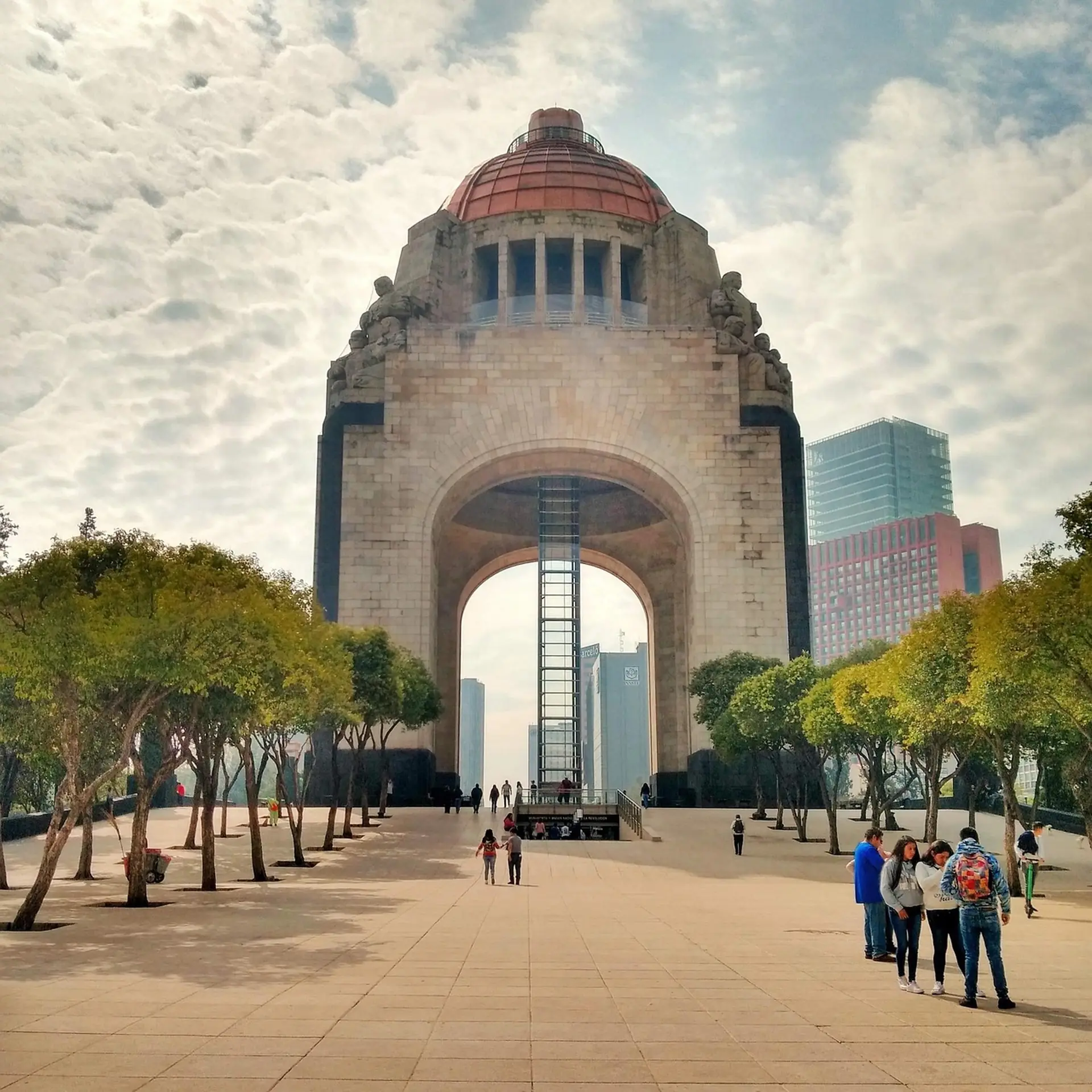
Getting around, in detailGet around · Connect
Get around
Walk inside a district; use an app car between districts; use the Metro for cheap, fast trips outside rush hour and Metrobús for long avenues. Avoid street taxis, and avoid the Metro with bags at rush hour.
| Mode | Verdict | Fare | Use it for | What breaks |
|---|---|---|---|---|
| Walking | use | Free | Inside Centro, Alameda, Roma and Condesa | Pavements are uneven; watch the traffic and the sun. |
| App car (Uber, DiDi, Cabify) | use | MXN 70–180 (≈ US$4–10) across the centre | Between districts and at night | Check the plate and driver; share your trip; fare shown up front. |
| Metro | use | MXN 5 (≈ under US$1) flat (check) | Fast, cheap trips on the main lines | Crowded at rush hour; keep bags in front; use the front women-only cars if you like. |
| Metrobús | use | MXN 6–15 (≈ under US$1) (check) | Long avenues such as Insurgentes and Reforma | Dedicated lanes; a rechargeable card is needed. |
| Ecobici (bike share) | ok | About MXN 130–500 (≈ US$8–30) a pass (check) | Short rides in Roma and Condesa | Helmets are not supplied; watch the traffic. |
| Authorised site taxi (taxi de sitio) | ok | MXN 100–250 (≈ US$6–14) for short rides | Airport and hotel pick-ups | Prepay at the airport booth; do not hail on the street. |
| Street taxi (hailed) | avoid | Varies | — | Not recommended for visitors; overcharging and robbery have been reported. |
Taxis and ride-hailing
Uber
app
Widely used; fare shown before you ride.
DiDi
app
Another app option; compare fares.
Cabify
app
A third option; compare fares.
Hotel and site taxis
hotel
A safe choice for the airport and at night.
On foot and car-free hours
| Where | When | Note |
|---|---|---|
| Centro around the Zócalo and pedestrian streets | Morning | Busy by day and quiet on Sunday evenings. |
| Roma Norte and Condesa | Morning and early evening | Leafy, walkable and full of cafés. |
More on getting around
Traffic is heavy at all hours and worst at about 07:00–10:00 and 17:00–21:00. Rain slows everything. Give yourself extra time for airport runs, and use the Metro for short hops when traffic is bad.
Streets in Roma and Condesa have names and a colonia; give the driver both. Keep a photo of your hotel's address, and screenshot the app's pin before you set out.
Connect
| Option | Verdict | What breaks |
|---|---|---|
| Telcel, AT&T or Movistar shop or airport kiosk | use | Passport needed; data-only tourist packs are cheap. |
| eSIM from a provider before you fly | use | Instant connection on landing if your phone supports it. |
| Street SIM sellers | avoid | Registration is required; an unregistered SIM can be cut off. |
Uber
Cars
Widely used in the city; fare shown up front; check the plate and driver before you get in.
DiDi and Cabify
Cars
Other ride-hailing apps; compare fares.
Google Maps and Moovit
Metro, Metrobús and walking
Works well for routes and transit; save offline maps.
Restaurants, hotels, guides
The usual way to confirm bookings.
- Wi-Fi
- Available in hotels, cafés, malls and many museums; free public Wi-Fi is patchy.
- Signal
- Excellent across the city; weaker in the Metro tunnels between some stations.
Luggage
Where big bags are a problem, and how to get rid of them for the day.
Rule
- Lockers
- Few public lockers; hotels hold bags after check-out.
- Forwarding
- No forwarding service culture: keep the big bag at the hotel for trips away.
- Dead zone
- Late-flight day: ask the hotel to hold bags and for a room or shower for the afternoon.
Bags, area by area
4 walking areas rated
- Bags forbidden
- Bags painful
Centro Histórico (Zócalo & Templo Mayor)Alameda & Bellas ArtesRoma Norte
Lockers, forwarding and the gap between check-out and check-in are covered once, under Luggage.
See & doWalking clusters, day plans and the places worth the time
See & do
Walking clusters, day plans and the places worth the time
Clusters
Plan by cluster: each is a walkable area with a rescue point and a bag rule.
Morning cluster: the Zócalo, the cathedral and the Aztec ruins of Templo Mayor, on flat paved streets; go before 11:00 and plan lunch in a proper restaurant, not on your feet.
rescue 100% · max p90 5.8′ · half
Late-morning cluster: the Palacio de Bellas Artes, the Alameda park and the Diego Rivera mural museum; short indoor stops and shade on a hot day.
rescue 100% · max p90 5.7′ · half
Evening and late-morning cluster: tree-lined streets, cafés and restaurants around Plaza Río de Janeiro; the easiest neighbourhood for a slow day and a long lunch.
rescue 100% · max p90 5.7′ · half
Morning-to-early-afternoon cluster: the anthropology museum, then the castle on the hill; a full day for the first, half a day for the second, and no midday sun on the climb.
rescue 100% · max p90 5′ · full
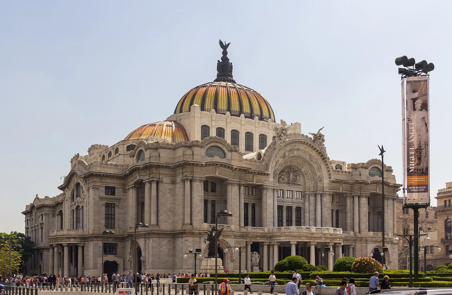
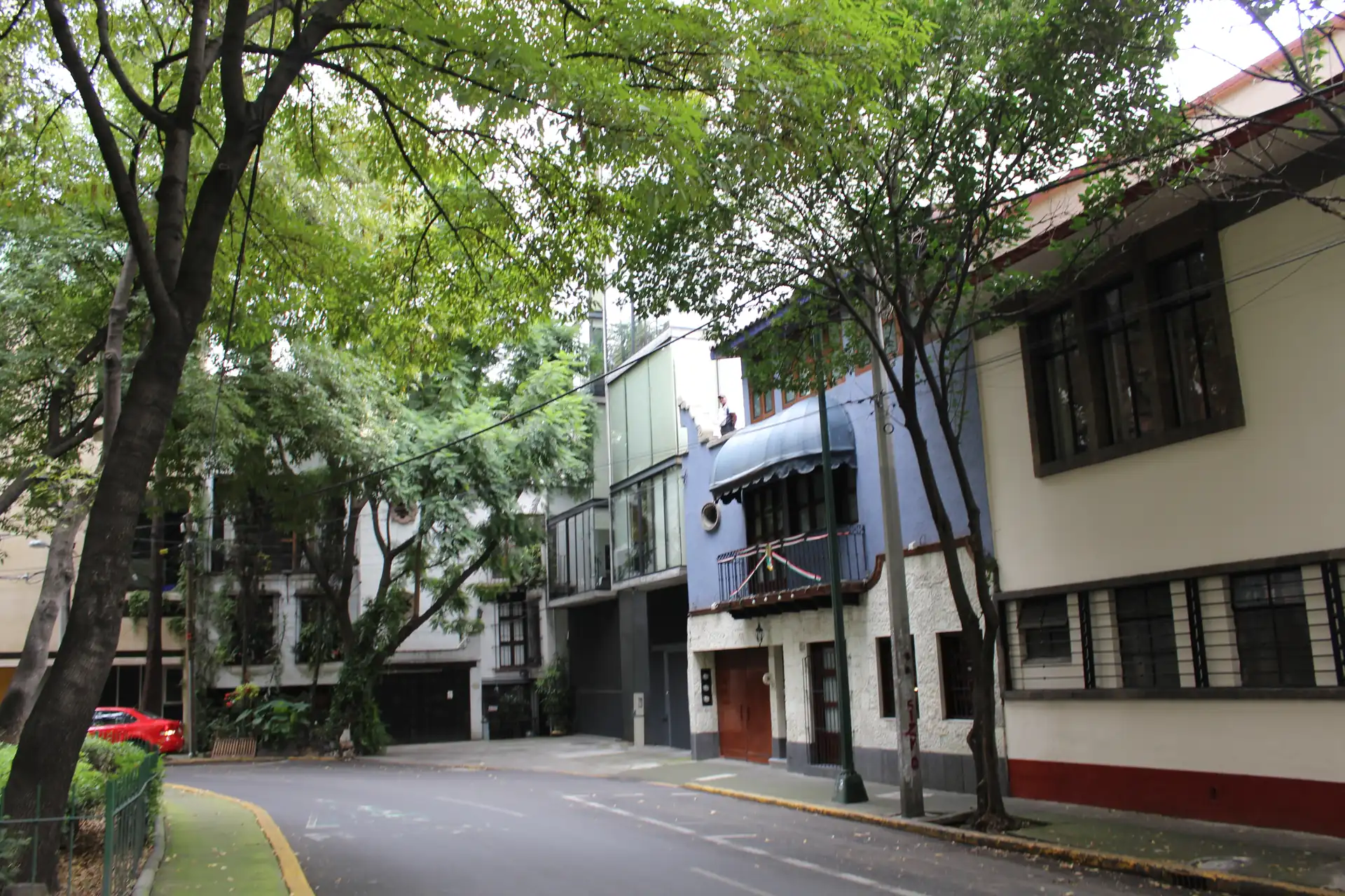
Days
Ready-made day plans, timed against opening hours and walking distances.
How long are you staying?
Loose outlines in the city's rhythm: museums and walking in the morning, a long lunch, rest at altitude in the afternoon, and app cars after dark.
1 day
A stopover between flights
- 08:30Zócalo & Metropolitan Cathedral — Zócalo and cathedral
- 09:30Templo Mayor — Templo Mayor
- 12:00Palacio de Bellas Artes — Walk to Bellas Artes
- 14:00Café de Tacuba — Long lunch at Café de Tacuba
- 16:30Plaza Río de Janeiro — Rest, then Roma at dusk
Skip: Chapultepec and the anthropology museum: they need a half-day.
Mexico City in 3 days
3 daysThe Centro before 11:00, a museum day at Chapultepec with a Roma lunch, and the palace and churros before the flight; a taxi or app car between clusters, walking inside them.
Day by day
Day 1 — Zócalo, Templo Mayor, 14:00 lunch at Café de Tacuba
- 08:30El Cardenal (optional)
- Zócalo & Metropolitan Cathedral
- Templo Mayor
- Los Cocuyos taquería (optional)
- 14:00Lunch table 14:00 (Café de Tacuba)
Day 2 — Chapultepec museums, 14:30 lunch in Roma
- 09:00National Museum of Anthropology
- Chapultepec Castle (optional)
- 14:30Lunch table 14:30 (Contramar)
Day 3 — Plaza, Bellas Artes, car to the airport at 13:30
- 09:00Mercado Roma (optional)
- Plaza Río de Janeiro
- Palacio de Bellas Artes
- Churrería El Moro (optional)
- 13:30Car to the airport at 13:30
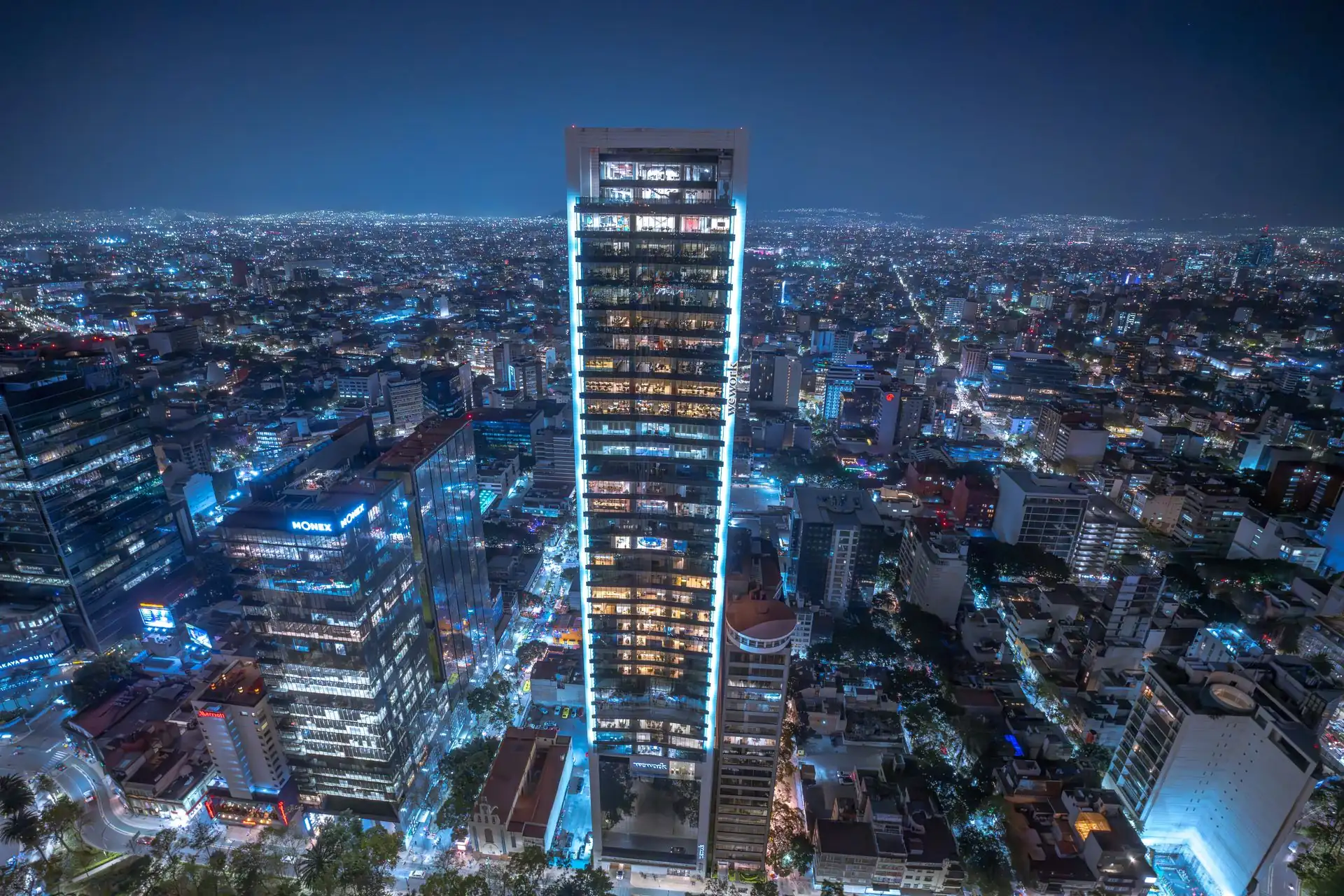
Places
“Best time” is when to arrive for the fewest crowds, for example “before 08:30”; “Go any time” means the hour makes little difference. More sights follow under “More sights and museums”.
6 places. Filters use the guide’s own ratings; a place with no rating is left out when a filter is on.
Tours, classes and shows in Mexico City →
Things to do in Mexico City: shows, nightlife and activities →
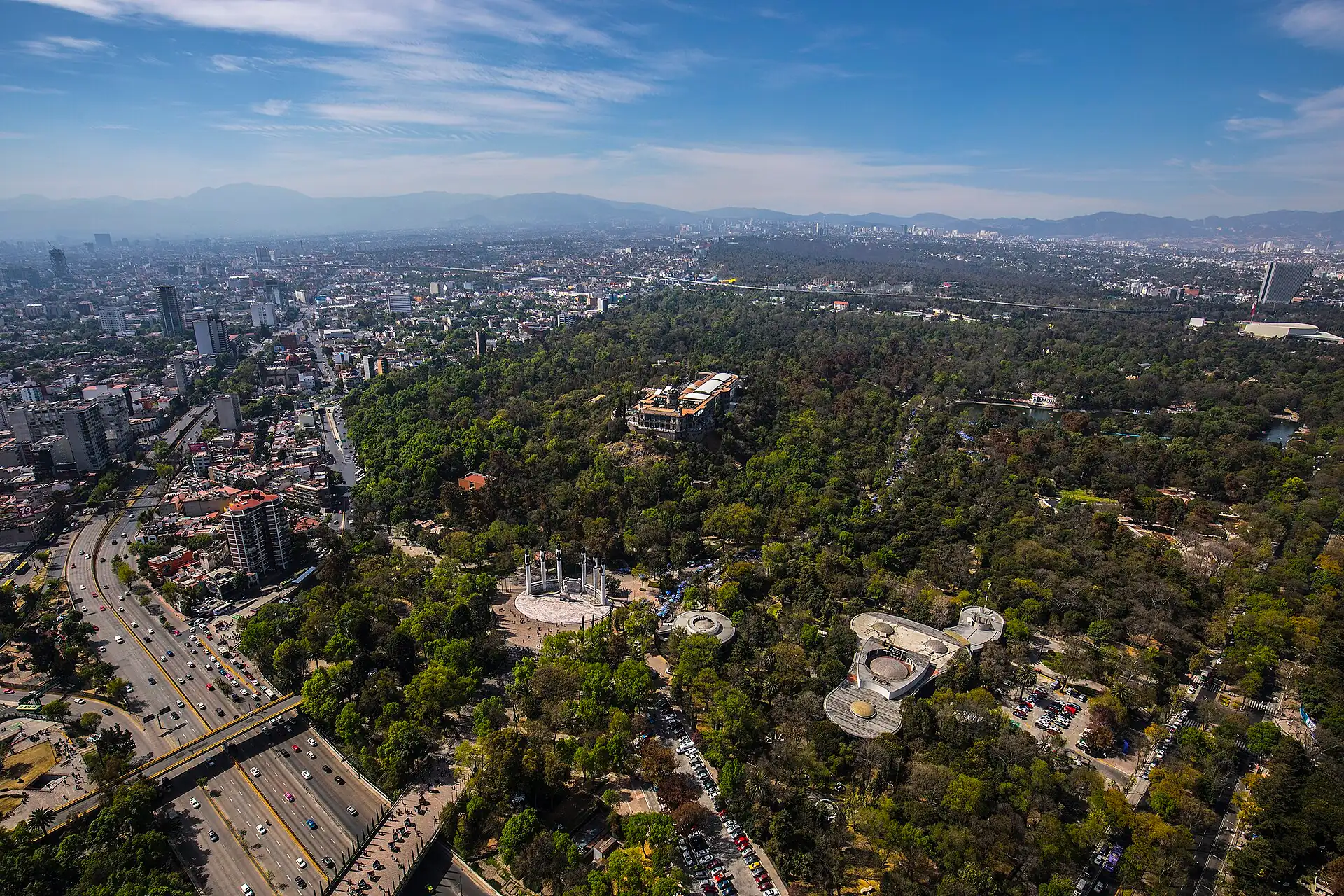
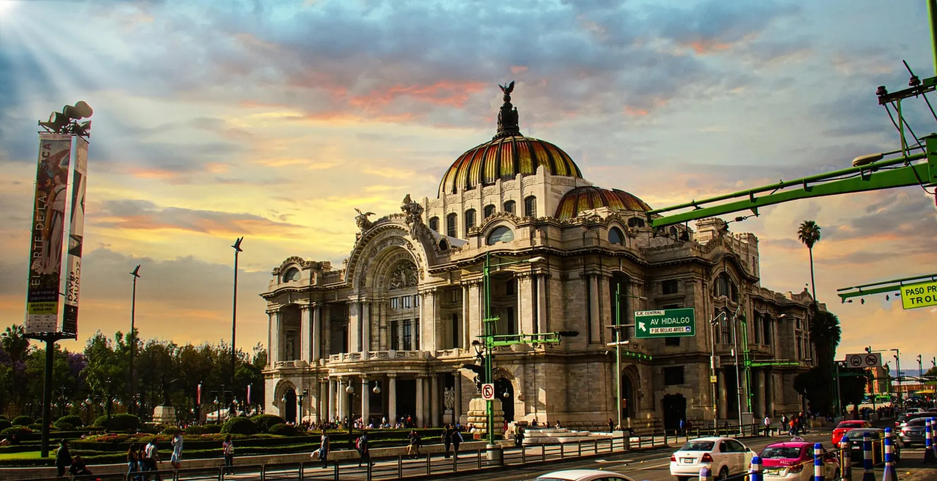
If you do ten things in Mexico City
Ranked for a first visit of 3–4 days. Prices are 2026 estimates in MXN.
- 1
Museo Nacional de Antropología
The best single museum for understanding Mexico before the Spanish and today.
- Time
- 2.5–3 h
- Best
- Weekday morning
- Cost
- MXN 90–130 (≈ US$5–8)
- 2
The heart of the Aztec capital, uncovered beneath the modern city.
- Time
- 1.5–2 h
- Best
- Morning
- Cost
- MXN 90–130 (≈ US$5–8)
- 3
Zócalo and Metropolitan Cathedral
The vast main square and the largest cathedral in the Americas by many accounts (check).
- Time
- 45–60 min
- Best
- Morning
- Cost
- Free (towers extra)
- 4
A marble palace with murals by Rivera, Orozco and Siqueiros.
- Time
- 1–1.5 h
- Best
- Weekday morning
- Cost
- MXN 90–130 (≈ US$5–8)
- 5
A hilltop castle, national history museum and views.
- Time
- 1.5 h
- Best
- Morning
- Cost
- MXN 90–130 (≈ US$5–8)
- 6
The city's famous seafood lunch: tuna tostadas and fish a la talla.
- Time
- 2 h
- Best
- 14:00–16:00
- Cost
- MXN 600–1,100 (≈ US$35–60)
- 7
A historic dining room with classic dishes and hot chocolate.
- Time
- 1.5 h
- Best
- Lunch
- Cost
- MXN 200–400 (≈ US$11–25)
- 8
Plaza Río de Janeiro and Roma Norte
A leafy square and a neighbourhood built for strolling and coffee.
- Time
- 1–2 h
- Best
- Late afternoon
- Cost
- Free to browse
- 9
A classic Centro taquería known for suadero and campechano.
- Time
- 30 min
- Best
- Late evening
- Cost
- MXN 60–150 (≈ US$4–9)
- 10
Teotihuacán
The vast pre-Hispanic city of avenues and pyramids, about an hour from the centre.
- Time
- Full day
- Best
- Early, weekday
- Cost
- Bus or tour plus entry
Good for…
Verdict is how well Mexico City works for that traveller, not how nice it is.
Rewarding but huge: pick one district per half-day and use app cars.
- 1Templo Mayor — the city's deep history in one stop.
- 2National Museum of Anthropology — context for everything else.
One of the best food cities in the world, from stands to tasting menus.
- 1Los Cocuyos taquería — classic late-night tacos.
- 2Contramar — the seafood lunch to plan around.
- 3El Cardenal — traditional breakfast and hot chocolate.
Museums are cheap, street food is cheaper and the Metro costs a few pesos.
- 1Comida corrida — a full lunch for MXN 100–200 (≈ US$6–11).
- 2Mercado Roma — cheap tastes if you graze.
- 1
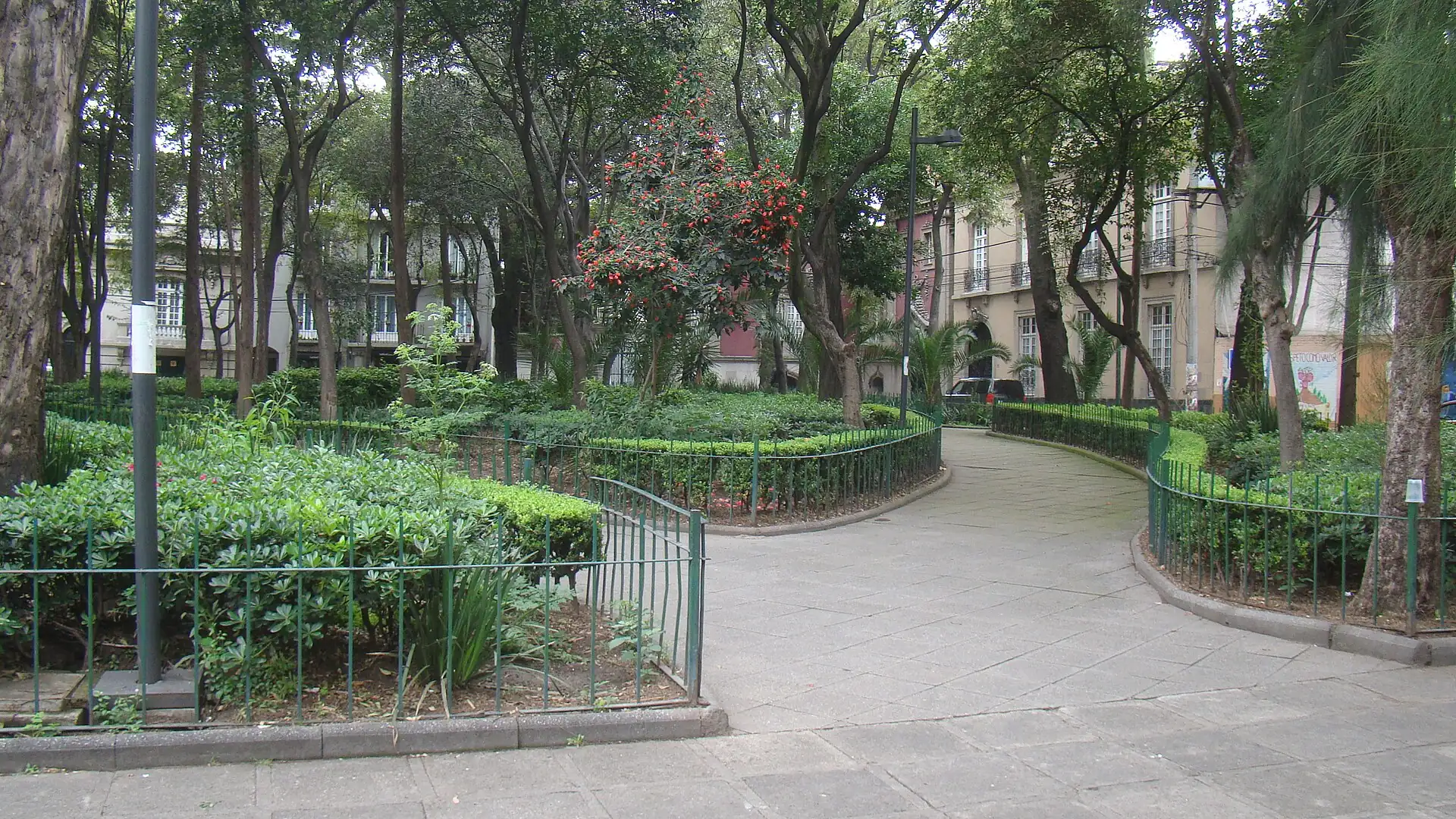 Plaza Río de Janeiro — a walk and a café stop.
- 2Contramar — a long, romantic lunch.
Great museums and parks; altitude, traffic and pavements are the hurdles.
- 1Chapultepec Castle — a castle and a big park.
- 2Xochimilco boat ride — colour and music on the canals.
- 1A Polanco or Reforma hotel — quiet, service and easy dining.
- 2A private driver — smooth days between distant districts.
Uneven pavements and few Metro lifts; plan by car and choose museums with lifts.
- 1National Museum of Anthropology — level halls and lifts.
- 2Larger hotels — confirmed accessible rooms.
Tours and classes: book or skip
Book through your hotel or a licensed operator with written inclusions and a cancellation policy. Prices per person, group tour unless stated.
| Tour or class | Verdict | Typical price | Why | Check before paying |
|---|---|---|---|---|
| Teotihuacán day tour | book | MXN 900–2,000 (≈ US$50–110) (check) | Transport and timing are handled; a guide adds depth. | Entry fees, start time and whether the balloon or lunch is included. |
| Street-food walking tour | maybe | MXN 700–1,500 (≈ US$40–85) (check) | A good way to try many stands safely with a guide. | Group size, which stands are used and dietary options. |
| Xochimilco and Coyoacán half-day tour | maybe | MXN 800–1,800 (≈ US$45–100) (check) | Combines two southern sights in one trip. | Boat time, entry fees and pick-up point. |
| Frida Kahlo Museum with a guide | maybe | Ticket plus guide (check) | Tickets sell out; a guide adds context. | Timed ticket included, and the meeting point. |
What each season brings
Dry season
Nov–Feb
Sunny days, cool nights and clear skies.
Watch: Chilly mornings; Day of the Dead and Christmas crowds.
Hot dry spring
Mar–May
Warm, sunny days and jacaranda blossom in spring.
Watch: Poor air quality and dust at times; Holy Week crowds.
Rainy season
Jun–Sep
Green parks, fewer crowds and lower prices.
Watch: Afternoon storms and traffic; Independence Day crowds.
Late rains
Oct
The rains ease; comfortable weather.
Watch: Day of the Dead events begin at the end of the month.
Photo spots and the light
Light times are for clear days; the dry season is the best time for sharp views.
| Spot | Best light | Tip |
|---|---|---|
| Cathedral and Zócalo | Early morning | The flag and the cathedral; empty in the early hours. |
| Palace exterior and Alameda | Late afternoon | Warm light on the marble; check photography rules inside. |
| Castle terraces and city view | Morning | A wide view from the terraces; a wide lens helps. |
| Roma streets and the plaza | Golden hour | Art nouveau houses and tree-lined streets. |
Mexico City travel FAQ
Answers are 2026 desk estimates; fares and rules marked (check) change.
Is Mexico City safe for visitors?
Generally yes in the main visitor areas by day; the common problems are pickpocketing, unlicensed taxis and scams. Use app cars after dark, keep phones out of sight and check your government's travel advice.
Do I need a visa?
Many visitors need no visa for short stays and others need one; check current requirements for your passport.
Is tap water safe to drink?
No. Drink bottled or purified water and avoid ice from unknown sources.
How do I get from the airport to the centre?
By app car, prepaid airport taxi or the Metro; allow 30–60 minutes by road depending on traffic. Book the ride before you go if you arrive late.
How many days do I need?
Three days cover the four clusters; add a day for Teotihuacán and another for Coyoacán or Xochimilco.
Do I need cash?
Some. Cards are widely taken, but taquerías, markets, tips and small shops want pesos.
Will I feel the altitude?
Many people do on day one: headache and breathlessness. Rest, drink water and go slowly.
What is the best time to visit?
November to April for dry weather; October and November for Day of the Dead; avoid heavy afternoon storms by visiting outdoors in the morning in the rainy season.
Are the museums closed on Mondays?
Most national museums are closed on Mondays; check each place before you go.
Uber or taxi?
Use an app car, a hotel taxi or a prepaid airport taxi; avoid hailing a street cab.
More to see and doSee & do · Learn & work · Rain & heat · Wheelchair and stroller
Wheelchair and stroller, place by place
How each place in this guide works for wheels, from its own page. Ratings are desk estimates unless a page says it was checked on the ground.
| Place | Step-free | Wheelchair | Stroller | What to know |
|---|---|---|---|---|
| Chapultepec Castle | partial | caution | caution | A lift or shuttle may operate (check); steep approach and stairs inside. |
| National Museum of Anthropology | yes | ok | ok | Level halls and lifts to the upper floor; long distances. |
| Palacio de Bellas Artes | yes | ok | ok | Lifts to upper floors; steps at some entrances (check). |
| Plaza Río de Janeiro | yes | ok | ok | Flat paths around the square; tree roots lift pavements on nearby streets. |
| Templo Mayor | partial | caution | ok | Ramps along the ruin paths; uneven paving in places (check). |
| Zócalo & Metropolitan Cathedral | partial | ok | ok | The square is level; the cathedral has ramps at some entrances and uneven stone floors (check). |
See & do
12 of 12
The great museum of Mexico's peoples, with the Aztec Sun Stone; give it 2–3 hours.
Chapultepec · Tue–Sun daytime; closed Mondays (check) · MXN 90–130 (≈ US$5–8)(check)
- Museums
A hilltop castle with the national history museum and views over the city.
Chapultepec · Tue–Sun daytime; closed Mondays (check) · MXN 90–130 (≈ US$5–8)(check)
- ruins
The excavated Aztec temple precinct and its museum, beside the cathedral.
Centro Histórico · Tue–Sun daytime; closed Mondays (check) · MXN 90–130 (≈ US$5–8)(check)
Zócalo & Metropolitan Cathedral
monumentThe huge main square and the Metropolitan Cathedral, built in stages from 1573.
Centro Histórico · Square always open; cathedral daytime · Free (cathedral towers extra)
- Museums
A marble palace of murals by Rivera, Orozco and Siqueiros, plus a Tiffany glass curtain.
Alameda · Tue–Sun daytime; closed Mondays (check) · MXN 90–130 (≈ US$5–8)(check)
- square
A leafy Roma square with a David replica and a fountain; the neighbourhood's living room.
Roma Norte · Open air · Free
Mercado de San Juan or La Ciudadela crafts market
MarketsFood and craft markets for a look at ingredients and objects from across Mexico.
Centro · Daytime · Free to browse
Teotihuacán day trip
day tripThe pyramids and avenues; go early to beat heat and crowds.
Teotihuacán · Early start · Bus or tour plus entry (check)
Xochimilco boat ride
ActiveColourful trajineras on canals; weekdays are calmer.
Xochimilco · Daytime · MXN 500–700 (≈ US$30–40) an hour per boat (check)
Street-food tour or taco crawl
foodTacos, tlacoyos and tamales at stands; book a guide if you want context.
Centro and Roma · Evening or late night · MXN 500–1,200 (≈ US$30–65) (check)
Lucha libre night
SportMasked wrestling in a lively arena; go with a guide or a group and check dates.
Arena México (check) · Evening (check dates) · MXN 200–600 (≈ US$11–35) (check)
Mezcal tasting
ClassesA short lesson in agave spirits at a mezcalería.
Roma and Centro (check) · Afternoon or evening · MXN 300–900 (≈ US$17–50) (check)
- Booking
- Frida Kahlo Museum, Teotihuacán tours and popular restaurants are best booked ahead; museums often sell tickets online or at the door.
Learn & work
| What | Where | Cost | Note |
|---|---|---|---|
| Spanish classes | Language schools in Centro, Roma and Coyoacán (check) | MXN 3,000–7,000 (≈ US$170–400) a week (check) | Many schools offer short intensive courses and cultural activities. |
| Mexican cooking | Cooking schools and market tours (check) | MXN 900–2,200 (≈ US$50–120) (check) | Half-day classes covering salsas, tacos and mole. |
| Mezcal and tequila workshops | Bars and specialist schools (check) | MXN 400–1,200 (≈ US$25–65) (check) | A short course on production and tasting. |
Working here
- Tourist entry
- Many visitors need no visa for short stays and others need one; check current requirements for your passport. Tourist entry does not allow paid work.
- Work permit
- Legal work needs an employer-sponsored permit and residence formalities; expect legalised documents from home.
- Remote work
- Mexico City is a popular remote-work base; tourist stays are limited in length, and longer stays need a visa or residence permit, so check current rules before relying on it.
Rain-day and heat-day plan
Rain day
June to September storms usually arrive in the afternoon: do outdoor stops in the morning and keep a museum for the afternoon.
- 01National Museum of Anthropology — Indoor halls; allow 2–3 hours.
- 02Palacio de Bellas Artes — Murals and a covered building; about an hour.
- 03Café de Tacuba — A long lunch under cover while the storm passes.
Heat day
March to May can be hot and dusty at altitude: outdoor stops before 12:00 and after 16:00, shade or a museum in between, and water every hour.
- 09:00Templo Mayor — Cool air and open ruins before the crowds.
- 11:30Zócalo & Metropolitan Cathedral — The cathedral interior is cool.
- 14:00Café de Tacuba — A long lunch in the heat of the day.
- 17:00Plaza Río de Janeiro — Golden light and a café stop.
Day-trips and nearby
Places you can reach from Mexico City in a day or with one night away, with the route and what it costs. Door to door, not ride time.
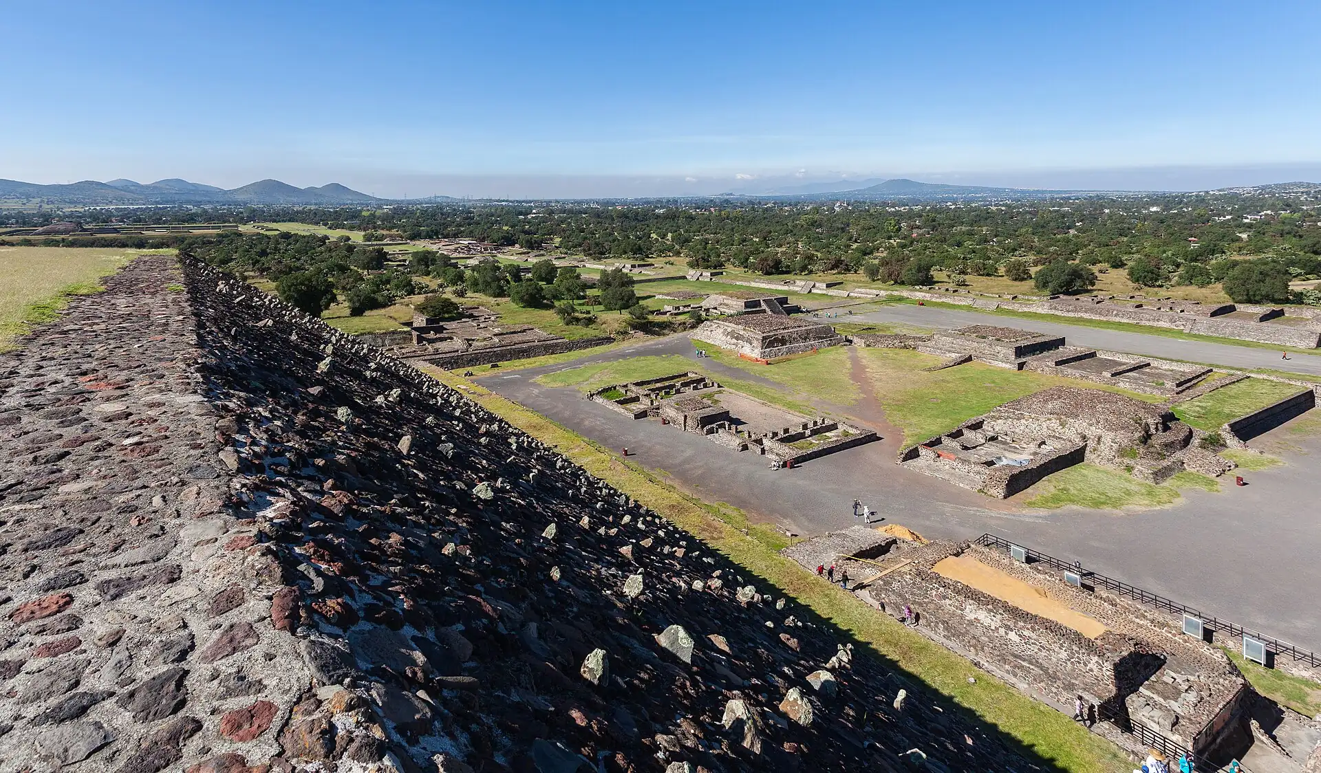 Photo: Diego Delso, CC BY-SA 3.0
Teotihuacán
goBus from Terminal del Norte about 1–1.5 h, or a tour or car
The vast pre-Hispanic city of pyramids and avenues; go early to beat heat and crowds, wear a hat and closed shoes.
- Time
- Full day
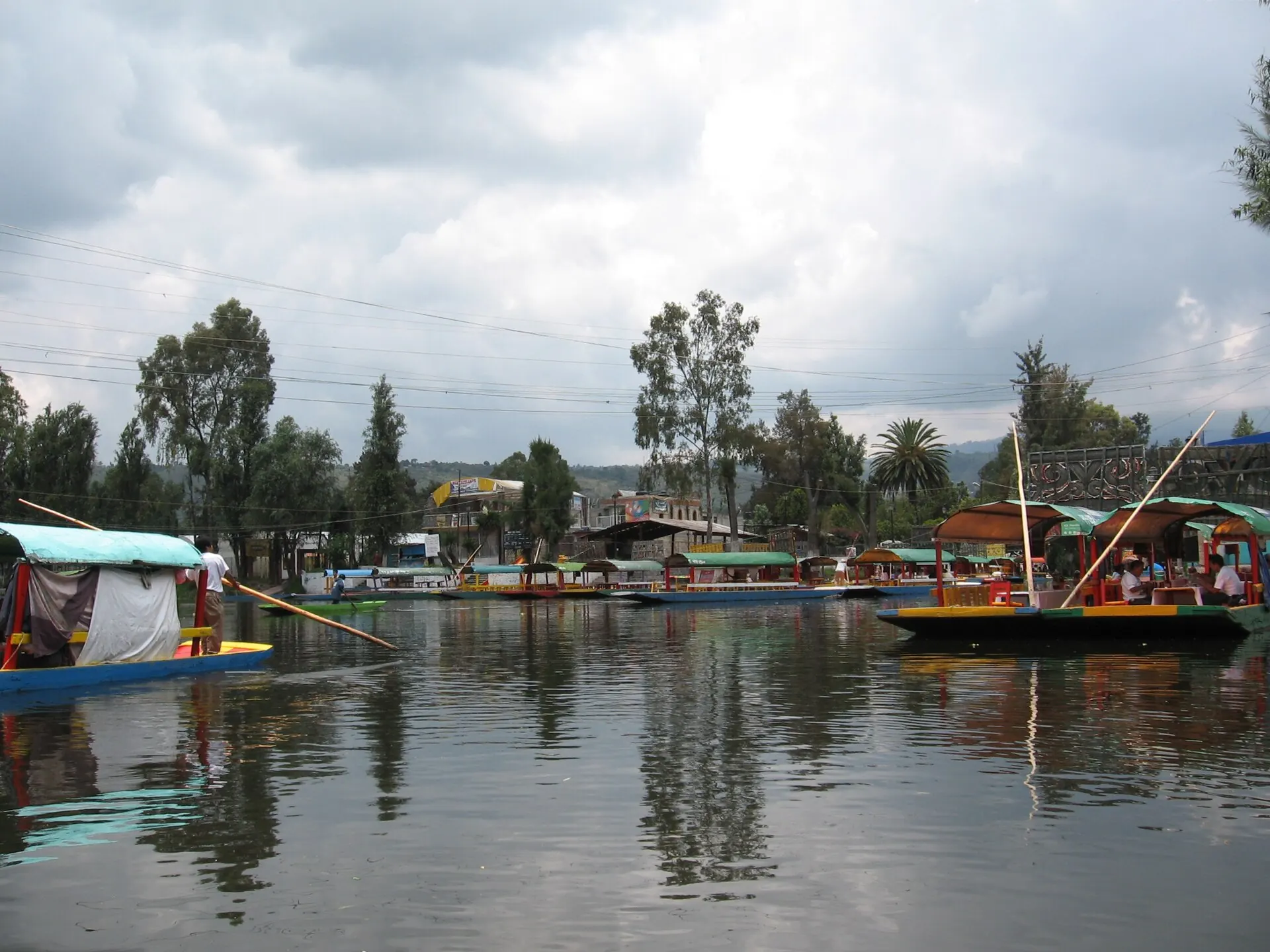 Photo: Syced, CC0
Xochimilco
goMetro and light rail about 1–1.5 h, or an app car
Colourful trajinera boats on the last canals of the old lake; weekends are loud and crowded.
- Time
- Half day
Coyoacán and the Frida Kahlo Museum
goApp car about 30–50 min
A leafy old village; the Frida Kahlo Museum sells timed tickets in advance.
- Time
- Half day
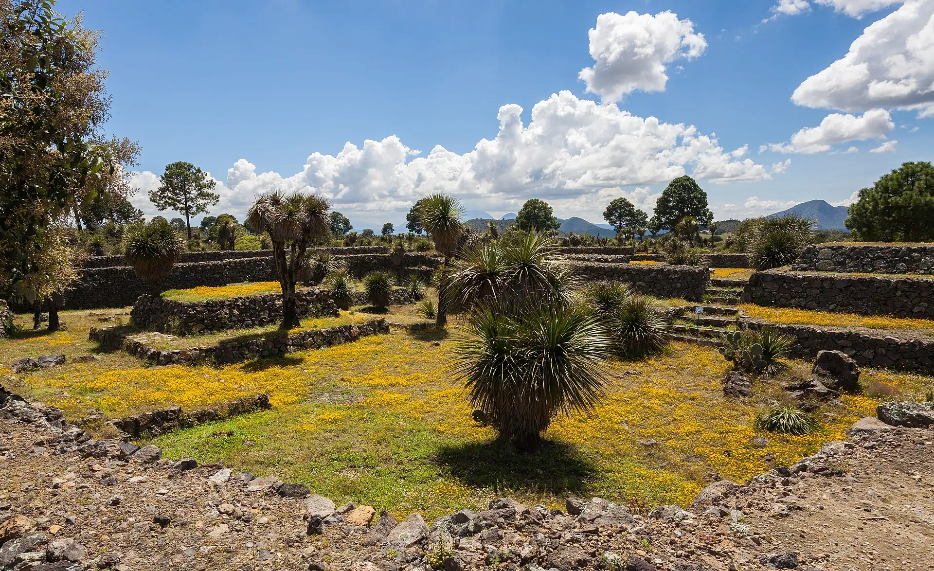 Photo: Diego Delso, CC BY-SA 3.0
Puebla
overnightBus from TAPO about 2–2.5 h
A colonial city of tiled churches and mole; a night turns it into a proper visit.
- Time
- Full day or overnight
Cuernavaca and Taxco
overnightBus about 1.5–3 h
Warmer, lower towns with markets and silver in Taxco.
- Time
- Full day or overnight
Go next
Oaxaca
overnightDoor to door: About 3 h by air door to door
Flight about 1.2 h, or an overnight bus
A separate trip for food and craft; fly rather than bus.
Tepoztlán
goDoor to door: About 2 h
Bus or car about 1.5–2 h
A hill town with a pyramid hike and markets; best on weekdays.
Eat & sleepWhere to eat and which area to sleep in
Eat & sleep
Where to eat and which area to sleep in
Eat
A short list of places worth crossing the city for, each with how to get a seat.
Restaurant finder: filter every place to eat in Mexico City →
Vegetarian-friendly score
3.5 / 5 · Good
- Country diet noteOur country guide rates vegetarian eating as easy.2 / 2
- Places to eat in this guide5 of 6 places with a known answer are vegetarian-friendly, 1 partly.1.38 / 1.5
- Budget eating lines0 vegetarian lines in "Eat by budget".0 / 0.6
- Meat-free national dishes2 meat-free dishes in the country food list.0.2 / 0.4
- Dedicated vegetarian kitchens0 mentions of vegetarian restaurants, Buddhist or fasting kitchens.0 / 0.5
Country note: Easy in Mexico City and Oaxaca; lard and chicken stock hide in beans, rice and soups.
Vegetarian places near me →Make a diet card →
How we score
- Country diet note (up to 2): easy 2, workable 1, mixed 0.75, hard 0; no note 0.5.
- City places to eat (up to 1.5): 1.5 × (vegetarian-friendly + half of partly friendly) ÷ places with a known answer; needs 3 or more known places.
- Budget eating lines marked vegetarian (up to 0.6): 0.2 each.
- Meat-free national dishes (up to 0.4): 0.1 each.
- Dedicated vegetarian kitchens mentioned — Buddhist chay, shōjin ryōri, Jain, fasting food, vegan cafés (up to 0.5): 0.1 each.
- Total rounded to the nearest half point, 0 to 5. Built from our own pages only, not from reviews.
Eating and drinking guideEat by budget · Drink
Before you sit down to eat
Short version; full text linked
- Queues and hours
- Per person, one dish or one meal, 2026 estimate. More →
Eat by budget
Under MXN 150 (≈ US$9) a meal
| Where | Order | Area | Price | Note |
|---|---|---|---|---|
| Los Cocuyos taquería | Tacos de suadero and campechano | Centro Histórico | MXN 60–150 (≈ US$4–9) | A late-night classic; watch the queue and order by the piece. |
| Churrería El Moro | Churros and hot chocolate | Alameda area | MXN 90–180 (≈ US$5–10) | A sweet breakfast or snack, open at all hours (check). |
| Comida corrida at a family restaurant | Set lunch with soup, main and drink | Centro and Roma | MXN 100–200 (≈ US$6–11) | A cheap, filling weekday lunch. |
Dishes to know
| Dish | What it is | Where to look | When | Price |
|---|---|---|---|---|
| Tacos al pastor | Marinated pork carved from a vertical spit with pineapple | Taquerías | Any time, especially late | MXN 20–45 (≈ US$2–3) each |
| Tacos de suadero | Thin-cut beef cooked on a griddle | Taquerías and stands | Late night | MXN 20–40 (≈ US$2–3) each |
| Tlacoyos and quesadillas | Griddled masa cakes filled with beans or cheese | Markets and stands | Morning, snack | MXN 30–70 (≈ US$2–4) |
| Pozole | Hominy and pork stew with garnishes | Family restaurants | Lunch, dinner | MXN 100–220 (≈ US$6–12) |
| Enchiladas and chilaquiles | Tortillas in salsa, with chicken, cheese or egg | Cafés and restaurants | Breakfast, lunch | MXN 100–220 (≈ US$6–12) |
| Mole | A rich sauce of chiles, spices and chocolate, served with chicken | Traditional restaurants | Lunch | MXN 150–300 (≈ US$9–17) |
| Tamales and atole | Steamed masa parcels and a warm corn drink | Street sellers and markets | Morning | MXN 25–50 (≈ US$2–3) |
| Churros with chocolate | Fried dough with thick hot chocolate | Churrerías | Breakfast, evening | MXN 90–180 (≈ US$5–10) |
| Mezcal and pulque | Agave spirits and a milky fermented agave drink | Bars and pulquerías | Afternoon, evening | MXN 60–250 (≈ US$4–14) |
- Eat where the turnover is fast and the food is hot: a busy stand is safer than an empty one.
- Ask if it is spicy (¿pica?) before you bite: salsa is often served separately.
- Choose purified water and ice; fruit should be peeled or washed in purified water.
Drink & nightlife
| Where | What | Until | Note |
|---|---|---|---|
| Roma Norte and Condesa bars | Cocktail bars, mezcalerías, wine bars | About 01:00–02:00About 1:00 AM–2:00 AM | The main evening strip for visitors; walkable between bars; use an app car back. |
| Centro cantinas and rooftop bars | Traditional cantinas, terraces | About midnight | Old-school cantinas serve snacks with drinks; rooftops overlook the Zócalo. |
| Zona Rosa and Reforma clubs | Clubs and LGBTQ+ venues | Very late | Go by app car; keep your bag close. |
By style
| Style | What | Where | Price | Until |
|---|---|---|---|---|
| Mezcal and tequila | Agave spirits, served neat with orange and salt (sal de gusano)Sip slowly; ask about the maguey and region. | Mezcalerías in Roma and Centro | MXN 100–250 (≈ US$6–14) a glass | About 01:00 |
| Beer and micheladas | Beer, sometimes with lime and salt or a spicy mixThe everyday drink; a michelada is a spicy beer cocktail. | Cantinas, taquerías and bars | MXN 60–120 (≈ US$4–7) | Late |
| Coffee and horchata | Local coffee and sweet rice drinkMexican coffee has a strong café scene. | Cafés and markets | MXN 40–90 (≈ US$3–5) | Daytime |
Rules that bite
- Use an app car or a hotel taxi after dark; do not hail a street cab.
- Watch your drink and never leave it unattended; drink spiking has been reported.
- Do not carry more cash than you need and keep your phone out of sight on the street.
Sleep
Pick the area first: it decides your walk home at night and your first morning.
Which neighborhood fits you
Three questions, one recommendation, with the reasons.
Your best fit
- The Zócalo, Templo Mayor and museums are walkable.
- A wide range from hostels to boutique hotels.
- Hotels keep desks staffed; app cars are easy.
Watch out: Traffic and street noise by day; quieter at night except on event days.
Next best: Roma Norte hotels
Built from our 1–5 desk scores per area; your answers stay in this browser.
More on sleepingSleep by budget · Your area · With kids
Sleep by budget
| Band | Price | Where | Room types | What to expect |
|---|---|---|---|---|
| budget | MXN 500–1,200 (≈ US$30–65) | Centro hostels and small hotels | Hostels and budget hotels | Simple rooms, basic breakfast, shared bathrooms in hostels. |
| mid | MXN 1,500–3,500 (≈ US$85–190) | Roma Norte, Condesa and Centro | Boutique and business hotels | Lift, breakfast, AC or heating, Wi-Fi. |
| splurge | MXN 4,500 (≈ US$250)+ | Reforma, Polanco and Roma design hotels | 5-star and design hotels | Pools, spas, restaurants and concierge services. |
Booking checks
- Ask about street noise: Centro and Reforma can be loud; ask for an interior room.
- Confirm an airport pick-up or a safe app-car plan before you arrive.
- Check the building's earthquake and fire exits when you check in.
Which area is yours
| If you are | Sleep in | Because |
|---|---|---|
| First visit, sights first | Centro Histórico hotels | Walk to the Zócalo and museums; take a car for Chapultepec. |
| Cafés, restaurants and a longer stay | Roma Norte hotels | A walkable, leafy base with many places to eat and drink. |
| Nightlife-focused stay | Roma Norte hotels | Bars and restaurants within walking distance and a short ride home. |
For a first visit with an early Zócalo morning: a hotel with a 24-hour desk on a street a taxi can reach; the square is a walk, the rest is a short ride.
Calmer nights and better food streets: a hotel with a night desk on a tree-lined block; museums and the Centro are a taxi ride away.
Areas are in our default order until you tick a priority.
Scores are 1–5 desk judgements per priority (2026).
With kids
- Chapultepec Park has a zoo, boating and playgrounds, and the anthropology museum has a children's-friendly courtyard fountain.
- Altitude can tire small children on day one: keep the schedule light and drink water.
- Strollers struggle on broken pavements: use a carrier, and use app cars with a booster or ask your hotel for a car with a child seat.
- Air quality alerts can affect outdoor play; check the local air-quality index.
PracticalMoney, essentials, safety and the pocket card
Practical
Money, essentials, safety and the pocket card
Money
What a day costs at three comfort levels, and how to pay.
- Budget
- MXN 700–1,400 (≈ US$40–80) excl. bed / day
- Mid
- MXN 1,400–3,000 (≈ US$80–170) excl. bed / day
- High
- MXN 3,000 (≈ US$170)+ excl. bed / day
- Transit card
- No transit card needed: app cars and walking; the Metro exists but is crowded at rush hour.
- Cash rule
- Keep MXN 500 (≈ US$30) in small notes for tips, snacks and site taxis; use ATMs inside banks or malls and choose to be charged in pesos.
More on moneyCosts · Budget · Buy
What things cost
- Tacos at a street stand or taquería, eachMXN 20–45 (≈ US$2–3)
- Seafood or tasting-menu lunch at a well-known restaurant, per personMXN 600–1,100 (≈ US$35–60)
- Large bottle of purified waterMXN 15–30 (≈ US$1–2)
- App car, airport to Centro or RomaMXN 250–450 (≈ US$14–25)
Trip budget
| Hotel double room1 × 3 nights × MX$2,000 | MX$6,000 |
| Food, local transport, entries2 × 3 days × MX$2,000 | MX$12,000 |
| Airport app car, both ways1 × MX$800 · one car per 4 people | MX$800 |
| Museum entries2 × MX$300 | MX$600 |
| Tourist SIM, about a week2 × MX$250 | MX$500 |
| Buffer 15%Price creep, a taxi you did not plan, one splurge | MX$2,985 |
| Trip total≈ MX$3,814 per person per day, bed included | MX$22,885≈ US$1,300 |
2026 estimate in MXN; flights, visas and tours excluded. Your choices stay in this browser.
Prices of common things
| Short app car rideSurge pricing applies in rain and at rush hour. | MXN 70–180 (≈ US$4–10) |
| Airport app car to the centre | MXN 250–450 (≈ US$14–25) |
2026 estimate; check locally.
Buy
- Bargaining
- Shops, malls and restaurants have fixed prices. At markets and craft stalls you can bargain politely, especially for crafts: counter at about two-thirds and settle around 70–80%. Do not bargain for food, at fixed-price shops or with street vendors selling small items.
- Fixed-price check
- Check the price of a craft item in a fixed-price shop (for example a government-run craft store) before you buy the same item in a market; that is your ceiling.
Markets and shopping streets
| Where | What | When | Haggle | Note |
|---|---|---|---|---|
| Mercado de Artesanías La Ciudadela | Crafts from across Mexico: textiles, pottery, silver, masks | Daytime (check) | light | A large, calm craft market near Centro; a good place to compare prices. |
| Mercado de San Juan | Gourmet foods, meat, cheese, chocolate, tropical fruit | Daytime (check) | no | A food market known for unusual ingredients; go for a look and a snack. |
| Mercado Roma (food hall) | Restaurants and food counters | Daytime to evening (check) | no | A modern food hall for a snack or a lunch. |
| Mercado de Coyoacán | Tostadas, fruit, crafts, flowers | Daytime (check) | light | A busy local market in southern Mexico City; famous for tostadas. |
| Sunday flea markets (Lagunilla, Roma, Bazar del Sábado in San Ángel on Saturdays; check) | Antiques, clothes, crafts | Weekend mornings (check) | hard | A big weekend draw; go early and watch your bag. |
Shops by what they sell
| For | Where | Hours | Note |
|---|---|---|---|
| Handicrafts: textiles, pottery, silver, masks | La Ciudadela, government craft shops and boutiques in Roma and Condesa | Shop hours | Ask the maker or region; look for fair-trade and government-run shops if you want fixed prices. |
| Chocolate, mezcal, coffee and spices | Markets, specialist shops and supermarkets | — | Check that mezcal is labelled with a maker and region; airline rules limit liquids. |
| Books, art and design | Roma and Condesa bookshops and galleries | — | A strong scene; some shops ship abroad. |
Changing money
| Where | Verdict | Why |
|---|---|---|
| Bank ATMs inside banks or malls | use | The best rate; choose to be charged in pesos, not your home currency. |
| Bank branches | use | Passport needed; limited hours. |
| Airport bureaux | ok | Fine for a small amount on arrival; weaker rate. |
| Street changers | avoid | Not licensed; counterfeit and short-change risk. |
ATMs
- Per withdrawal
- Bank ATMs typically cap a foreign card at about MXN 6,000–12,000 (≈ US$350–650) per withdrawal; the screen shows the limit.
- Fees
- A local fee plus your own bank's foreign fee; take a larger amount rather than several small ones.
- Where
- Machines inside banks, malls and hotels in daylight; avoid street-side machines after dark.
- Conversion
- If a machine or terminal offers to charge in your home currency, decline and pay in pesos.
Essentials and accessEssentials · Access
Essentials
- Plugs & power
- 127 V, 60 Hz; sockets are type A and B (two flat pins, often with a round earth pin). Many visitors from Europe need an adapter and to check that their devices accept 127 V.
- Drinking water
- Do not drink tap water. Use bottled or purified water; restaurants generally use purified ice, but ask if unsure.
- Toilets
- Cafés, museums and malls; small fee (MXN 5–10 (≈ under US$1)) at some public toilets, so carry coins and tissues.
- Opening hours
- Museums usually close on Mondays and open about 09:00–17:00; restaurants serve the main meal (comida) between about 14:00 and 17:00 and dinner is late; many shops open about 10:00–20:00.Museums usually close on Mondays and open about 9:00 AM–5:00 PM; restaurants serve the main meal (comida) between about 2:00 PM and 5:00 PM and dinner is late; many shops open about 10:00 AM–8:00 PM.
- Health
- Altitude of 2,240 m (headache and breathlessness on day one), air quality that can be poor in the dry season, stomach upsets from street food if you are unlucky, and strong sun. Travel insurance with medical cover is advised.
- Accessibility
- Uneven, high-kerbed pavements and few lifts on the Metro; museums and newer hotels are the practical step-free options.
- Laundry
- Hotels charge by the item; self-service and drop-off laundries (lavanderías) are common in Roma, Condesa and Centro.
- Emergency numbers
- 911 for police, fire and ambulance; save your hotel's number and your embassy's line.
Pack
- Layers: mornings and evenings are cool at altitude year round, and afternoons can be warm
- A light rain jacket or compact umbrella for the June–September afternoon storms
- Comfortable, closed shoes for cobbles and broken pavements
- Sunscreen, a hat and a refillable bottle; the sun is strong at altitude
- A cross-body bag with a zip, and a small photocopy or photo of your passport
Accessibility
Mexico City is hard going on wheels. Pavements are uneven, kerbs are high and Metro lifts are few. Museums and newer hotels have lifts and ramps; plan door-to-door app-car rides.
- Pavements
- Uneven, with tree roots and steep kerbs; Roma has short flat stretches.
- Getting around
- App cars and Metrobús are the practical options; the Metro has few working lifts.
- Museums
- Bellas Artes, Antropología and Chapultepec Castle have ramps or lifts in places (check each).
- Hotels
- Newer and international hotels have lifts and adapted rooms on request.
- Toilets
- Accessible toilets in malls, museums and larger hotels; rare elsewhere.
Sights, step-free or not
| National Museum of Anthropology | step-free | Level halls and lifts; long distances. |
| Palacio de Bellas Artes | step-free | Lifts to upper floors; steps at some entrances. |
| Chapultepec Castle | with help | A steep approach; a lift or shuttle may operate (check). |
| Templo Mayor | with help | Ramps on the ruins; uneven paving. |
| Zócalo & Metropolitan Cathedral | step-free | A large, level square; some steps at the cathedral. |
Survive
Safety basics, the lines not to cross, and practical habits that save the day.
Safety
- Emergency: 911.
- After dark use an app car or hotel taxi, even for short distances.
- Altitude: drink water, go slowly on day one, and rest at the first sign of dizziness.
Red lines
- Do not photograph inside museums where signs forbid it.
- Keep phones out of hand on Metro platforms and in crowds.
- Bags are checked at the big museums: leave large packs at the hotel.
Practical
- Toilets: museums, cafés and malls; carry small coins and tissues.
- Do not drink tap water: use bottled or filtered water.
More on staying safeStay safe · Stay healthy · Safety map · Solo & women · Etiquette · Cope · Scams
After dark, by area
4 flagged areas
- Take care
- Take care
- Take care
Metro
Take care
Day = about 07:00–20:00. What to watch in each area, day and night →
Scams and red flags
Walk away if you see these
- Street taxis that are not authorised: hailing one on the street has led to overcharging and robbery. Use an app car, a hotel taxi or a site taxi (taxi de sitio) at the airport or from your hotel.
- Fake police or 'inspectors' who ask to see your passport or cash: ask for identification and offer to go to the nearest station; real officers do not inspect money on the street.
- The staged spill: someone spills something on you, a helper offers to clean it and a partner takes your bag. Keep a hand on your things and decline help.
- Card skimming at ATMs and restaurants: use ATMs inside banks, keep your card in view and pay by phone or contactless where possible.
- Overcharging by a street helper who 'guides' you: agree the price first, or decline; official guides at museums have IDs.
Stay safe
Crossing the road
- 01Traffic is fast and drivers do not always yield: cross at a light or a clear gap, and look both ways on one-way streets.
- 02Uneven pavements and open drains: watch your footing, especially at night and in the rain.
Hustles specific to this city
| Hustle | Where | The tell | What to do |
|---|---|---|---|
| Street taxi robbery | Anywhere, airport | A street cab that is not a site taxi | Use an app car, a hotel taxi or a prepaid airport taxi. |
| Fake police | Streets, transit | 'Officers' ask to see your cash or passport | Ask for ID and offer to go to the station; do not hand over cash. |
| Staged spill | Crowds, Metro | Someone spills something on you and a helper offers to clean it | Keep a hand on your bag and decline help. |
| ATM skimming | Street ATMs | A loose card slot or a helper offering advice | Use ATMs inside banks and cover the keypad. |
- Police
- Report thefts at the nearest police agency with your passport; insurers need the written report; call 911 in an emergency.
- Earthquakes
- The city sits on soft ground in a seismic zone: know the exits, follow staff instructions and expect drills and sirens.
- Demonstrations
- Marches are frequent, especially along Reforma and to the Zócalo; avoid them and check for road closures.
- Altitude
- Pace the first day, drink water and skip strenuous climbs if breathless.
Stay healthy
- Altitude
- At 2,240 m, headache, breathlessness and poor sleep on the first days are common; take it easy, drink water and avoid heavy alcohol.
- Food and water
- Choose busy stalls; drink purified water; peel fruit. Traveller's diarrhoea happens; carry rehydration salts.
- Sun
- Strong sun at altitude: hat, sunscreen and shade.
- Mosquitoes
- Dengue and Zika exist in Mexico but the city's altitude keeps the risk low; use repellent if you travel to lower areas.
- Medical care
- Good private hospitals in the city; pay upfront and claim later. Travel insurance with medical cover is advised.
- Vaccination
- Ask a travel clinic several weeks before you travel; check routine vaccinations and hepatitis A.
Hospitals and clinics: see Cope.
Safety by area and hour
| Area | Day | Night | What to watch |
|---|---|---|---|
| Centro Histórico | fine | caution | Empty side streets after dark; use an app car; pickpockets in crowds. |
| Alameda and Bellas Artes | fine | caution | Watch bags near the Metro and on Eje Central. |
| Roma Norte | fine | fine | Phone snatching from cafés and streets; keep phones out of sight on the pavement. |
| Chapultepec | fine | caution | Park closes at dusk; be out before dark. |
| Metro | caution | caution | Crowds and pickpockets; use women-only cars where offered and keep bags in front. |
- Keep phones out of hand on the street and in the Metro; snatching from café tables and pavements happens.
- Use app cars or hotel taxis after dark; do not hail a street cab.
Solo, women and LGBTQ+ travellers
Solo
- Manageable with care: use app cars after dark, keep valuables out of sight and share your trip details with someone.
- Hostels and small hotels in Roma and Centro are good for meeting other travellers.
Women
- Catcalling is common; a firm, brief response and continuing to walk usually ends it. Use the front women-only cars on the Metro and avoid quiet streets at night.
- Use app cars with the safety-share features turned on.
LGBTQ+
- Mexico City is one of the most welcoming cities in Latin America: same-sex marriage has been legal here since 2010, and Zona Rosa, Roma and Condesa have a lively scene.
- Discretion is still wise outside the main areas; check your government's travel advice.
Etiquette in Mexico City
- Greetings
- Say buenos días or buenas tardes when entering a shop, taxi or restaurant; a quick greeting is expected.
- Tipping
- 10–15% in restaurants unless a service charge is added; small tips for porters, guides and helpers.
- Churches
- Dress modestly; no flash; keep quiet and do not photograph people at prayer.
- Photos
- Ask before photographing people; follow museum rules, since flash and tripods are often banned.
- Lunch and dinner
- Lunch (comida) is the main meal, from about 14:00; dinner is late; a long table conversation (sobremesa) is normal.Lunch (comida) is the main meal, from about 2:00 PM; dinner is late; a long table conversation (sobremesa) is normal.
- Queueing
- Museum and ticket queues are orderly; respect them and avoid pushing on the Metro.
- Bargaining
- Only at craft markets, politely; not at shops with prices or for food.
Cope
Hospitals and clinics that handle foreigners
| Where | Area | Use it for |
|---|---|---|
| Hospital ABC (American British Cowdray) | Observatorio and Santa Fe | A large private hospital with English-speaking staff; pay upfront and claim later; check services. |
| Médica Sur | Tlalpan | A large private hospital used by expats and visitors; check services. |
| Hospital Ángeles (several branches) | Various | A private hospital chain with emergency departments; check the nearest branch. |
| Farmacias (Farmacias del Ahorro, Benavides, Guadalajara) | Citywide | Pharmacies with long hours; many have doctors' offices attached for a low-cost consultation. |
Visa extensions
- Office
- The National Migration Institute (INM) has offices in the city; check the address and hours before going.
- Entry record
- Keep your immigration receipt or digital record of entry; you may be asked for it when you leave.
- Overstay
- Fines apply for overstaying; resolve any problem before you reach the airport.
Embassies and consulates
| Country | Address | Phone | Note |
|---|---|---|---|
| United States | Paseo de la Reforma area (check) | — | (check) |
| United Kingdom | Lerma or Reforma area (check) | — | (check) |
| Canada | Polanco (check) | — | (check) |
| France | Polanco (check) | — | (check) |
| Germany | Polanco (check) | — | (check) |
| Spain | Polanco (check) | — | (check) |
- Lost passport
- Police report from the nearest agency (Ministerio Público), then your embassy for an emergency document; budget a few working days.
- Pharmacies
- Farmacias are common, with a green cross or brand signs; some are open 24 hours.
- Gyms and pools
- Day passes at larger hotels and gyms, roughly MXN 150–400 (≈ US$9–25) (2026 estimate).
- Co-working
- Many co-working spaces in Roma, Condesa and Polanco sell day passes; cafés with Wi-Fi are also common.
- Laundry
- Lavanderías in Roma and Centro do wash-and-fold by the kilo, usually next day.
Apps and offline kitOffline kit
Offline kit
Set up before you leave, so Mexico City still works with no signal or a dead roaming plan.
On your phone
- Maps: open the city in Google Maps, tap the place name, then Download offline map (or use an offline-maps app).
- Data: install an eSIM or buy a local SIM before the first taxi; the apps in this guide depend on it.
- Translation: download the local language for camera translation.
- Screenshots: booking confirmations, hotel address in the local script, and the emergency numbers.
This guide
Save the Mexico City guide and its pages on this device; it opens without a connection.
Phrases that do the work
Greeting
Hello / good morning
Hola / Buenos días
oh-la / bway-nos dee-as
Greeting
Good afternoon
Buenas tardes
bway-nas tar-des
Thanks
Thank you
Gracias
gra-see-as
Thanks
Please
Por favor
por fa-vor
Food
The bill, please
La cuenta, por favor
la kwen-ta por fa-vor
Food
No spicy, please
Sin picante, por favor
sin pee-kan-te por fa-vor
Food
Is it spicy?
¿Pica?
pee-ka
Taxi
Please take me to this address
Lléveme a esta dirección, por favor
yeh-veh-meh a es-ta dee-rek-syon por fa-vor
Market
How much is it?
¿Cuánto cuesta?
kwan-to kwes-ta
Everyday
I do not understand
No entiendo
no en-tyen-do
Pocket card
Fill in, then print or save as PDF
Stays in this browser only; nothing is sent anywhere.
Mexico CityCiudad de México
Pocket card · Voykit
My bed tonight
—
—
—
Lléveme a esta dirección, por favorPlease take me to this address
Emergency
- Police, fire and ambulance911
- Tourist assistance (check)Ask your hotel
Embassy
Most embassies are along Paseo de la Reforma or in Polanco; write your own embassy's 24-hour line below.
My embassy: —
Fare anchors (2026 estimate)
- Airport (MEX) to Centro or Roma, app car: MXN 250–450 (≈ US$14–25), 30–60 min depending on traffic
- Short app car ride, centre: MXN 70–180 (≈ US$4–10)
- Metro ride: MXN 5 (≈ under US$1) flat fare (check)
Share your app-car trip with a friend and check the plate before you get in.
Deep diveHistory, reading, photos and every source
Deep dive
History, reading, photos and every source
Sources
Ask about Mexico City
Loading…
Was this useful?