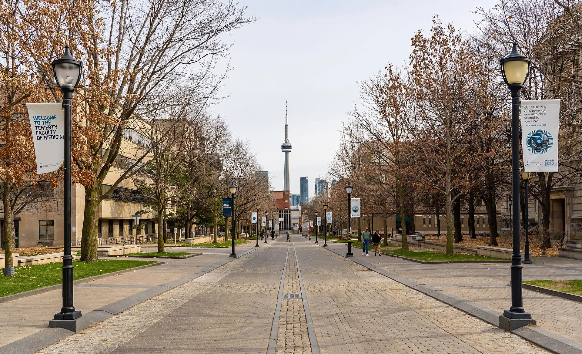
Toronto
Code CA · 4 walking zones
Toronto is a transit-and-market city: keep one bed downtown, use the subway and streetcars between four clusters, and put the CN Tower on a clear day and the museums on the wet or cold one.
Our quick read of Toronto, scored 1–5 (friction is out of 100). Cash need: how often you still need notes. Heat risk: how hot days get. Stroller: how easy wheels are. Friction: overall effort for a first visit. Desk judgements, so check before relying on them.
- Local time
- --:--
- Weather
- forecast below
- Currency
- CAD
- Best months
- May · Jun · Jul · Aug · Sep · Oct
- Airport
- Toronto Pearson (YYZ)
Walking zones: the 4 areas this guide plans a day around. Each is a district you can cover on foot, so you do one zone per half-day and ride the train between them. The code (CA 01, CA 02…) is just the zone's number on the Toronto line; the line under each name says how bags fare there and how much time it needs.
Map of Toronto
Use the switches to show or hide each kind of pin. A switch that is on shows its pins on the map; tap it again to hide them. "Show only" keeps just the pins that match (for example, places that fit a suitcase). Tap any pin for its name and a link to its page.
- Where to sleep
- Places
- Eat
- Walking clusters
- Rest stops
From the airport Toronto Pearson (YYZ) to your bed
Tap a pin for its card. Places without their own coordinates are shown by their walking cluster.
Why Toronto
Toronto's sights sit in a strip a few kilometres wide, joined by the subway and streetcars, so the trips that go wrong are about weather and timing: the CN Tower on a cloudy day, the market on a closed day, or a January walk between clusters. Four clusters cover a first visit; Niagara Falls is a full-day trip, not a stop between them.
See first
- 1
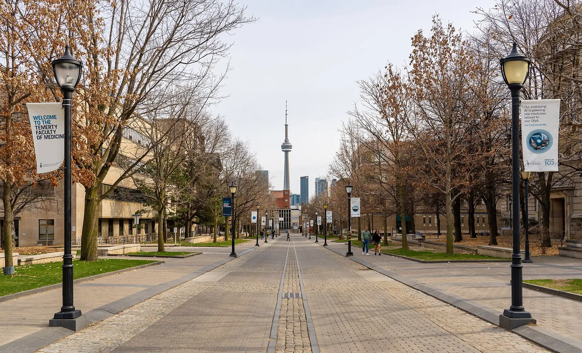 CN Tower · 1–2 h
- 2
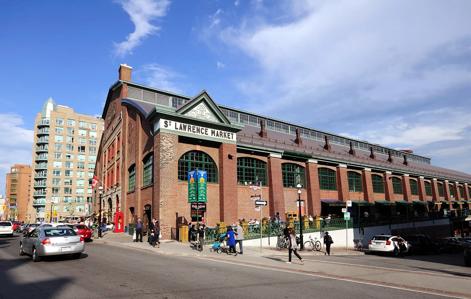 St. Lawrence Market · 1–1.5 h
- 3
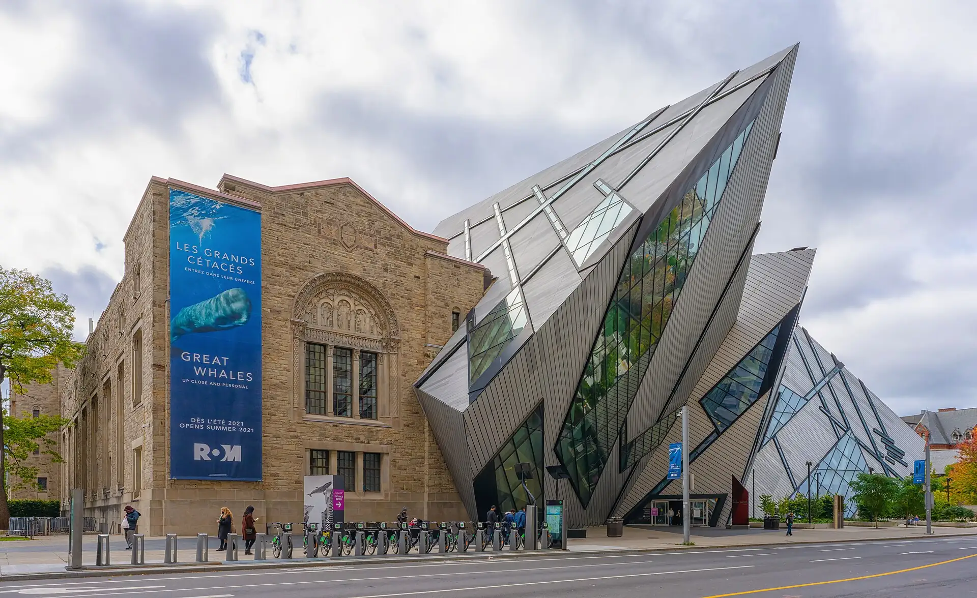 Royal Ontario Museum · 2–3 h
- 4
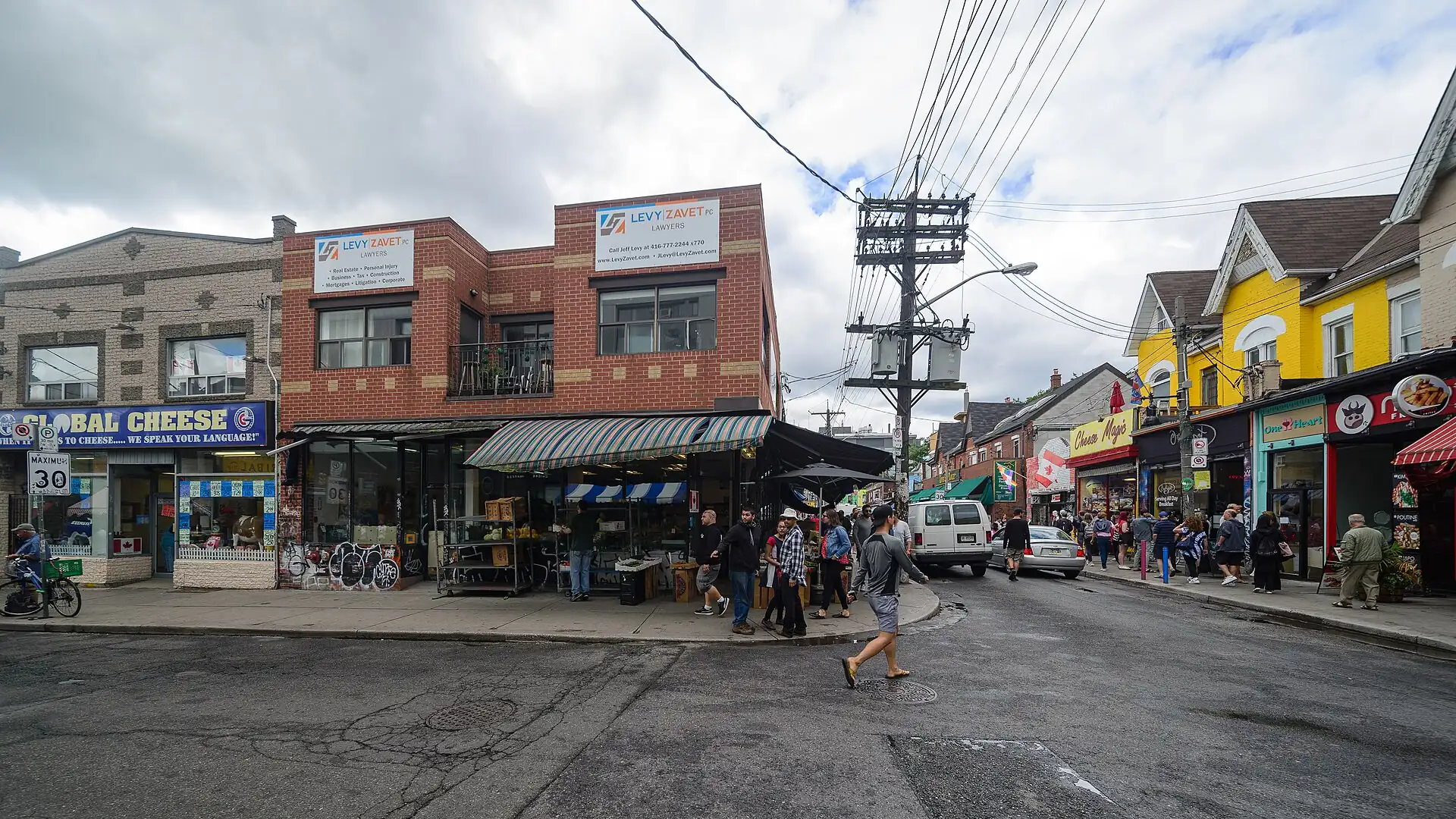 Kensington Market · 1.5 h
- 5
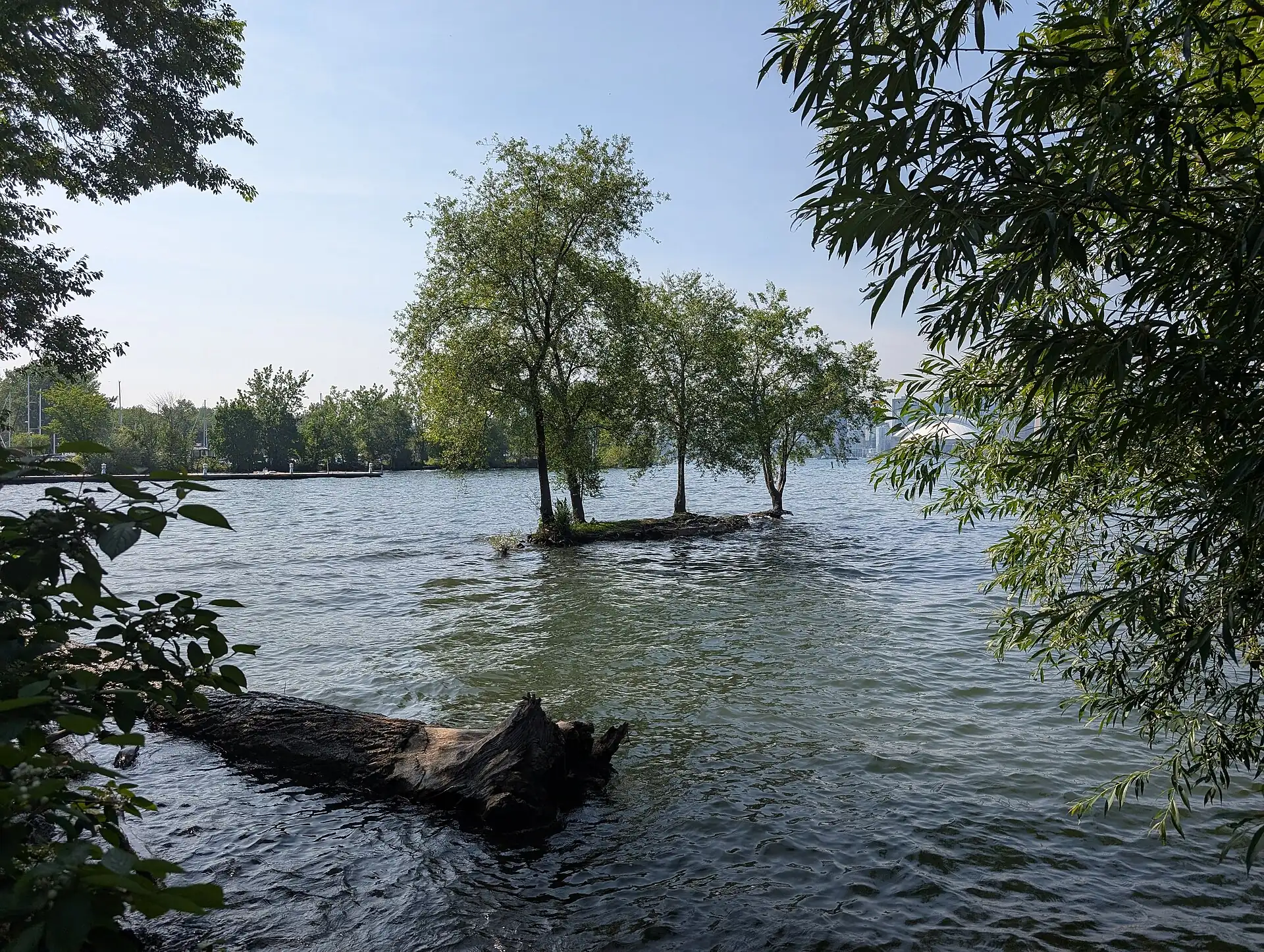 Toronto Islands · 3–5 h
Fits
- City breaks with food and museums
- Travellers who use transit
- Winter and shoulder-season visits
Does not fit
- Travellers who want mountains or beaches
- Winter visitors without a warm coat
- Very tight budgets in summer (hotels are expensive)
How long
- 2 daysWaterfront + St. Lawrence in one day, Kensington and Chinatown on the second
- 3 daysFour clusters: waterfront and market, Kensington and Chinatown, Yorkville and the ROM
- 5 daysFour clusters + Niagara Falls day trip + one slow day
Good for
- First timers
- Foodies
- Families
- Budget travellers
About Toronto
Toronto sits on the north shore of Lake Ontario. Its name is usually traced to a Mohawk word for a place where trees stand in the water, and the land is the traditional territory of the Mississaugas of the Credit and other Indigenous peoples. The British built Fort York in 1793 as the new capital of Upper Canada; the town was called York until it was renamed Toronto in 1834.
It is Canada’s largest city, with about 2.8 million people in the city and more than six million in the wider region. About half of its residents were born outside Canada, which is why the food and the neighbourhoods are so varied.
For a visitor, it is a city of neighbourhoods on a grid, joined by a subway and streetcars. The lake is the south edge and the orientation point.
Good to know
- The Toronto Islands are a ferry ride away, not part of the downtown clusters; Niagara Falls is about 1.5 hours by car.
- The main visitor information is run by Destination Toronto; check the official site for opening hours of the visitor centres.
- Shops calling themselves "Tourist Information" may be tour sellers; use the official sites for tickets.
Go deeper 11 min read · 6 chapters
Toronto is a city of neighbourhoods on a lakeshore grid, built by successive waves of newcomers and stitched together by streetcars and a subway. This deep dive reads it in six layers, from the shoreline where it began to the winters that shape how people use it, so that a day of markets and museums becomes a way of understanding why the city looks and eats the way it does.
1History2 min
Toronto stands on land that Indigenous peoples used long before Europeans arrived. The name is usually traced to a Mohawk word for a place where trees stand in the water, and the Mississaugas of the Credit, the Haudenosaunee and the Wendat all have deep ties to the area. French traders built posts on the lakeshore in the 1700s, but the modern city starts with the British. In 1787 the Crown negotiated the Toronto Purchase with the Mississaugas, a deal whose terms were disputed for more than two centuries until a settlement in 2010.
In 1793 the lieutenant governor of Upper Canada, John Graves Simcoe, chose the site for a new capital and built Fort York to guard the harbour. The town was called York. In April 1813, during the War of 1812, American forces attacked and burned the parliament buildings, an event that shaped how the town remembered itself and how Canadians talk about the war. The town grew as a port and a centre of government and trade, and in 1834 it was incorporated as a city and took the older name, Toronto. William Lyon Mackenzie, later a leader of the 1837 rebellion, was its first mayor.
The nineteenth century brought the railways, the University of Toronto and a strongly British and Protestant city that Torontonians later nicknamed Toronto the Good for its Sunday closing laws. In April 1904 a fire destroyed a large part of the downtown warehouse district, and the rebuilt blocks along Front Street and King Street are the brick streets you walk today. Skyscrapers and the first suburbs followed in the 1920s.
The most important change came after the Second World War. Immigration from Italy, Portugal, Greece and later the Caribbean, China, South Asia and elsewhere remade the population. The first subway line, along Yonge Street, opened in 1954. In 1998 the province merged the old Metro Toronto with its six municipalities into one city, which now has about 2.8 million people and is the centre of a region of more than six million. About half of Toronto’s residents were born outside Canada, and that fact explains almost everything a visitor tastes and hears.
For a first visit, Fort York is the place to see the origin story, and the brick streets around St. Lawrence Market are the oldest commercial blocks that survive. The market building itself is a good place to feel the city’s early trading life, and the Distillery District shows how a Victorian industrial site became a pedestrian quarter.
- Fort York founded
- 1793
- Renamed Toronto
- 1834
- Great Fire
- April 1904
- First subway line
- 1954
- Amalgamated city
- 1998
2The lake and the layout2 min
To read Toronto, start with the water. Lake Ontario is the south edge of the city, and almost every trip begins by looking for it. The lakefront is not a single beach but a working waterfront: rail lines, expressways, harbour piers, condo towers and a long strip of parks and boardwalks. The Toronto Islands, a chain of sandbars and lagoons a short ferry ride offshore, were a peninsula until a storm in 1858 broke the neck of land and made them islands. They now form a car-free park with beaches, bike paths and a small residential community.
North of the water the city runs on a grid that Simcoe and the early surveyors laid down. Yonge Street is the spine, and it divides east from west; addresses count outward from it. Bloor Street is the northern edge of downtown, and Queen, King, Dundas and College Streets run east to west across the centre. Streetcars run on most of the downtown east–west streets, and Line 1 of the subway forms a U shape from Union Station north to Bloor and back up University Avenue.
Below the downtown towers is the PATH, an indoor network of about 30 kilometres of tunnels and concourses that links Union Station, the office towers, shopping centres and some hotels. It is a useful way to move in winter, though it is confusing for a first-time visitor, and the outdoor SkyWalk from Union Station to the CN Tower is simpler. The CN Tower, at 553 metres, was built in the 1970s as a broadcast tower and became a symbol of the city; for visitors, it is also the best place to see the grid, the lake and the islands at once.
The ravines are the other geography that is easy to miss. The Don and Humber rivers and their tributaries cut deep valleys through the city, and many of them are parks with trails. They are the reason the grid breaks and bridges appear in places, and they give Toronto a green interior that visitors rarely see. If you have a free afternoon, a ravine walk is a quiet alternative to the museums.
For planning, the takeaway is that the city is spread out but simple. Four clusters cover a first visit, and each is a short subway or streetcar ride from Union Station. The lake gives you your bearings; when in doubt, walk toward it.
- CN Tower height
- 553 m
- PATH network
- about 30 km (19 mi)about 19 mi (30 km)
- Islands ferry
- about 15 min
3Neighbourhoods and food2 min
Toronto’s food is the story of its neighbourhoods, and each market street was built around a community. Kensington Market began in the early twentieth century as a Jewish market area, then became Portuguese, Caribbean and Latin American, and it kept a tight, walkable street pattern with small shops and counters. It was named a National Historic Site of Canada in 2006 in recognition of that layered history. Today you find vintage shops, cafés, tacos and bakeries within a few blocks, and it is a good example of how a place can keep its shape while its stores change.
The Chinatown on Spadina Avenue is the main one today. The older Chinatown on Elizabeth Street was largely cleared in the 1960s for the new City Hall and Nathan Phillips Square, and the community moved west to the Dundas and Spadina area. Dim sum restaurants, bakeries and dumpling shops cluster along Spadina and Dundas, and prices are lower than in the tourist streets downtown. There are other Chinatowns in the suburbs, and Toronto also has large Italian, Greek, Portuguese, Korean, Tamil and Caribbean districts, each with its own market street.
St. Lawrence Market is the city’s food hall in the old sense. The South Market is a Victorian building with counters for meat, cheese, fish, bread and prepared food, and the North Market hosts a Saturday farmers’ market and a Sunday antique market. The local order is a peameal bacon sandwich, made from back bacon rolled in cornmeal, served on a bun. It is a Toronto habit rather than a health food, and it is a fair first taste of the city.
Beyond the markets, the food scene is defined by variety more than by one dish. Butter tarts and poutine are the national snacks you will see on menus; Toronto’s own contribution is the mix. A day of dumplings for lunch and tacos for a snack is typical. Prices are lower in the immigrant neighbourhoods than in the central towers, and the cheaper places often have the longer queues at lunch.
When you plan a day, think in terms of streets rather than restaurants. Pick a market street, walk it in the late morning, and eat at the counter with the shortest line. Check the day of the week first, because many market halls and small counters close on Mondays or Sundays, and because winter hours are shorter.
- Kensington Market
- National Historic Site since 2006
- Peameal sandwich
- C$9–14 (2026 estimate)
- Residents born abroad
- about half
4Getting around2 min
Toronto’s transit is run by the Toronto Transit Commission, the TTC, which has operated since 1921. The network has a subway with four lines, a large streetcar network in the downtown and a dense bus system. The subway is fast but does not reach every neighbourhood, and the streetcars are slow but useful, especially the 504 King, 505 Dundas and 510 Spadina, which serve the routes most visitors take. A single fare, about C$3.35 in 2026 (check), covers transfers for two hours, and you can pay by tapping a credit card, a debit card or a Presto card at the gate or on board.
For a visitor, the simplest plan is to stay near Union Station, use the subway for the ROM and Yorkville, and use streetcars for Kensington Market and the Distillery District. Ride-hailing is common and convenient at night or in bad weather, but prices rise when it rains or when an event ends. In winter, allow extra time: streetcars slow in snow and ice, and the subway can be crowded during delays.
From the airport, the UP Express train is the traffic-proof option: it runs from Pearson to Union Station in about 25 minutes, and a tap of a card pays for the ride. Taxis and ride-hails from Pearson to downtown cost about C$60–90 and take 35 to 75 minutes depending on the highway traffic. Union Station is also the hub for VIA Rail to Montreal and Ottawa, and for GO Transit to the wider region.
Walking is the best way to see a cluster. The main sights sit within one or two kilometres of each other, and the streets are flat. The one hazard is the weather: a January walk between clusters is unpleasant, and a July walk at midday is hot and humid. The PATH and the subway are useful bridges in either case.
Finally, some practical points. The subway does not run all night, and there is a night bus network for the late hours; check the app before you go out. Streetcars and buses require you to tap on the way in, and the rear doors are for exit. Keep your bag in front on crowded trains, and stand on the right of escalators.
- TTC single fare
- about C$3.35 (check)
- UP Express, Pearson to Union
- about 25 min
- Payment
- Tap a card or Presto
5Four seasons2 min
Toronto has a continental climate, and the seasons decide what you can do. Winter, from December to March, is cold: daily highs hover near or below freezing, snow falls on a few dozen days, and wind off the lake lowers the feel of the temperature. Days are short, with the sun setting before 17:00 in December. The city responds by moving indoors: museums, the PATH and covered markets do good business, and outdoor skating rinks at Nathan Phillips Square and in parks are a winter activity.
Spring arrives slowly. March is often wet and slushy, April is cool with showers, and May is the first pleasant month, with blossoms in the parks and patios reopening. Summer is warm and humid; July and August often reach 27 to 30 degrees Celsius with heat waves above that, and the waterfront, the islands and the beaches are busy. Long evenings mean sunset is after 20:30, and many festivals, from Pride in June to the Caribbean carnival in late summer, fill the streets.
Autumn is the best season for many visitors. September can be warm and clear, and October brings colour to the ravines and parks and crisp, bright days. By November it is grey and damp, and the first Christmas lights appear in the Distillery District and downtown in late November and December. The film festival, in early September, brings crowds and higher hotel prices to the King Street area for about ten days.
The planning rule is to match the day to the weather. On a clear day, use the outdoor sights: the CN Tower, the Toronto Islands, the waterfront. On a wet or cold day, use the museums, the market and the dumpling counters. Because forecasts change, keep one indoor and one outdoor option ready for each day and swap them when the weather changes.
Clothing matters more than in many cities. In winter you need a real coat, gloves, a hat and boots with grip; in summer you need light clothes, sun cream and water. Spring and autumn need layers and a rain jacket. If you visit in February, be ready for a few days of extreme cold, when the wind chill can make walking outdoors difficult; the subway and indoor plans then become the plan.
- January high and low
- about -1 and -8 °C (18 °F)about -1 and 18 °F (-8 °C)
- July high and low
- about 27 and 17 °C (63 °F)about 27 and 63 °F (17 °C)
- Best months
- May, June, September, October
6Arts, museums and sport2 min
Toronto’s cultural life is large and easy to reach on foot or by subway. The Royal Ontario Museum, opened in 1914, is the biggest natural-history and world-culture museum in the country, and its Michael Lee-Chin Crystal, a glass-and-metal addition by Daniel Libeskind opened in 2007, is a landmark of its own. The Art Gallery of Ontario, extended by Frank Gehry in 2008, holds a large collection of Canadian art including the Group of Seven and a Henry Moore sculpture collection.
The city is also a film and theatre centre. The Toronto International Film Festival began in 1976 as the Festival of Festivals and took its present name in 1994; it now draws large crowds in early September, and the streets near the main venues are busy for ten days. The Entertainment District has large theatres, and smaller independent theatres and music venues are spread across the neighbourhoods. In summer, festivals in the parks and on the waterfront run almost every weekend.
Sport is part of the city’s identity. The Blue Jays play baseball at Rogers Centre in summer, the Maple Leafs play hockey at Scotiabank Arena in winter, and the Raptors play basketball there too. The Raptors won the NBA championship in 2019, and the city held a large parade. A game is a good way to spend an evening, but tickets for popular matches sell out, so buy from the official sites.
Indigenous history and contemporary art are part of the picture too. Several galleries and public artworks recognise the Mississaugas of the Credit and the Indigenous communities of the region. The city’s public art, from the murals of Kensington Market to the sculptures around the AGO, gives an informal outdoor gallery for anyone who wants to walk.
To use this on a trip, choose one museum per rainy day and one cultural outing per evening. The ROM and AGO each need two to three hours, and both are closer to a subway station than most visitors expect. If your dates overlap with the film festival or Pride, book hotels early, because prices double in those weeks.
- ROM opened
- 1914
- Gehry addition at the AGO
- 2008
- Film festival
- early September
Read, watch, wordsGlossary · Sources
Glossary
| Term | Local | Meaning |
|---|---|---|
| PATH | An indoor network of underground walkways linking Union Station and downtown towers. | |
| Toonie | Toonie | The two-dollar coin. |
| Loonie | Loonie | The one-dollar coin. |
| Peameal bacon | Back bacon rolled in cornmeal; a Toronto sandwich staple. | |
| HST | Harmonised Sales Tax, 13% in Ontario, added at the till. | |
| Streetcar | A tram on rails; the 504, 505 and 510 are the main visitor routes. |
Read for this deep dive
Background reading only: the text above is written by Voykit, not copied from these pages.
Photos
Toronto: Princes' Gates, das Eingangstor des Exhibition Place Photo: – Wladyslaw [Disk.], CC BY-SA 3.0
One Yonge Street building in Toronto, Canada Photo: Arild Vågen, CC BY-SA 4.0
Rules in force · 7Crossing between the US, Canada and Mexico by land needs …Cannabis is legal in Canada and in many US states, but ta…
- North America ↗Crossing between the US, Canada and Mexico by land needs your passport even on a day trip; rental cars need the company's written permission to cross, and most US and Canadian rental insurance stops at the Mexican border.
- North America ↗Cannabis is legal in Canada and in many US states, but taking any amount across the US, Canadian or Mexican border is a federal crime — including edibles and vapes.
- North America ↗The busiest US and Canadian national parks need timed-entry, campsite or lodge reservations in summer; release dates are months ahead.
- Canada ↗Visa-exempt travellers flying to or through Canada usually need an eTA; check your passport on the official Government of Canada site (canada.ca) and apply only there.
- Canada ↗A Parks Canada pass is needed to stop in national parks such as Banff and Jasper; some spots (for example Moraine Lake) are reached only by shuttle or tour, so book ahead.
- Canada ↗Keep well away from bears, elk and moose; carry bear spray on Rockies trails and follow trail closures.
- Southern Ontario ↗December to March is cold and can be snowy: check road and rail conditions before a day trip.
Entry rules depend on your passport. Full visa guide
Emergency numbers for Toronto911 ▾
- Police, ambulance, fire911
- Non-emergency police (Toronto Police Service)+1 416 808 2222
Tap a number to call from your phone. These are the numbers listed in this guide; a row marked check has not been verified.
Planning is the full guide. I'm here keeps what is open and the cheat card.
Right now
Checking the weather…
Working out what is open near you…
What is open nowclock, closures, places open
Now in Toronto
Local time in Toronto
--:--
Loads in your browser · America/Toronto
This month
Month verdict appears here.
Closed today
See the weekly grid below.
| Weekly closure | Mon | Tue | Wed | Thu | Fri | Sat | Sun |
|---|---|---|---|---|---|---|---|
| Art Gallery of Ontario (AGO) | ✕ | · | · | · | · | · | · |
| St. Lawrence Market | ✕ | · | · | · | · | · | · |
| St. Lawrence Market (South)checkNormally closed Sunday and Monday; check the market page. | ✕ | · | · | · | · | · | ✕ |
| Art Gallery of OntariocheckNormally closed Monday; check the gallery page. | ✕ | · | · | · | · | · | · |
If today is a closure day: Monday: many museums are closed and St. Lawrence Market is shut; use the day for the CN Tower, the Toronto Islands or Kensington.
Open every day: CN Tower, Distillery District, Kensington Market, Royal Ontario Museum (ROM), Toronto Islands (ferry).
Weekly closures come from our place pages; statutory holidays (New Year, Family Day, Good Friday, Victoria Day, Canada Day, Civic Holiday, Labour Day, Thanksgiving, Christmas, Boxing Day) change hours.
Cheat cardthe pocket version
Cheat card
The essentials on one card: save it as an image for your phone, share it, or print it.
Toronto
- Money
- Cards work almost everywhere; carry a small amount of cash for markets and tips.
- SIM
- Install an eSIM before you fly, or buy a prepaid SIM at a phone shop or the airport (passport needed)…
- Ride app
- TTC app or Transit · Uber and Lyft · Presto
- Emergency
- 911 police, ambulance, fire · +1 416 808 2222 Non-emergency police (Toronto Police Service)
- Plugs
- Sockets A/B. US/Canada (A/B): fits · UK/Ireland (G): adapter · Australia/NZ (I): adapter. 120 V: UK and AU 230 V-only devices need a converter; most chargers are dual-voltage.
Say it
- Thank you: Thanks (eh?) (thanks)
Top 5
- CN Tower
- St. Lawrence Market
- Royal Ontario Museum
- Kensington Market
- Toronto Islands
EssentialsQuick answers, what things cost and how to get around
Essentials
Quick answers, what things cost and how to get around
Quick answers
The questions people ask first about Toronto, one line each. Tap a card for the full answer.
- Cash or card?Cards and contactless work almost everywhere, including the TTC.
- SIM or eSIMInstall an eSIM before you fly, or buy a prepaid SIM at a phone shop or the airport (passport needed)…
- Ride-hailing appTTC app or Transit · Uber and Lyft · Presto.
- Tap waterTap water is safe to drink; ask for tap water at a restaurant.
- TippingExpected: 15–20% in restaurants and bars, on the pre-tax amount; C$1–2 (≈ US$1–2) per drink at a bar; 10–15% for taxis and ride-hail.
- Plugs & powerSockets A/B. US/Canada (A/B): fits · UK/Ireland (G): adapter · Australia/NZ (I): adapter. 120 V: UK and AU 230 V-only devices need a converter; most chargers are dual-voltage.
Show all 14 answers
- Safe at night?Take more care after dark in St. Lawrence Market and Old Town, Kensington Market and Chinatown.
- Emergency numbers911 police, ambulance, fire · +1 416 808 2222 Non-emergency police (Toronto Police Service)
- Your embassycheckUS, UK embassies listed with addresses (check before you go).
- Closed which day?Mon: 4 on our list shut · Sun: 1 on our list shut.
- Sundays & holidaysShops open about 10:00–20:00 (later on Thursday and Friday); many museums are closed on Mondays; bars serve until 02:00…Shops open about 10:00 AM–8:00 PM (later on Thursday and Friday); many museums are closed on Mondays; bars serve until 2:00 AM…
- Late at nightBars serve until 02:00; last call is about 01:30.Bars serve until 2:00 AM; last call is about 1:30 AM.
- Rainy-day planRain and snow are common: plan one indoor stop for every outdoor stop, and use the PATH and subway to move between them.
- Landing lateYYZ: ride-hailing car or taxi to the door runs all night.
Cost cheat-sheetwhat everyday things cost
Cost cheat-sheet
Typical prices for the everyday things, as ranges. Change the currency right here; the local price stays first.
2026 desk estimate · check
- CoffeeCoffee (latte in a café)C$4.50–6.50 (≈ US$4–5)
- Sit-down mealLunch at a casual restaurantC$18–35 (≈ US$14–30)
- Street or quick mealPeameal bacon sandwichC$9–14 (≈ US$7–11)
- BeerPint of beer in a pubC$8–12 (≈ US$6–9)
- Taxi, about 5 km (3 mi)Taxi, about 3 mi (5 km)Taxi or ride-hail, Pearson to downtownC$60–90 (≈ US$45–70)
- Metro or bus rideTTC single fare (subway, streetcar, bus)about C$3.35 (≈ US$3)
- SIM or eSIM, a weekTourist eSIM, about a week of dataC$10–25 (≈ US$8–19)
- Museum or sight ticketRoyal Ontario Museum, adultC$26–32 (≈ US$19–25)
- Budget bedHostel dorm bed, a night, per personC$45 (≈ US$35)
- Mid-range bedHotel double room, a night, per roomC$280 (≈ US$250)
- High-end bedHotel double room, a night, per roomC$520 (≈ US$400)
A day, not counting the bed: Budget C$110 (≈ US$80) · Mid C$210 (≈ US$160) · High C$420 (≈ US$350)
Local prices, with USD next to them (rates 2026-09 (approximate); change it in the header). Ranges are desk estimates: check locally. Every price and the budget calculator →
Source: Prices in Toronto
Draft
Written from desk research. Not yet compared with the official source.
No official source is recorded for this figure.
Prices are 2026 desk estimates, not yet compared with an official source. Check on the day.
Not checked in the last 12 months (no check date on file).
DecideWho it suits, the trade-offs and when to go
Decide
Who it suits, the trade-offs and when to go
Best months at a glance
The guide's verdict for each month
Jan
Care
−1°C (30°F)30°F (−1°C)
Feb
Care
0°C (32°F)32°F (0°C)
Mar
Care
5°C (41°F)41°F (5°C)
Apr
Care
12°C (54°F)54°F (12°C)
May
Best
19°C (66°F)66°F (19°C)
Jun
Best
24°C (75°F)75°F (24°C)
Jul
Best
27°C (81°F)81°F (27°C)
Aug
Best
26°C (79°F)79°F (26°C)
Sep
Best
22°C (72°F)72°F (22°C)
Oct
Best
14°C (57°F)57°F (14°C)
Nov
Care
8°C (46°F)46°F (8°C)
Dec
Care
2°C (36°F)36°F (2°C)
Best: May–Oct. Mixed: Nov–Apr. Month by month →
Warmest Jul (27°C (81°F)81°F (27°C)), coolest Jan (−8°C (18°F)18°F (−8°C) low), wettest Jan (15 rain days), driest Jul (10). Averages, not a forecast.
Toronto across the year
Best-looking months for Toronto: May, Jun, Sep.
| Measure | Jan | Feb | Mar | Apr | May | Jun | Jul | Aug | Sep | Oct | Nov | Dec |
|---|---|---|---|---|---|---|---|---|---|---|---|---|
| Weather | Mixed (care) | Mixed (care) | Mixed (care) | Mixed (care) | Great (good) | Great (good) | Good (good) | Good (good) | Great (good) | Great (good) | Mixed (care) | Mixed (care) |
| Crowds | Low (good) | Low (good) | Low (good) | Low (good) | Medium (ok) | Medium (ok) | High (care) | High (care) | Medium (ok) | Medium (ok) | Low (good) | Medium (ok) |
| Prices | Low (good) | Medium (ok) | Low (good) | Low (good) | Medium (ok) | Medium (ok) | High (care) | High (care) | Medium (ok) | Medium (ok) | Low (good) | High (care) |
| Events | 1 event (ok) | 1 event (ok) | 1 event (ok) | None listed (ok) | 1 event (ok) | 3 events (care) | 2 events (ok) | 2 events (ok) | 1 event (ok) | None listed (ok) | 1 event (ok) | 2 events (care) |
Green is good news, amber needs planning, red is a month to avoid; dashed grey with a question mark means our data does not say. Open the year heatmap →
Not checked in the last 12 months (no check date on file).
Source: Months, temperatures and crowds
Draft
Written from desk research. Not yet compared with the official source.
Monthly highs, rain and crowd levels are climate averages and desk estimates for the city, not a forecast.
Understand the cityUnderstand · Districts
Orientation & districts
Almost everything a first visit needs sits within about 4 km of Union Station, in a strip along the lake and Bloor Street. Downtown is the base; the waterfront is south, the market east, Chinatown and Kensington west, and the museums and Yorkville north.
Streets are on a grid: Yonge Street divides east and west; Bloor Street is the northern edge of downtown. The PATH is an indoor pedestrian network linking Union Station to the towers.
Shaded shapes: walking areas (click one). Black pins: sleep areas. Grey dots: places. Round badges: arrivals. Click the map to turn on scroll-wheel zoom.
Hover, tap or tab to an area to see what it is like. Pins are sleep areas; arrows at the edge point to the airport.
Where’s what, as a list:
- Union Station, CN Tower and the waterfront (Union Station): The transit hub; the CN Tower and the ferry to the islands are within 15 minutes on foot. Suits: First visit, transit, the tower and the ferry. Price band $$$.
- St. Lawrence Market and Old Town (St. Lawrence): Flat and walkable; quiet on Sundays when the market is closed. Suits: Market lunch, brick streets, the Distillery District by streetcar.
- Kensington Market and Chinatown (Kensington): A walk on Baldwin, Augusta and Spadina; best on weekdays. Suits: Food counters, vintage shops, dim sum.
- Yorkville and the ROM (Yorkville): Quieter and more upmarket; the ROM is 6 minutes on foot. Suits: Museums, quiet nights, shopping. Price band $$$.
- Sleep area Downtown core (Union Station): suits First visit, transit, the tower and the ferry, price band $$$.
- Sleep area Yorkville: suits Museums, quiet nights, shopping, price band $$$.
- Toronto Pearson International Airport (YYZ), about 20 km (12 mi)12 mi (20 km) from the centre, 40–75 min by the usual route.
Neighbourhoods at a glance
One tab per area, pulled together from this guide’s districts table, area notes, sleep-area scores and place pages. Scores are desk judgements (1–5); prices are estimates, check before you book.
Union Station, CN Tower and the waterfront
$$$Union Station
The transit hub; the CN Tower and the ferry to the islands are within 15 minutes on foot.
- Suits:
- First visit, transit, the tower and the ferry
- Best time:
- Morning and sunset
- Rooms:
- C$220–380 (from the sleep guide)
Pick this if: First timers and families
Watch out for: Midday queues at the tower.
- Quiet nights3/5 Medium
- Nightlife4/5 High
- Families4/5 High
- Late arrival5/5 Very high
Why these scores
- Quiet nights: Busy streets and construction; ask for a high floor.
- Nightlife: The Entertainment District is a short walk.
- Families: Large hotels with lifts and family rooms.
- Late arrival: 24-hour desks are the norm.
Getting around from here
- 12–18 min walk to St. Lawrence Market and Old Town
- Streetcar or car west: about 20 min to Kensington Market and Chinatown
- YYZ: about 20 km (12 mi) in a straight line (arrival ride 40–75 min)YYZ: about 12 mi (20 km) in a straight line (arrival ride 40–75 min)
St. Lawrence Market and Old Town
St. Lawrence
Flat and walkable; quiet on Sundays when the market is closed.
- Suits:
- Market lunch, brick streets, the Distillery District by streetcar
- Best time:
- Weekday mornings
Pick this if: Food lovers
Watch out for: Sunday and Monday.
Getting around from here
- Walk west: about 18 min to Union Station, CN Tower and the waterfront
- Streetcar or car west: about 25 min to Kensington Market and Chinatown
- YYZ: about 22 km (14 mi) in a straight line (arrival ride 40–75 min)YYZ: about 14 mi (22 km) in a straight line (arrival ride 40–75 min)
Kensington Market and Chinatown
Kensington
A walk on Baldwin, Augusta and Spadina; best on weekdays.
- Suits:
- Food counters, vintage shops, dim sum
- Best time:
- Weekday late morning
Pick this if: Browsers and street-food fans
Watch out for: Weekend crowds.
Getting around from here
- Streetcar east: about 20 min to Union Station, CN Tower and the waterfront
- Subway or car north: about 15 min to Yorkville and the Royal Ontario Museum
- YYZ: about 19 km (12 mi) in a straight line (arrival ride 40–75 min)YYZ: about 12 mi (19 km) in a straight line (arrival ride 40–75 min)
Yorkville and the ROM
$$$Yorkville
Quieter and more upmarket; the ROM is 6 minutes on foot.
- Suits:
- Museums, quiet nights, shopping
- Best time:
- Opening time
- Rooms:
- C$380+ (from the sleep guide)
Pick this if: Museum-goers
Watch out for: School-group hours at the ROM.
- Quiet nights4/5 High
- Nightlife3/5 Medium
- Families4/5 High
- Late arrival4/5 High
Why these scores
- Quiet nights: Calm side streets.
- Nightlife: Restaurants and lounges.
- Families: Quiet and safe.
- Late arrival: Hotels have 24-hour desks.
Getting around from here
- 30–40 min walk to Kensington Market and Chinatown
- Subway south: about 20 min to Union Station, CN Tower and the waterfront
- YYZ: about 19 km (12 mi) in a straight line (arrival ride 40–75 min)YYZ: about 12 mi (19 km) in a straight line (arrival ride 40–75 min)
Ward by ward
12 area guides. Open one for the short answer, the key facts and what the area is like; the full guide is linked inside. Prices marked (check) are estimates.
Downtown EastBest for: Walkable sightseeing: St Lawrence Market, Distillery District, Cabbagetown, Church-Wellesley Village
Stay in Downtown East if you want walkable Victorian streets, the St Lawrence Market and the Distillery District, with subway line 1 at King, Wellesley and Union. Skip it if you want nightlife density or quick airport links; the west side of downtown is better for that. Book early for summer weekends.
- Best for:
- Walkable sightseeing: St Lawrence Market, Distillery District, Cabbagetown, Church-Wellesley Village
- Subway access:
- Line 1 at Wellesley, King and Union; streetcar 504 King to the Distillery District
- Walk to Distillery District:
- About 15–20 minutes from Union Station, or streetcar 504A to its east entrance
- Typical hotel price:
- CAD 200–350 per night in summer (2026 estimate)
- Quietest streets:
- Cabbagetown and Corktown; busiest around Yonge and Church-Wellesley
- Taxes and tipping:
- Prices before 13% HST; 15–20% tip at restaurants
- Best months:
- May–October; December for the Distillery District winter market (check)
What the area is like
Downtown East covers the strip south of Bloor Street between Yonge Street and the Don River. It is not one neighbourhood but several, and they feel different within a few minutes' walk.
In the north, Church-Wellesley Village centres on the Church and Wellesley intersection and is the city's main LGBTQ+ district, with bars, cafés and restaurants. East of Parliament Street, Cabbagetown is a grid of renovated Victorian houses, named for the cabbages Irish settlers once grew on front lawns. Its commercial heart is Parliament and Carlton Streets.
South of Queen Street East, Old Town Toronto holds Victorian commercial buildings, St Lawrence Hall and St Lawrence Market. Further east, Corktown and the West Don Lands lead to the Distillery District, a preserved Victorian industrial complex of brick lanes, galleries, shops and restaurants.
Sights cluster at the two ends: north of Gerrard Street or south of Queen Street. The middle is mostly offices and residential blocks.
Full Downtown East guideShould you stay here
Yes, if your trip is about walking to markets, historic streets and the Distillery District, and you value a quieter base over nightlife. The trade-off is that the district is wide: pick your hotel by the nearest subway or streetcar stop, not by the name Downtown East.
Stay near King or Union for St Lawrence Market and the Distillery District. Stay near Wellesley for Church-Wellesley Village. Cabbagetown has few hotels; it is a place to visit or rent an apartment, not a hotel strip.
Skip it if you want the club-and-theatre density of the Entertainment District, or if you plan to leave early for Pearson airport often. The west side of downtown is better connected for both.
Entertainment and Financial DistrictsBest for: First visits, event nights, business trips, short stays
Stay here if you want Toronto's biggest sights, arenas and theatres within a short walk and Line 1 access to the rest of the city, with transfers where needed. Skip it if you want quiet streets, cheap food or a local feel. Union, King and St Andrew stations are all on Line 1.
- Best for:
- First visits, event nights, business trips, short stays
- Not for:
- Budget travellers, light sleepers, anyone wanting a residential feel
- Walk to:
- CN Tower, Rogers Centre, Scotiabank Arena, theatres (City Hall: check distance)
- Transit:
- Union, King, St Andrew, Osgoode, Queen on Line 1; 504 King and 501 Queen streetcars
- From the airport:
- UP Express from Pearson to Union, about 25 minutes (check)
- Room prices:
- Higher than most of Toronto; 2026 estimate
- Quiet hours:
- Club blocks near Richmond and Adelaide stay loud late on weekends (check)
What the area is like
This is downtown Toronto in its densest form: two districts that share a border and swap character by the hour. By day the Financial District runs on Bay Street money — glass towers, underground concourses, coffee queues at 8am. After about 6pm the towers empty and the crowd shifts west to the Entertainment District for hockey, concerts, theatre and clubs.
The Financial District is compact and walkable, and the PATH network — roughly 27 km (17 mi) of tunnels and passages under the streets with more than 1,200 shops and services — keeps you indoors in rain, snow or August heat. Entrances are marked with PATH signs. The Entertainment District, around King West, Richmond, Adelaide and John Street, mixes theatres, arenas, restaurants and late bars, with the Fashion District loft buildings along Spadina Avenue to the west.The Financial District is compact and walkable, and the PATH network — roughly 17 mi (27 km) of tunnels and passages under the streets with more than 1,200 shops and services — keeps you indoors in rain, snow or August heat. Entrances are marked with PATH signs. The Entertainment District, around King West, Richmond, Adelaide and John Street, mixes theatres, arenas, restaurants and late bars, with the Fashion District loft buildings along Spadina Avenue to the west.
Yonge-Dundas Square and City Hall sit at the northern edge, so the area runs continuously into the rest of downtown. You are never far from a subway entrance.
Full Entertainment and Financial Districts guideShould you stay here
Yes if this is your first Toronto trip and you want to walk out of the hotel into the CN Tower, Rogers Centre, Scotiabank Arena, Nathan Phillips Square and the theatre strip. Yes if you are here for a game or a show, or on business near Bay Street. Yes if you value transit: Union Station connects to the airport train, GO commuter rail and VIA Rail intercity trains, and Line 1 puts the rest of the city a few stops away, with transfers where needed.
No if you want quiet. Club blocks near Richmond and Adelaide are reported to stay loud late on weekends, and construction and traffic noise are common (check current conditions). No if you are on a tight budget — this is one of the pricier parts of the city for hotels and restaurants. No if you want a neighbourhood feel with local cafés and grocery streets; look at Kensington-Chinatown or the West End instead.
A middle option: stay two or three stops away on Line 1 and walk in. You keep the access and lose the noise.
EtobicokeBest for: Lower hotel rates, parking, airport access, lakeside trails
Stay in Etobicoke if you want cheaper, quieter rooms with easy parking and a fast subway or GO train into downtown; skip it if your trip is about walking to Toronto's sights. Base near Islington, Bloor West or Mimico for transit, and near the airport only for early flights.
- Best for:
- Lower hotel rates, parking, airport access, lakeside trails
- Worst for:
- Walkable sightseeing; downtown is 25–40 minutes by transit
- Subway:
- Line 2 stations: Kipling, Islington, Royal York, Old Mill
- GO stations:
- Mimico and Long Branch (Lakeshore line), Kipling (Milton), Etobicoke North (Kitchener)
- Airport:
- Toronto Pearson (YYZ) sits on the western border; taxi to Etobicoke $24–47 (2026 estimate) (check)
- Subway fare:
- Single ride about $3.35–3.40 CAD by PRESTO card (2026 estimate) (check)
- Parking:
- Usually free or cheap at suburban hotels; downtown rates are far higher (check)
What Etobicoke is like
Etobicoke is the westernmost of the six former boroughs that merged into Toronto in 1998, and it still behaves like its own town. The Humber River marks the eastern edge, Etobicoke Creek and Highway 427 the western border with Mississauga, Steeles Avenue the northern edge and Lake Ontario the southern one. Most of it is low-rise housing on quiet streets, with pockets of towers in the north and along Lake Shore Boulevard.
The practical consequence for a visitor is that Etobicoke is a place to sleep and eat, not a sightseeing district. It has no single must-see cluster like downtown. What it does have is a fast transit spine along Bloor Street, a lakefront with trails, and a large park in the northwest.
Neighbourhoods worth knowing: Islington and the Six Points area around Kipling station, the commercial heart with restaurants and shops; the Kingsway along Bloor near Royal York Road, the affluent pocket with boutiques and higher-end dining; Mimico, New Toronto and Long Branch strung along Lake Shore Boulevard, low-rise and lakeside; and Rexdale in the north, closest to the airport and Highway 401.
Full Etobicoke guideShould you stay here
Yes, if you are driving, want free or cheap parking, are flying in or out of Pearson, or are visiting friends and family in the west end. Suburban hotels here typically cost less than downtown for the same standard, and Line 2 gets you to the core without a car.
No, if this is a first visit and you plan to walk to the CN Tower, the Royal Ontario Museum or the Distillery District. Downtown Toronto is compact and walkable; Etobicoke is not. You will spend 25–40 minutes each way on transit and lose the evenings to travel.
The compromise that works for many people: stay two or three nights downtown for the sights, then move west for the airport night or the cheaper tail of the trip. If you are here for a week and value space and quiet over doorstep convenience, Etobicoke is a reasonable base.
HarbourfrontBest for: Families, lake views, ferry access to the Toronto Islands, quiet evenings
Stay in Harbourfront if you want lake views, quiet nights and a 10–15 minute walk or streetcar ride to Union Station; skip it if you want bars, restaurants and street life at your door. Families and first-timers on a short Toronto trip get the most from it. It is a residential strip, not a nightlife district.
- Best for:
- Families, lake views, ferry access to the Toronto Islands, quiet evenings
- Skip if:
- You want nightlife, dense restaurant choice or a short walk to most sights
- Walk to Union Station:
- About 15–20 minutes north up Bay Street, or one 509/510 streetcar ride
- Streetcar:
- 509 Harbourfront and 510 Spadina run under Bay Street to Queens Quay
- Ferry to Toronto Islands:
- From Jack Layton Ferry Terminal at Queens Quay and Bay Street
- Main street:
- Queens Quay West; most shops and fast food sit along it
- Airport:
- Billy Bishop Toronto City Airport is a tunnel walk from Bathurst Street and Queens Quay West
- Quiet hours:
- Residential towers dominate; expect few late-night venues (check)
What the area is like
Harbourfront runs along Lake Ontario from Exhibition Place in the west to Parliament Street in the east, with the rail corridor as its northern edge. Almost all of it sits on land reclaimed from the lake in the 19th and 20th centuries, which is why the shoreline is straight and the streets are wide.
For most of Toronto's history this was an industrial harbour: shipping, factories and warehouses, with a large rail yard between the water and downtown. From the early 1970s the city began turning the west side toward public use, and Ontario Place and Harbourfront Centre opened as family and visitor draws. The east side kept its industrial character longer; the Redpath Sugar Refinery still operates beside new towers, parks and a George Brown College campus.
Today Queens Quay is the spine of the neighbourhood, lined with fast food, convenience stores and Queen's Quay Terminal, a shopping and condo complex that acts as a central point. South of it, slips separate piers holding condo towers, converted warehouses and small parks. In summer the plaza and park around Harbourfront Centre host concerts, festivals and markets, and the Martin Goodman Trail carries cyclists and skaters along the water.
Full Harbourfront guideShould you stay here
Harbourfront suits travellers who want calm, water views and easy ferry access, and who do not mind walking or riding a streetcar to reach the rest of downtown. It is a strong pick for families with children, for a first Toronto trip of two or three nights, and for anyone who values a quiet room over a doorstep full of bars.
It is a weak pick if your trip is built around restaurants, nightlife or sightseeing on foot. The neighbourhood is mostly residential towers, the dining is largely casual chains and fast food, and the main cluster of downtown attractions sits 15–25 minutes away on foot or by transit. If you want to step out of your hotel into the action, look at the Entertainment and Financial Districts or Downtown East instead.
Hotel supply is thin and skewed to a few large lakefront properties, so rates rise fast in summer and during festival weekends. Book early for June to September.
IslandsBest for: Day trips: beaches, picnic areas, cycling, skyline views
Stay on the Islands only if you want a car-free park with a small cottage community and accept a ferry commute; there are no hotels, so most visitors sleep in Downtown or Harbourfront and come for a half or full day. Go in summer, skip it in winter unless you want cold solitude.
- Best for:
- Day trips: beaches, picnic areas, cycling, skyline views
- Not for:
- Nightlife, hotels, winter sightseeing
- Ferry terminal:
- Jack Layton Ferry Terminal, foot of Bay St at Queens Quay
- Ferry fare:
- Return: about $9.11 adults, $5.86 seniors and 19 and under, $4.29 children; bikes free (2026 estimate) (check)
- Winter ferries:
- Reduced schedule, Ward's Island only, roughly late October to mid-April (check)
- Cars:
- Not allowed on the Islands
- Accommodation:
- No hotels; the island is a day trip, not a base (check)
What the Islands are like
The Toronto Islands are a car-free park and a small year-round residential community of about 250 families, sitting in the lake just south of Downtown. Locals say "the Island" as if it were one place, but there are three main islands, eight named ones and several unnamed, linked by bridges and lagoons.
Centre Island is the busiest: big picnic lawns, gardens, a maze, a beach, a small amusement park and the main ferry docks. Ward's Island, at the east end, is a peninsula rather than an island and holds the cottage neighbourhood with 1920s houses and gardens. Hanlan's Point, at the west end, has a beach and the western docks. Some lagoon areas are closed as wilderness zones for migratory birds.
Expect it to be a few degrees cooler than the mainland, with lake wind that makes it feel colder still. In summer it is a full day out; in winter it is quiet, exposed and mostly closed.
Full Islands guideShould you stay here
There are no hotels on the Islands, so "staying" means renting in the cottage community, which is rare and usually not aimed at short visits. Treat the Islands as a day trip and sleep on the mainland.
Base in Downtown or Harbourfront if you want a short walk to the ferry docks; Harbourfront is the closest and puts you five to ten minutes from the terminal. Downtown East and the Entertainment and Financial Districts are also walkable or a short streetcar ride away. Yorkville and the Annex and Midtown suit travellers who prefer quieter streets and are happy to ride transit to Queens Quay.
Choose the Islands as a base only if you specifically want car-free quiet, plan to cook, and do not mind ferry timetables shaping your evenings. Otherwise the ferry becomes a daily cost and a schedule you have to plan around.
Kensington-ChinatownBest for: Budget beds, dim sum and Cantonese food, vintage and thrift shopping, market browsing
Stay here if you want cheap food, markets and a walkable downtown base: Kensington Market and Chinatown sit 10–15 minutes on foot from the Art Gallery of Ontario and Queen Street West. Skip it for quiet nights or hotel comfort — most beds are hostels and small guesthouses, and Augusta Avenue stays loud in summer.
- Best for:
- Budget beds, dim sum and Cantonese food, vintage and thrift shopping, market browsing
- Not for:
- Quiet nights, chain hotels, easy parking, travellers who want a polished streetscape
- Walk to AGO:
- About 5–10 minutes east from Spadina Avenue
- Transit:
- TTC streetcar 506 Carlton on College Street; Spadina and College are the main cross streets (check)
- Cash:
- Smaller Kensington shops often prefer cash; some card readers have a minimum spend
- Sunday in summer:
- Kensington Market streets close to cars and fill with pedestrians, music and stalls
- Parking:
- Scarce and metered; a car is a liability here (check)
What the area is like
Kensington-Chinatown is two adjacent downtown neighbourhoods on Toronto's west side, roughly between College Street to the north, Queen Street West to the south and University Avenue to the east. Chinatown runs along Spadina Avenue, one of the largest Chinese districts in North America, with fruit markets spilling onto the pavement, dim sum halls and East Asian groceries. Kensington Market is a few narrow blocks west of Spadina, a grid of Victorian row houses turned into food shops, spice and cheese counters, vintage clothing stores, cafés and small bars.
The two share a mood: busy, low-rise, independent, and not polished. Kensington was the city's Jewish market in the 1920s and has since become a mix of Caribbean, Middle Eastern, Latin American, Portuguese and East Asian businesses. Chain stores are largely absent, and locals are protective of that. Expect graffiti, patched pavements and food that is cheap and good rather than styled.
South of the neighbourhood, Queen Street West shifts from chain clothing near University Avenue to fabric shops and independent stores further west. The Art Gallery of Ontario sits at the eastern edge of Chinatown, on Dundas Street West.
Full Kensington-Chinatown guideShould you stay here
Yes, if your priorities are price, food and walking distance. This is one of the few central Toronto areas where a dorm bed or a small independent room can cost noticeably less than a downtown hotel, and you can eat well for a fraction of what you would pay near the Entertainment District. You can walk to the Art Gallery of Ontario, Queen Street West and the University of Toronto campus, and reach the rest of downtown by streetcar or subway.
No, if you want quiet, space or hotel services. Most accommodation is hostels, guesthouses and small budget hotels rather than full-service properties. Augusta Avenue and the bar strips get loud on summer weekends, delivery trucks work the market streets early, and rooms in older buildings can be small and worn. If you are travelling with a car, parking is scarce and expensive; leave it and use transit.
It also suits a specific kind of trip: two or three nights in Toronto with a focus on food and neighbourhood wandering, rather than a base for day trips or a quiet work stay.
MidtownBest for: Longer stays, families, slower trips, Line 1 access to downtown in about 20 minutes
Stay in Midtown if you want quieter, cheaper rooms on subway Line 1 and a local restaurant scene rather than sights. Skip it if you have two days and want the CN Tower, museums and harbour on foot. Yonge–Eglinton is the practical base; Rosedale and Summerhill are the prettiest walks.
- Best for:
- Longer stays, families, slower trips, Line 1 access to downtown in about 20 minutes
- Skip if:
- You have 1–2 days and want major sights within walking distance
- Main axes:
- Yonge Street (subway Line 1) north–south; St Clair Avenue West (512 streetcar) east–west
- Rough boundaries:
- Davenport Rd south, Lawrence Ave north, Humber River west, Don Valley east
- Subway to downtown:
- Union from Eglinton or Davisville on Line 1, roughly 20–25 minutes (check)
- Airport link:
- Line 5 Eglinton to Mount Dennis, then UP Express to Pearson (check)
- Typical hotel rate:
- CAD 180–320 a night, 2026 estimate (check)
- Walkability:
- High along Yonge and St Clair; side streets are residential and hilly in places
What Midtown is like
Midtown is the residential city north of downtown, not a sightseeing district. It has few museums or theatres, and that is the point: people live here, shop here and eat here. The pleasure is treating it as a neighbourhood for a few days rather than ticking off attractions.
Two streets organise everything. Yonge Street runs north–south above subway Line 1, with a chain of retail strips: Rosedale, Summerhill and St Clair; Yonge and Davisville; Yonge and Eglinton; and Yonge–Lawrence Village. St Clair Avenue West runs east–west along the 512 streetcar, with Wychwood Heights, Hillcrest Village, Northcliffe Village and Corso Italia in a row west of Bathurst Street.
Rosedale, between Yonge Street and the Don Valley, is one of Canada's wealthiest areas: quiet, tree-lined streets of early-1900s houses. The slope on Yonge north of Summerhill Station is the old shore of Glacial Lake Iroquois, and Fire Hall 311 on Balmoral Avenue, built in 1911, is a national historic site. Eglinton Avenue West around Little Jamaica is an Afro-Caribbean business and cultural strip along Line 5.
For this guide, Midtown is taken broadly: the traditional Midtown core plus Leaside and the old borough of York. Boundaries are approximate.
Full Midtown guideShould you stay here
Yes, if your trip is three nights or more, or you are travelling with family and want space and quiet. Midtown hotels and rentals often cost less than downtown for the same standard, and Line 1 puts you at Union in about 20–25 minutes. You trade walking access to the CN Tower, the Royal Ontario Museum and the harbour for a calmer base with better everyday food.
No, if Toronto is a two-day stop on a longer Canada trip. Downtown, the Entertainment and Financial Districts or Harbourfront put the main sights within a walk and save you two subway rides a day.
Within Midtown, Yonge and Eglinton is the most practical base: two subway lines, buses, shops and restaurants within a few blocks. Summerhill and Rosedale are prettier but quieter and pricier. St Clair West around Corso Italia is the best value for food, with a streetcar straight to the subway.
North YorkBest for: Families, longer stays, Korean and Persian food, parking, a base north of downtown
Stay in North York if you want cheaper hotels, big Korean and Persian food strips on Yonge Street, and a direct subway to downtown in about 30–40 minutes. Skip it if your trip is built on walking between downtown sights, nightlife or the waterfront. Families and longer stays get the most from it.
- Best for:
- Families, longer stays, Korean and Persian food, parking, a base north of downtown
- Skip if:
- You want to walk to downtown sights, nightlife or Harbourfront
- Subway to downtown:
- Line 1 from North York Centre or Finch to Union; travel time check (check)
- Main food streets:
- Yonge Street: Koreatown North (Churchill to Steeles) and the Persian strip (Finch to Steeles)
- Green space:
- Downsview Park, the Don Valley ravines, Earl Bales Park
- Crime note:
- Jane and Finch and Flemingdon Park have higher reported crime; most visitor areas are ordinary suburbs (check)
- Car:
- Useful for Downsview Park and malls; not needed for the Yonge strip
- Tax:
- Prices before 13% HST; tipping 15–20% at restaurants
What North York is like
North York was its own city until 1999, when it merged with five other municipalities into today's Toronto. It sits north of the old city of York and south of York Region, which is why the name confuses visitors: it is not the northern edge of Toronto, and it is not York Region either.
The shape of the place is a spine along Yonge Street, from Highway 401 up to Steeles Avenue, with high-rise condos and offices around North York Centre, then block after block of low-rise retail and family housing. Away from Yonge it turns into quiet residential streets, ravines and parks.
It is one of the most diverse parts of the city. Within a few subway stops you pass Korean groceries and karaoke bars, Persian kebab houses and bakeries, Russian shops around Bathurst and Steeles, and the kosher delis and synagogues of Lawrence Manor, the heart of Jewish Toronto since the 1950s.
Full North York guideShould you stay here or not
North York makes sense if your budget matters more than your walking radius. Hotel rates here are often below downtown Toronto for the same standard, rooms tend to be larger, and parking is easier if you have a car (rates and comparisons check). The trade-off is time: you ride the subway into the centre rather than stepping out of your door into it.
It also suits travellers with a specific food interest. The Yonge strip between Finch and Steeles is one of the largest Korean concentrations outside Korea, and the Persian stretch just north of it is where locals go for kebabs, halva and baklava.
Skip it if you are in Toronto for two or three nights and want to walk to the CN Tower, the waterfront, Kensington Market or the Entertainment District. You would spend an hour or more a day on the subway, and late nights mean waiting for trains or paying for a taxi back.
ScarboroughBest for: Car-based trips, the zoo, Rouge National Urban Park, cheap suburban hotels, South Asian and Chinese food
Stay in Scarborough only if you want suburban hotels near Highway 401, the zoo or Rouge National Urban Park, or you are visiting family in Agincourt. Most first-time visitors should base downtown and ride the Line 2 subway east for food. Choose Scarborough if you have a car and a reason to be east.
- Best for:
- Car-based trips, the zoo, Rouge National Urban Park, cheap suburban hotels, South Asian and Chinese food
- Worst for:
- Walkable sightseeing; it is low-density suburbia with long bus rides between stops
- Subway:
- TTC Line 2 Bloor-Danforth from Victoria Park to Kennedy; Line 5 Eglinton along Eglinton Ave E (check)
- Airport:
- Toronto Pearson (YYZ) is about 40–60 minutes by car; no direct rail link to Scarborough
- Hotel prices:
- 2026 estimate: CAD 130–220 a night for suburban chains, often below downtown rates
- Car:
- Useful here; Highway 401 is Canada's busiest and jams at peak hours
- Tap water:
- Drinkable, as across Toronto
What Scarborough is like
Scarborough is the easternmost of Toronto's former municipalities, covering everything east of Victoria Park Avenue down to Lake Ontario and the Rouge River. It was farmland into the 1950s, then filled in with suburban housing, malls and arterial roads as Metro Toronto grew. Population is about 632,000, larger than most Canadian cities.
The result is not a sightseeing district. It is a grid of low-rise neighbourhoods, strip malls and big-box stores, with pockets of real interest: the Toronto Zoo, Rouge National Urban Park on the eastern edge, the Scarborough Bluffs along the lake, and food strips that reflect decades of immigration, especially in Agincourt and along Markham Road.
Distances are long. A single errand can mean two buses. If you are here without a car, plan around the subway and accept that some places take an hour to reach.
Full Scarborough guideShould you stay here?
For a first Toronto trip, no. Downtown, Midtown or the Harbourfront put the museums, restaurants and waterfront within walking or short transit distance. Scarborough hotels are cheaper and parking is easy, but the trip to the centre is long and varies a lot by neighbourhood: from Kennedy or Victoria Park stations it is roughly 30–45 minutes on Line 2 to the downtown core, while addresses further east or north need a bus first (check).
Scarborough makes sense if you are driving through on Highway 401, visiting the zoo or Rouge park, attending an event at the Scarborough Town Centre area, or staying near family. It also suits travellers who want a quiet suburban base and do not mind the commute.
West EndBest for: Food streets, parks, residential feel, lower hotel prices than downtown core
Stay in the West End if you want residential Toronto with strong food streets and easy subway access, not first-timer sightseeing. Base near Bloor-Danforth line 2 (Dundas West, Keele, High Park) or on a streetcar line; pick it for 3+ nights, skip it if your plan is CN Tower, museums and the harbour on foot.
- Best for:
- Food streets, parks, residential feel, lower hotel prices than downtown core
- Worst for:
- First-timers wanting walkable big sights; the core is 20–40 min away by transit
- Transit backbone:
- Subway line 2 (Bloor-Danforth) plus 501 Queen, 504 King, 505 Dundas, 506 College streetcars
- Key hub:
- Dundas West station: subway, streetcars, buses and GO trains at Bloor GO
- Rough bounds:
- Bathurst St east, St Clair Ave north, Humber River west, Lake Ontario south
- Airport:
- Toronto Pearson (YYZ) is west of the city; taxi, rideshare or UP Express plus transit
- Best season:
- May–Oct for parks and patios; winter is cold but transit runs
What the West End is like
The West End is a large, mostly residential slice of Toronto running from Bathurst Street west to the Humber River, and from St Clair Avenue down to the lake. It is not one neighbourhood but a chain of them, each with its own main street: Little Italy and Little Portugal on College and Dundas, Ossington Village, West Queen West, Parkdale, Roncesvalles Village, The Junction, Bloor West Village, Koreatown and Liberty Village.
That mix is the point. You get Portuguese churrasqueiras, Polish bakeries and delis in Roncesvalles, Korean restaurants and groceries in Koreatown, and a dense run of bars and cafés along Queen Street west of Bathurst. High Park, the city's biggest green space, sits in the middle of the district with gardens, wilder trails and a pond large enough to feel like a small lake.
The trade-off is distance. Most of the famous Toronto sights — CN Tower, Royal Ontario Museum, the harbour — are downtown or in the Annex, not here. The West End rewards travellers who have already done the headline stops, or who would rather spend an evening eating on a local street than queueing at an attraction.
Full West End guideShould you stay here
Yes, if you want a quieter base with real neighbourhood life and you are comfortable using the subway and streetcars. The Bloor-Danforth line 2 runs along the north edge of the district, and streetcars cover Queen, King, Dundas and College, so most of the West End is reachable without a car. Dundas West station is the main hub, with subway, streetcar, bus and GO commuter train connections at Bloor GO.
No, if this is your first trip and you plan to see the core on foot. Getting to the CN Tower or the waterfront from Parkdale or The Junction takes roughly 25–45 minutes door to door by transit, and late-night service thins out. Families and light sleepers should also check the address: Queen Street West and Ossington have a busy bar scene, while Bloor West Village and Roncesvalles are much calmer.
For a 3-night Toronto stay, the West End works well as a base if you split your days: one downtown, one High Park and the lake, one eating your way along College, Dundas and Queen. If you only have one full day, stay closer to the core.
Yonge-DundasBest for: First-time visitors who want to walk to Eaton Centre, City Hall and Mirvish theatres
Stay in Yonge-Dundas if you want Toronto's subway hub, Eaton Centre shopping and walkable nightlife on your doorstep; skip it if you want quiet streets or cheap parking. Two nights covers the core. Crowds peak on weekend evenings, and hotel rates climb sharply in summer and around major events.
- Best for:
- First-time visitors who want to walk to Eaton Centre, City Hall and Mirvish theatres
- Skip if:
- You want quiet, easy parking or a residential feel
- Subway:
- Line 1 (Yonge-University) at Queen, Dundas/TMU, College and Wellesley stations
- Streetcar:
- 501 Queen, 505 Dundas, 506 Carlton
- Walk to Eaton Centre:
- Directly at Dundas/TMU station
- Crowds:
- Heaviest on weekend evenings around Sankofa Square
- Typical stay:
- 2 nights
What the area is like
Yonge-Dundas sits at the crossing of Yonge Street and Dundas Street, the busiest pedestrian intersection in Toronto. Vehicle turns have been banned here since 2008 because foot traffic is so heavy at almost every hour, so expect to cross with a crowd rather than against one.
The area is both the commercial and civic centre of the city. The Eaton Centre anchors the shopping, Sankofa Square (long known as Yonge-Dundas Square) hosts events and screens, and two city halls stand within a few blocks of each other: the Romanesque Revival Old City Hall, completed in 1899, and the modern Nathan Phillips Square complex beside it.
It is also a theatre district: the Mirvish theatres on and around Yonge Street stage large musicals and plays, which is why hotel demand spikes on show nights. Almost every visitor to Toronto passes through here at some point, whether or not they sleep here.
Full Yonge-Dundas guideShould you stay here or not
Stay here if your priority is not needing a taxi. Line 1 runs under Yonge Street with stations at Queen, Dundas (TMU), College and Wellesley, and the same line curves under University Avenue to Osgoode and St Patrick on the west edge. From Dundas/TMU station you step out into the Eaton Centre and Sankofa Square.
Skip it if you want calm. The intersection is loud late into the evening, sirens are frequent, and hotel rates in the core run higher than in Midtown or the West End for the same standard of room. Drivers should also note that parking downtown is expensive and turning restrictions make the immediate blocks awkward.
A practical compromise: book two nights here for the sightseeing core, then move to a quieter neighbourhood for the rest of the trip.
Yorkville and the AnnexBest for: Museums, shopping, bookshops, university atmosphere, quiet evenings
Stay here if you want museums, bookshops and quiet residential streets within a 10-minute walk of two subway lines, and you value that over nightlife. Yorkville suits shoppers and festival-goers; the Annex suits students, academics and families. Skip it if you want bars open late or the lake at your door.
- Best for:
- Museums, shopping, bookshops, university atmosphere, quiet evenings
- Subway:
- Line 1 (Yonge-University) and Line 2 (Bloor-Danforth); Spadina, St George, Museum, Bay, Bloor-Yonge
- Walk to Royal Ontario Museum:
- Museum station on Line 1, or about 10 minutes from Bloor-Yonge
- Airport transfer:
- UP Express from Union to Pearson, about 25 minutes; then Line 1 north (check)
- Parking:
- Very hard on Bloor and side streets; one commercial lot on Lippincott Street (check)
- Typical hotel price:
- CAD 250–450 a night in Yorkville, 2026 estimate (check)
- Quiet hours:
- Mostly residential after 22:00; nightlife sits downtown, not hereMostly residential after 10:00 PM; nightlife sits downtown, not here
What the area is like
Yorkville and the Annex sit along Bloor Street where downtown Toronto meets midtown. The University of Toronto's St. George campus, the Royal Conservatory of Music and the Royal Ontario Museum give the district an academic, residential feel that the condo towers south of Bloor do not have.
The Annex is one of the city's oldest neighbourhoods and its first streetcar suburb: tall, narrow houses on the side streets, and a commercial strip on Bloor with small restaurants, pubs and bookshops. Students and faculty from the university keep it busy but not loud. Boundaries are roughly Avenue Road to the east, Bathurst Street to the west, Harbord Street to the south and Dupont Street to the north.
Yorkville was the centre of Toronto's 1960s counterculture and was rebuilt in the 1980s and 1990s into the city's upscale shopping district. The stretch of Bloor from Yonge Street to Avenue Road is known as the Mink Mile for its high-end stores. Smaller independent boutiques and private art galleries cluster on Cumberland Street, Yorkville Avenue and Hazelton Avenue. During the Toronto International Film Festival in September, this is where the crowds and cameras gather. Condo towers have been replacing low-rise buildings since 2018, so expect construction in places.
Full Yorkville and the Annex guideShould you stay here
Yes, if your Toronto days are built around the Royal Ontario Museum, the university, bookshops and Bloor Street shopping, and you want to come back to a quiet street at night. Two subway lines cross the district, so downtown, the Entertainment District and Union Station are a short ride away.
No, if you want bars and clubs within walking distance, a lake view, or a cheaper bed. Nightlife is concentrated downtown, and the waterfront is a streetcar ride south. Hostel beds are scarce here; look at Kensington-Chinatown or Downtown East for lower prices.
Yorkville hotels are the priciest in the city and fill early during TIFF in September and around university events. The Annex has fewer hotels but more apartment-style stays near the campus.
Decide
The honest trade-off: what you will enjoy, what will wear you down.
You will like
- Food from many cuisines
- Markets and museums
- Waterfront views
- Easy transit
You will hate
- Long cold winters
- Summer humidity
- Expensive hotels
Similar citiesif this one is not quite right
Similar cities
If Toronto does not fit your dates or budget, these match it on season, cost and feel.
- Helsinki
Finland
- Good in the same months: May, Jun, Jul, Aug, Sep
- A mid-range day costs about the same (≈US$151 vs US$152, excl. bed)
- Works well for first-timers, families
- Stockholm
Sweden
- Good in the same months: May, Jun, Jul, Aug, Sep
- A mid-range day costs about the same (≈US$158 vs US$152, excl. bed)
- Works well for first-timers, families
- A similar climate through the year
- London
United Kingdom
- Good in the same months: May, Jun, Jul, Sep, Oct
- A mid-range day costs about the same (≈US$140 vs US$152, excl. bed)
- Works well for first-timers, food trips, families
When
Best months: May, Jun, Jul, Aug, Sep, Oct. Month-by-month verdicts below, with the live forecast first. When to go, month by month →
Toronto: next 7 days
Loading forecast…
Forecast: Open-Meteo (CC BY 4.0), model data for this point.
Air quality
Loading…
Model estimate (CAMS via Open-Meteo), not a street-level station; readings near busy roads run higher.
Month by month, all 12best May, Jun, Jul, Aug, Sep, Oct
Cold, often below freezing; snow.
Cold; short daylight.
Cool and wet; slush.
Cool, showers; spring flowers late.
Mild; patios open.
Warm; long evenings.
Hot and humid; festivals.
Hot; busy waterfront.
Warm; film festival crowds early in the month.
Cool and clear; autumn colour.
Grey, cold, early dark.
Cold; holiday markets and lights.
Climate, calendar and eventsClimate · Calendar · Events · Packing by season
Climate
| Jan | Feb | Mar | Apr | May | Jun | Jul | Aug | Sep | Oct | Nov | Dec | |
|---|---|---|---|---|---|---|---|---|---|---|---|---|
| High | −1°C (30°F)30°F (−1°C) | 0°C (32°F)32°F (0°C) | 5°C (41°F)41°F (5°C) | 12°C (54°F)54°F (12°C) | 19°C (66°F)66°F (19°C) | 24°C (75°F)75°F (24°C) | 27°C (81°F)81°F (27°C) | 26°C (79°F)79°F (26°C) | 22°C (72°F)72°F (22°C) | 14°C (57°F)57°F (14°C) | 8°C (46°F)46°F (8°C) | 2°C (36°F)36°F (2°C) |
| Low | −8°C (18°F)18°F (−8°C) | −7°C (19°F)19°F (−7°C) | −3°C (27°F)27°F (−3°C) | 3°C (37°F)37°F (3°C) | 9°C (48°F)48°F (9°C) | 14°C (57°F)57°F (14°C) | 17°C (63°F)63°F (17°C) | 16°C (61°F)61°F (16°C) | 12°C (54°F)54°F (12°C) | 6°C (43°F)43°F (6°C) | 2°C (36°F)36°F (2°C) | −4°C (25°F)25°F (−4°C) |
| Rain days | 15 | 12 | 12 | 13 | 13 | 11 | 10 | 10 | 11 | 12 | 13 | 14 |
| Verdict |
- Winter is cold and can stay below freezing for weeks; wind off the lake makes it feel colder. The PATH and the subway make indoor connections easy.
- Summer is warm and humid; July and August often reach 30 °C (86 °F) with heat waves; go up the tower or to the islands early.Summer is warm and humid; July and August often reach 86 °F (30 °C) with heat waves; go up the tower or to the islands early.
- May, June and September are the best months for a first visit; October has autumn colour and clear days.
Events by month
New Year’s Day
holiday1 January (statutory holiday) · Whole city(check dates)
Most shops and museums closed or reduced; transit on a holiday timetable.
Winterlicious
festivalLate Jan to Feb (check) · Restaurants(check dates)
Fixed-price menus; book ahead.
Pride Toronto
festivalJune, parade late in the month (check) · Church and Wellesley and downtown(check dates)
Streets close; hotels fill.
Canada Day
holiday1 July (statutory holiday) · Waterfront and Nathan Phillips Square(check dates)
Fireworks and crowds; some shops closed.
Toronto Caribbean Carnival
festivalLate July to early August (check) · Lakeshore and downtown(check dates)
A large parade; hotels book early.
Toronto International Film Festival
festivalEarly September (check) · King Street West and Yonge Street(check dates)
Hotels peak; crowds near venues.
Christmas Market
festivalMid-November to late December (check) · Distillery District(check dates)
Ticketed on weekends.
Festivals and events that change the plan
| When | What | Effect on your plan |
|---|---|---|
| Feb | Winterlicious (check) | A restaurant week with fixed-price menus; book ahead. |
| Mar 17 | St. Patrick’s Day and parade (check) | Parade and crowded pubs downtown. |
| May | Victoria Day weekend | A holiday weekend; shops open, hotels fill. |
| Jun | Pride Month and parade (late June) | The largest weekend of the year in the Church and Wellesley area; streets close. |
| Jul 1 | Canada Day | Fireworks and closures; public transport on a holiday timetable. |
| Late Jul–early Aug | Toronto Caribbean Carnival (check) | A large parade and festival on the lakeshore; hotels book early. |
| Mid-Aug–Labour Day | Canadian National Exhibition (CNE, check) | A fair at Exhibition Place; busy transit. |
| Early Sep | Toronto International Film Festival (TIFF) | Hotels peak and streets near King Street West are busy for ten days. |
| Nov–Dec | Christmas Market, Distillery District (check) | Ticketed on weekends; very busy. |
What to pack, by season
From Toronto’s own climate table: the coldest, warmest and wettest three months, and what to bring for each.
Coldest months
Dec–Feb
-6° to 0°
Warm coat, hat, gloves and a thermal layer.
Warmest months
Jun–Aug
16° to 26°
Light clothes, sunglasses and sunscreen; a thin layer for air conditioning.
Wettest months
Nov–Jan
14 rain days a month
A compact umbrella or rain jacket and shoes that can get wet.
Arrive & moveGetting in, getting around, and your bags
Arrive & move
Getting in, getting around, and your bags
I land at…
Enter your landing time: what still runs from the airport, where you can eat when you get in, and which areas let you check in that late.
Toronto Pearson International Airport (YYZ)
Out of the airport about 23:5511:55 PM (01:02 (next day)1:02 AM (next day) if immigration and bags are slow); in town about 00:35 (next day)12:35 AM (next day).
Transport from the airport
- Any hourRide-hailing car or taxi to the door. Runs all night.
- RunningUP Express train to Union Station, then a short walk or cab. Until about 00:00.Until about 12:00 AM.
- Last resortOvernight near the airport. If nothing else works.
Places to eat open when you get in
We have no confirmed hours for the places to eat here yet. Plan on a convenience store or your hotel. What is open late →
Where to sleep with a late arrival
- Lets you inDowntown core (Union Station) 24-hour desk. 24-hour desks are the norm.
- Lets you inYorkville 24-hour desk. Hotels have 24-hour desks.
Typical times from our airport data, not a timetable: check the last departure on the day. Full airport-to-bed plan for Toronto Pearson International Airport (YYZ) →
Arrive
Each gateway has its own airport-to-bed page with timings and the last safe connection.
Getting in, in detailGet in
Get in by rail and road
| Station | Mode | Serves | Where | To the centre |
|---|---|---|---|---|
| Union StationUnion Stationuse | Train | VIA Rail (Montreal, Ottawa, Niagara, Windsor), GO Transit, UP Express, Subway Line 1 | Downtown, at Front and Bay Streets · Union Station and the waterfront | You are in the centre; the CN Tower is 12 minutes on foot via the SkyWalkBuy VIA Rail tickets ahead for cheaper fares; the UP Express runs to Pearson. |
| Billy Bishop Toronto City Airport (YTZ)Billy Bishopuse | Air | Short-haul flights within Canada and to the US | On the Toronto Islands, a short tunnel from the foot of Bathurst Street · Waterfront | Walk through the pedestrian tunnel, then a short shuttle or walk; taxi 10 minConvenient for a short flight; check the shuttle and tunnel details. |
| Union Station Bus TerminalBus Terminaluse | Bus | Coaches to Niagara, Montreal, Ottawa and the US | Beside Union Station · Union Station | Walk 5 minutes to UnionBook ahead on busy weekends. |
- VIA Rail seats are cheaper the further ahead you book; peak Friday and Sunday trains sell out.
- GO Transit trains to Niagara Falls run on summer weekends only (check the timetable).
Move
The default way around, when a pass pays off, and when the last trains go.
- Default
- Walk inside a cluster; subway or streetcar between clusters; ride-hailing car late at night.
- Passes
- No pass needed for one to three days: tap a card each ride and check the fare cap on the transit agency's site.
- Last trains
- The subway does not run all night; late buses and ride-hailing cover the gap.desk estimate
- Other modes
- Other modes (Rome2Rio) ↗
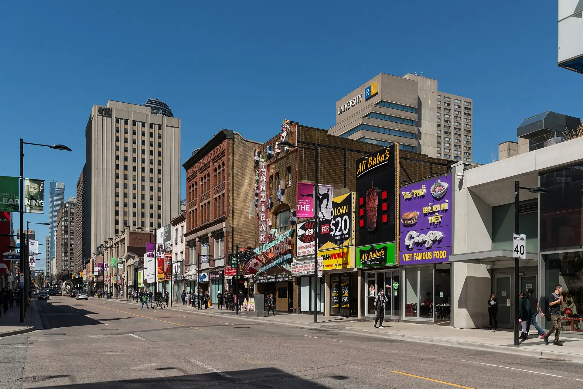
Getting around, in detailGet around · Connect
Get around
Walk inside a cluster, subway or streetcar between clusters, ride-hail late at night. The subway is fast but has few lines; streetcars are slow but go everywhere in the centre.
| Mode | Verdict | Fare | Use it for | What breaks |
|---|---|---|---|---|
| Walking | use | Free | The waterfront, the market and the museum clusters | The PATH is an indoor route between towers. |
| Subway | use | About C$3.35 (≈ US$3) (check) | Line 1 between Union, the ROM and Yorkville | Tap a contactless card at the gate; a two-hour transfer applies. |
| Streetcar | use | About C$3.35 (≈ US$3) (check) | 505 Dundas, 504 King and 510 Spadina | Slow at rush hour; check the app. |
| Ride-hail and taxi | use | C$10–25 (≈ US$8–19) for a downtown ride | Late nights, airport transfers and bad weather | Prices surge in rain and at events. |
Metro and rail lines
Toronto has a subway with four lines; Line 1 is the main route for visitors. Trains run about 06:00–01:30 (check); the subway does not run all night.Toronto has a subway with four lines; Line 1 is the main route for visitors. Trains run about 6:00 AM–1:30 AM (check); the subway does not run all night.
Line 1 Yonge–University
openA U-shaped line through Union, Museum, Bay and Bloor–Yonge; trains every 3–6 min
- Union — Union Station, the CN Tower, the waterfront
- St. Patrick — The Art Gallery of Ontario
- Museum — The Royal Ontario Museum
- Bay and Bloor–Yonge — Yorkville and shopping
City buses a visitor actually uses
| Bus | Route | Useful for | Fare | Note |
|---|---|---|---|---|
| 505 | Dundas streetcar west from downtown to Kensington and Chinatown | Kensington Market | About C$3.35 (≈ US$3) (check) | Runs every 5–10 min in the day.(check) |
| 504 | King streetcar east to the Distillery District | The Distillery District | About C$3.35 (≈ US$3) (check) | Busy at rush hour.(check) |
Taxis and ride-hailing
Uber
app
Fixed price shown before you ride.
Lyft and licensed taxis
app
Metered cabs at ranks; card accepted.
On foot and car-free hours
| Where | When | Note |
|---|---|---|
| Union Station to the CN Tower | All day | The SkyWalk is indoors and heated. |
| Front Street East | Morning | A flat walk to the market. |
More on getting around
Addresses use a street number, the street name and a postal code (A1A 1A1); postal codes narrow the area but do not give an exact block.
Connect
| Option | Verdict | What breaks |
|---|---|---|
| Tourist eSIM bought before you fly | use | No counter, no queue; data only on most plans. |
| Rogers, Bell, Telus or Freedom store | use | A prepaid SIM costs about C$30–55 (≈ US$25–40) for 30 days; bring your passport. |
TTC app or Transit
Subway, streetcar and bus times
Real-time arrivals; tap a card at the gate.
Uber and Lyft
Rides
Prices are shown before you ride; surge on wet days.
Presto
Transit fare card
Optional; contactless card also works.
- Wi-Fi
- Free in cafés, libraries and many attractions.
- Power
- 120 V, US-style plugs.
Luggage
Where big bags are a problem, and how to get rid of them for the day.
Rule
- Lockers
- Lockers at Union Station and some attractions; hotels hold bags after check-out.
- Forwarding
- No forwarding service culture; keep the big bag at the Toronto hotel for day trips.
- Dead zone
- Late flights: ask the hotel to hold bags; use the UP Express from Union Station to the airport.
Bags, area by area
4 walking areas rated
- Bags painful
- Bags ok
Union Station, CN Tower and the waterfrontSt. Lawrence Market and Old TownYorkville and the Royal Ontario Museum
Lockers, forwarding and the gap between check-out and check-in are covered once, under Luggage.
See & doWalking clusters, day plans and the places worth the time
See & do
Walking clusters, day plans and the places worth the time
Clusters
Plan by cluster: each is a walkable area with a rescue point and a bag rule.
Start here: Union Station is the transit hub, the CN Tower is a short walk, and the lakefront path is flat; go up the tower on a clear morning.
rescue 100% · max p90 5.7′ · half
Late-morning cluster: the market's food stalls are best at open-to-lunch; walk the Old Town blocks after, all flat and on the grid.
rescue 100% · max p90 6′ · 90m
Afternoon cluster on foot: Kensington's lanes, vintage shops and food stalls, then Spadina Avenue for dumplings; busy at weekends, quieter on weekday mornings.
rescue 100% · max p90 6′ · half
Museum-and-shopping cluster: the ROM at opening, then Yorkville's streets; a good wet or cold day, all within a few blocks.
rescue 100% · max p90 6′ · half
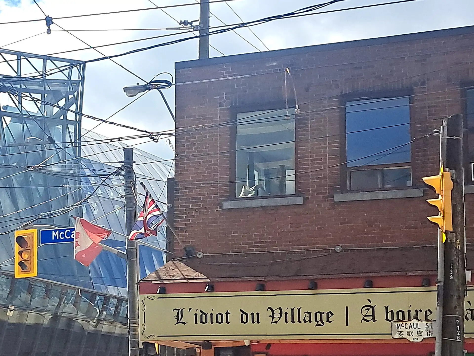
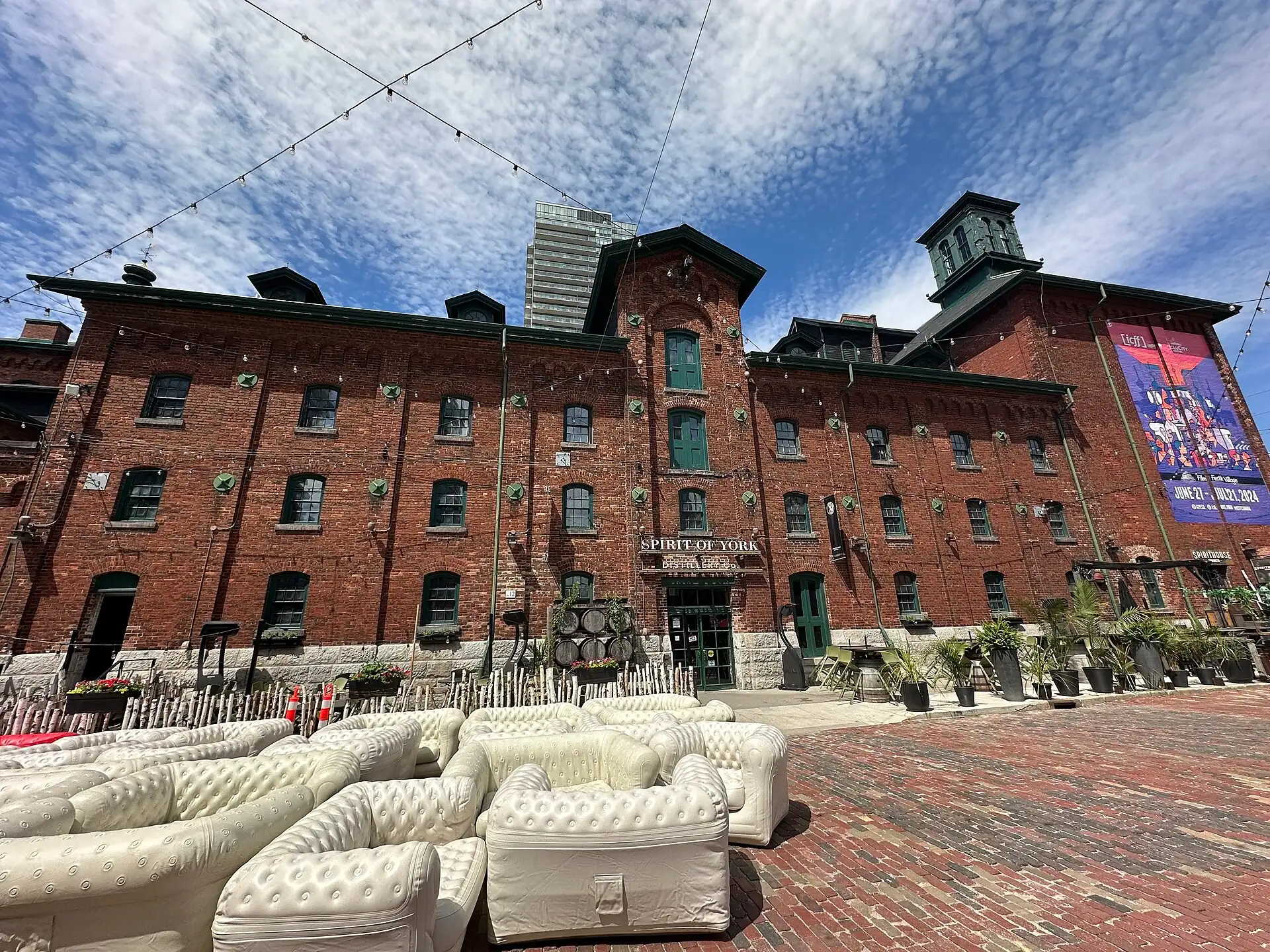
Days
Ready-made day plans, timed against opening hours and walking distances.
How long are you staying?
Loose outlines in the city’s rhythm: outdoors on the clear day, museums when it rains. The timed day plan checks the transit times.
1 day
A stopover
- 09:00CN Tower — CN Tower
- 12:00St. Lawrence Market — Lunch at St. Lawrence Market
- 14:30Kensington Market — Kensington Market
Skip: The ROM, the islands and Niagara.
Toronto in 3 days
3 daysWaterfront and market first, Kensington and Chinatown for the afternoon, the ROM on the last morning with the bags already sorted.
Day by day
Day 1 — CN Tower, then St. Lawrence Market lunch
Day 2 — Kensington Market and Chinatown
Day 3 — the ROM, car to Pearson at 14:00
- 09:30Royal Ontario Museum (ROM)
- 14:00Car to Pearson at 14:00
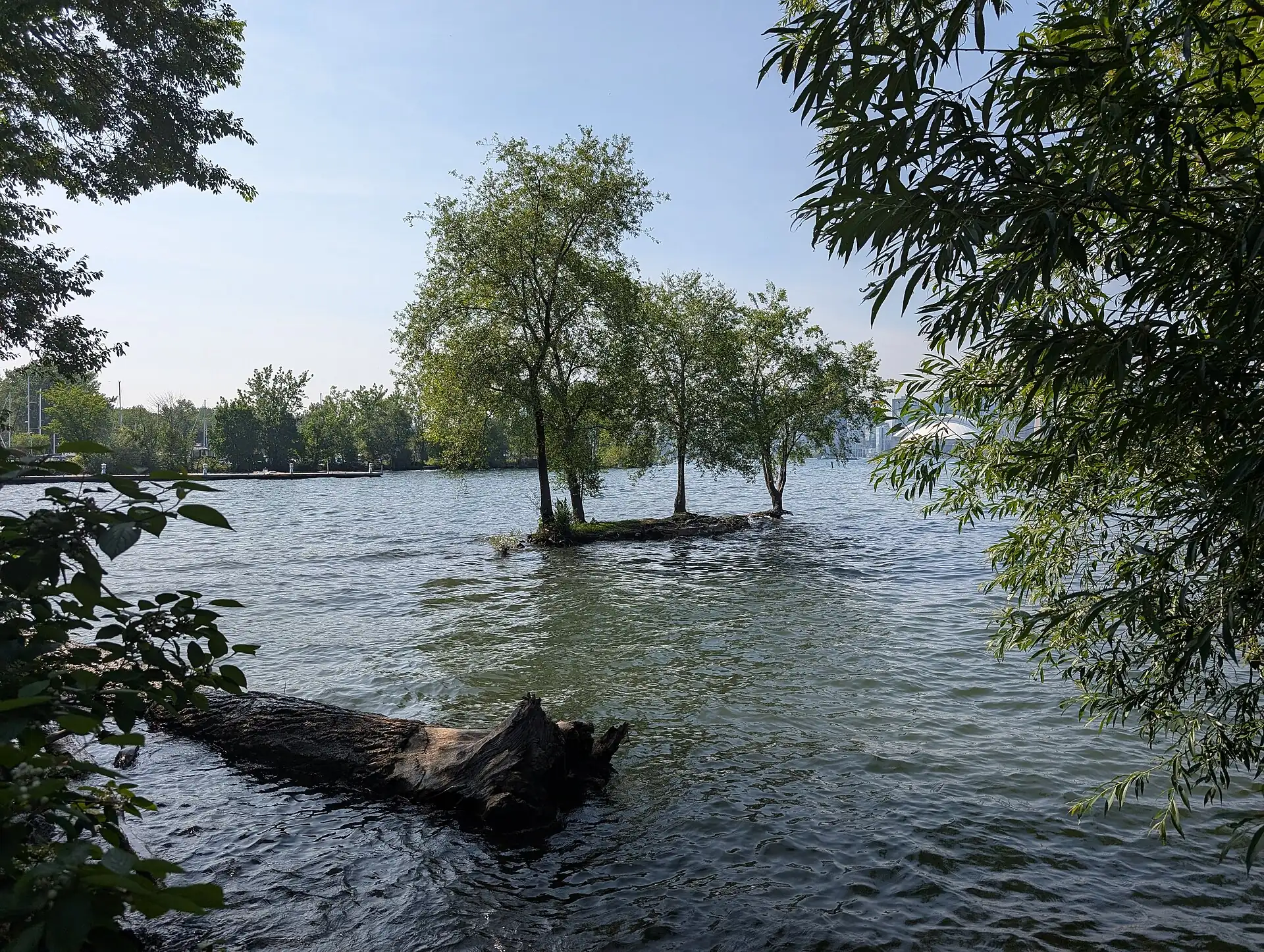
Places
“Best time” is when to arrive for the fewest crowds, for example “before 08:30”; “Go any time” means the hour makes little difference. More sights follow under “More sights and museums”.
7 places. Filters use the guide’s own ratings; a place with no rating is left out when a filter is on.
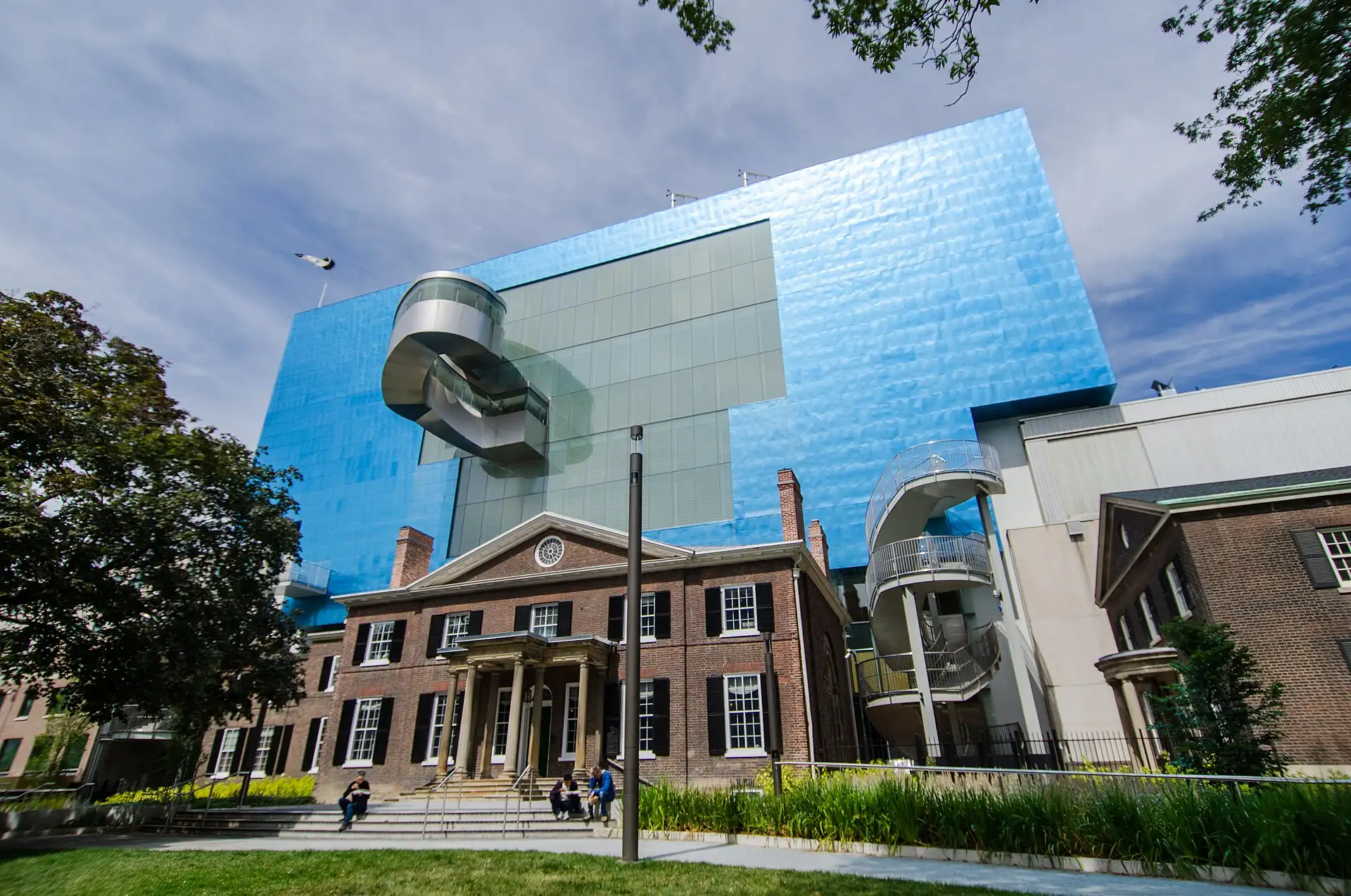
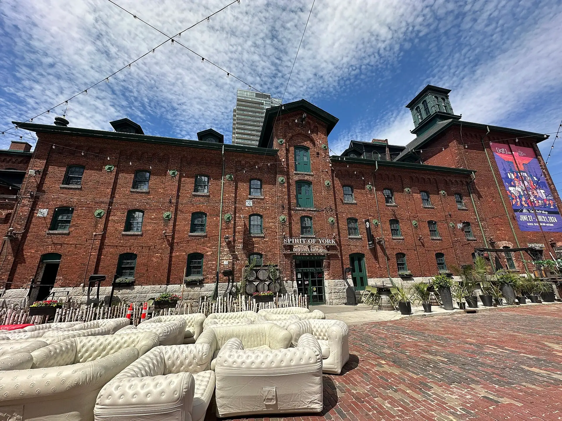
Tours, classes and shows in Toronto →
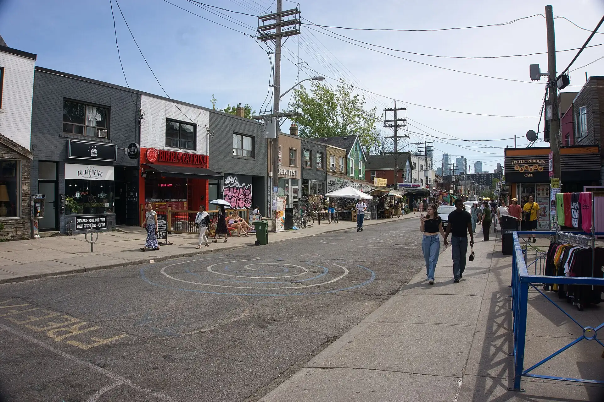
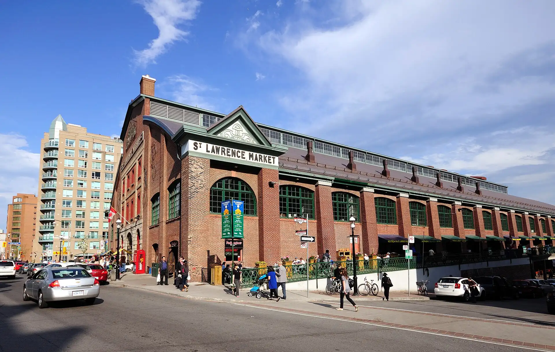
If you do ten things in Toronto
Ranked for a first visit of 2–4 days. Prices are 2026 estimates; hours marked (check) on the linked pages still need confirming.
- 1
The symbol of the city and a view over the lake; go on a clear morning.
- Time
- 1–2 h
- Best
- Clear morning
- Cost
- C$45–55 (≈ US$35–40)
- 2
A food hall for a peameal sandwich; closed Sunday and Monday.
- Time
- 1–1.5 h
- Best
- Weekday before noon
- Cost
- C$10–25 (≈ US$8–19)
- 3
Dinosaurs, the Bat Cave and Chinese galleries in an old and new building.
- Time
- 2–3 h
- Best
- Opening
- Cost
- C$26–32 (≈ US$19–25)
- 4
Vintage shops and small food counters on a walkable grid.
- Time
- 1.5 h
- Best
- Weekday 11:00–15:00
- Cost
- Free; food C$10–25 (≈ US$8–19)
- 5
A 15-minute ferry to beaches and the skyline view.
- Time
- 3–5 h
- Best
- Before 11:00 on a dry day
- Cost
- C$9–10 (≈ US$7–8)
- 6
Canadian art, Henry Moore and a Gehry staircase.
- Time
- 2 h
- Best
- Weekday afternoon
- Cost
- C$30 (≈ US$25)
- 7
Cobbled lanes, galleries and a winter market.
- Time
- 1–2 h
- Best
- Weekday afternoon
- Cost
- Free
Good for…
Verdict is how well Toronto works for that traveller, not how nice it is.
Compact clusters joined by transit.
- 1CN Tower on a clear morning — Shows how the city fits together.
Food from many cuisines within a few blocks.
- 1St. Lawrence Market — A peameal sandwich and cheese.
- 2Rol San — Dim sum in Chinatown.
Museums, the aquarium and the islands.
- 1Royal Ontario Museum (ROM) — Dinosaurs and the Bat Cave.
Hotels are pricey; food and museums are fair.
- 1Kensington Market — Free to walk and cheap food.
Tours and classes: book or skip
Book through the operator’s own site or the hotel, with written inclusions and a cancellation policy. Prices per person, 2026 estimate.
| Tour or class | Verdict | Typical price | Why | Check before paying |
|---|---|---|---|---|
| Niagara Falls day tour from Toronto | book | C$100–200 (≈ US$75–150) | Transport and timing are handled; the day is long. | Operator name, boat tour included, drop-off time. |
| Walking tour of Old Toronto or food walk | book | C$25–80 (≈ US$19–60) | A guide explains the neighbourhoods; two hours is enough. | Group size and meeting point. |
| Toronto Islands bike tour | maybe | C$40–60 (≈ US$30–45) | Convenient if you do not want to rent; the ferry is separate (check). | Whether the ferry ticket is included. |
What each season brings
Spring
Mar–May
Blossoms in the parks and patios open in May.
Watch: Cold and wet days in March and April.
Summer
Jun–Aug
Festivals, patios, beaches and long light.
Watch: Heat, humidity and hotel prices.
Autumn
Sep–Nov
Clear days, autumn colour and the film festival.
Watch: Grey and cold in November.
Winter
Dec–Feb
Christmas lights, skating and museums.
Watch: Ice, snow and short daylight.
Photo spots and the light
Light times are for clear days; overcast days flatten the colours.
| Spot | Best light | Tip |
|---|---|---|
| Roundhouse Park lawn | Morning | The tower from the base with the sun behind you. |
| Ward’s Island boardwalk | Sunset | The skyline over the water; check the last ferry back. |
| Trinity Street, Distillery District | Morning | Brick and cobbles without crowds. |
Toronto travel FAQ
Answers are 2026 desk estimates; fares and rules marked (check) change.
How many days do I need in Toronto?
Three days cover the four clusters; add a day for the islands and one for Niagara Falls.
Is Toronto safe at night?
Yes for violence toward tourists; the common problems are theft on transit and in crowds. Use ride-hail late at night.
Do I need cash?
Rarely: cards work almost everywhere. Carry C$40–60 (≈ US$30–45) for small stalls and tips.
What is the best month to visit?
June and September are the best; July and August are hot and busy, and January is very cold.
How do I get from Pearson to downtown?
The UP Express takes about 25 minutes to Union Station; a taxi or ride-hail costs C$60–90 (≈ US$45–70) and takes 35–75 minutes.
Do I need a visa?
Many visitors need an eTA or a visa; check the Canadian government website before you fly.
More to see and doSee & do · Learn & work · Rain & heat · Free things · Wheelchair and stroller
Free things to do
Sights in Toronto that cost nothing to enter. Each is described under Places or More sights; extra costs inside are marked there.
Wheelchair and stroller, place by place
How each place in this guide works for wheels, from its own page. Ratings are desk estimates unless a page says it was checked on the ground.
| Place | Step-free | Wheelchair | Stroller | What to know |
|---|---|---|---|---|
| Art Gallery of Ontario (AGO) | yes | good | good | None on the main route. |
| CN Tower | yes | good | ok | No stairs on the normal route. |
| Distillery District | partial | caution | ok | Some steps at shop doors. |
| Kensington Market | partial | caution | ok | Some shops have one or two steps. |
| Royal Ontario Museum (ROM) | yes | good | good | None on the main route. |
| St. Lawrence Market | partial | ok | poor | The entrance is level; some stairs between levels. |
| Toronto Islands (ferry) | yes | ok | good | The ferry ramp is level in most cases. |
See & do
11 of 11
- Views
The view over the lake and the islands; go on a clear morning.
Waterfront · Daily, times vary (check) · C$45–55 (≈ US$35–40)(check)
- Museums
Dinosaurs, the Bat Cave and Chinese galleries.
Yorkville · Daily, times vary (check) · C$26–32 (≈ US$19–25)(check)
- Museums
Group of Seven, Henry Moore and a Gehry staircase.
Kensington and Chinatown · Closed Monday (check) · C$30 (≈ US$25)(check)
- Markets
A food hall for a peameal sandwich and cheese.
St. Lawrence · Tue–Sat (check) · Free entry(check)
- Markets
Vintage shops and food counters.
Kensington · Shops 11:00–18:00Shops 11:00 AM–6:00 PM · Free(check)
Beaches, bikes and the skyline.
Waterfront · Ferry times vary (check) · C$9–10 (≈ US$7–8) return(check)
- street
Cobbled lanes and galleries.
St. Lawrence · Streets always open; shops 11:00–18:00Streets always open; shops 11:00 AM–6:00 PM · Free(check)
Ripley’s Aquarium of Canada
attractionA large aquarium beside the CN Tower; book a timed ticket.
Waterfront · Daily (check) · C$40–50 (≈ US$30–40)(check)
Hockey Hall of Fame
MuseumsA museum of ice hockey with the Stanley Cup; check the hours.
Financial District · Daily (check) · C$25–30 (≈ US$19–25)(check)
A Toronto Blue Jays or Maple Leafs game
Shows & musicBaseball in summer, hockey in winter; buy from the official site.
Rogers Centre and Scotiabank Arena · Match times vary (check) · C$40–200 (≈ US$30–150)(check)
Winter skating at Nathan Phillips Square
activityAn outdoor rink beside the Toronto sign.
City Hall · Winter only (check) · Free or a small rental fee(check)
- Booking
- The CN Tower, the aquarium and special exhibitions sell out on holidays and wet weekends; book a timed ticket a day or two ahead.
Learn & work
| What | Where | Cost | Note |
|---|---|---|---|
| English language courses | Language schools downtown | From about C$250 (≈ US$190) a week (check) | Most courses run all year.(check) |
| Cooking classes and food walks | Kensington and St. Lawrence | C$60–120 (≈ US$45–90) | Book ahead; some offer vegetarian menus.(check) |
Working here
- Tourist entry
- A visitor may not work; check eTA or visa rules before you fly.
- Work permit
- Foreign workers need a permit; check the Canadian government website.
Rain-day and heat-day plan
Rain day
Rain and snow are common: plan one indoor stop for every outdoor stop, and use the PATH and subway to move between them.
- 01Royal Ontario Museum (ROM) — A full indoor half-day.
- 02Art Gallery of Ontario (AGO) — Art and a spiral staircase.
- 03St. Lawrence Market — A covered market and food.
Heat day
Above 28 °C is hot and humid: take shade breaks and drink water.
- 09:00CN Tower — Cooler and clearer at opening.
- 11:00Toronto Islands (ferry) — A breeze on the water.
- 14:00Royal Ontario Museum (ROM) — Air-conditioned galleries.
Day-trips and nearby
Places you can reach from Toronto in a day or with one night away, with the route and what it costs. Door to door, not ride time.
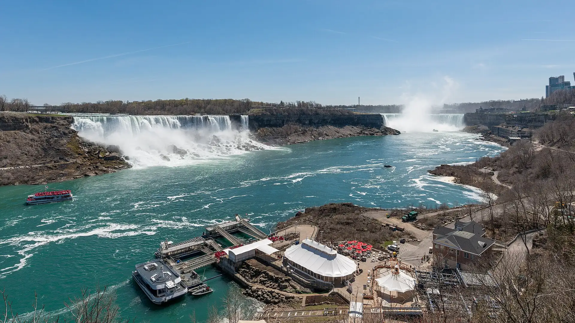 Photo: DXR, CC BY-SA 4.0
Niagara Falls
goGO Transit train (seasonal, check), coach or car about 1.5–2 h
Best in summer; view from the Canadian side; check the boat tour season.
- Time
- Full day
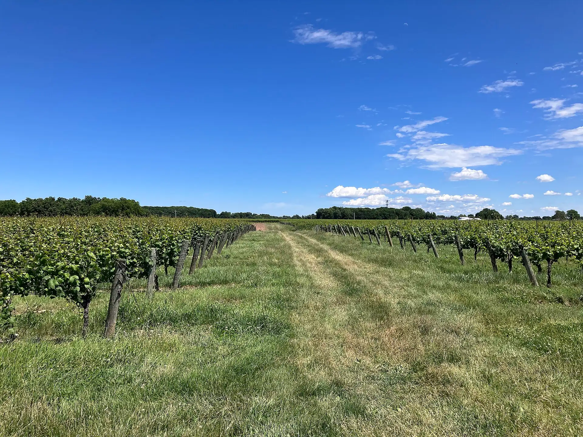 Photo: Gogerr, CC BY 4.0
Niagara-on-the-Lake
goCar or tour about 1.5 h
Wineries and a small town; a tour is easier than driving with wine.
- Time
- Full day
Hamilton and its waterfalls
goGO train or bus about 1–1.5 h
Waterfall trails; check park rules and permits.
- Time
- Half to full day
 Photo: Stratford Computers, CC BY-SA 4.0
Stratford (theatre)
go off seasonCar or coach about 2 h
A festival town; check the season and shows.
- Time
- Full day
Go next
Eat & sleepWhere to eat and which area to sleep in
Eat & sleep
Where to eat and which area to sleep in
Eat
A short list of places worth crossing the city for, each with how to get a seat.
Restaurant finder: filter every place to eat in Toronto →
Vegetarian-friendly score
3.5 / 5 · Good
- Country diet noteOur country guide rates vegetarian eating as easy.2 / 2
- Places to eat in this guide3 of 6 places with a known answer are vegetarian-friendly, 3 partly.1.13 / 1.5
- Budget eating lines0 vegetarian lines in "Eat by budget".0 / 0.6
- Meat-free national dishes5 meat-free dishes in the country food list.0.4 / 0.4
- Dedicated vegetarian kitchens0 mentions of vegetarian restaurants, Buddhist or fasting kitchens.0 / 0.5
Country note: Easy in cities; ask about beef gravy on poutine.
Vegetarian places near me →Make a diet card →
How we score
- Country diet note (up to 2): easy 2, workable 1, mixed 0.75, hard 0; no note 0.5.
- City places to eat (up to 1.5): 1.5 × (vegetarian-friendly + half of partly friendly) ÷ places with a known answer; needs 3 or more known places.
- Budget eating lines marked vegetarian (up to 0.6): 0.2 each.
- Meat-free national dishes (up to 0.4): 0.1 each.
- Dedicated vegetarian kitchens mentioned — Buddhist chay, shōjin ryōri, Jain, fasting food, vegan cafés (up to 0.5): 0.1 each.
- Total rounded to the nearest half point, 0 to 5. Built from our own pages only, not from reviews.
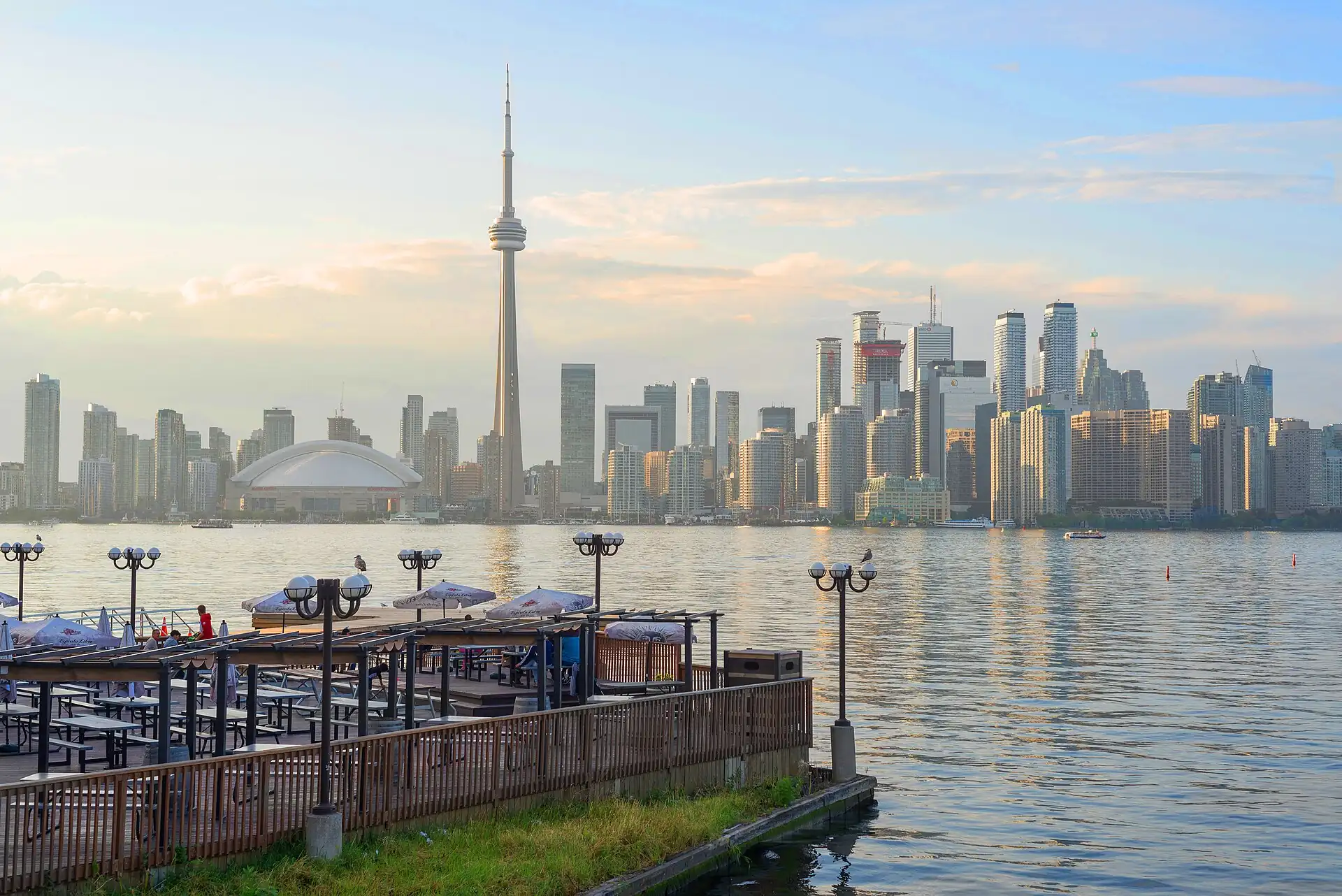
Eating and drinking guideEat by budget · Drink
Before you sit down to eat
Short version; full text linked
Eat by budget
Under C$15 (≈ US$11) a meal
| Where | Order | Area | Price | Note |
|---|---|---|---|---|
| Pancho’s Bakery | Pastry and coffee | Kensington | C$5–12 (≈ US$4–9) | Eat in the park. |
| Carousel Bakery | Peameal bacon sandwich | St. Lawrence Market | C$9–14 (≈ US$7–11) | Tuesday to Saturday. |
Dishes to know
| Dish | What it is | Where to look | When | Price |
|---|---|---|---|---|
| Peameal bacon sandwich | Cornmeal-crusted back bacon on a bun | St. Lawrence Market | Breakfast or lunch | C$9–14 (≈ US$7–11) |
| Dumplings and dim sum | Steamed or fried Chinese dumplings | Chinatown on Spadina | Lunch | C$9–35 (≈ US$7–30) |
| Butter tart | A small pastry with a sweet filling | Bakeries and markets | Any time | C$3–6 (≈ US$3–5) |
| Poutine | Chips, gravy and cheese curds | Casual restaurants and late-night counters | Late night | C$8–14 (≈ US$6–11) |
- Look for busy counters with a short menu.
- Check whether tip or tax is already on the bill; in Ontario, 13% HST is added at the till and tips are separate.
Drink & nightlife
| Where | What | Until | Note |
|---|---|---|---|
| A pub on Front Street East or the Distillery District | Pub or brewery | About 23:00–02:00About 11:00 PM–2:00 AM | Confirm hours locally. |
| Bars in the Entertainment District | Cocktail bars and clubs | 02:002:00 AM | Busy on weekends; confirm locally. |
By style
| Style | What | Where | Price | Until |
|---|---|---|---|---|
| Craft beer | Local breweries with pale ales and lagersAsk for a sample; a flight is a good first order. | Distillery District and breweries in the east end | C$8–12 (≈ US$6–9) a pint | Pub hours |
| Ontario wine and ice wine | Wines from the Niagara regionIce wine is sweet and small-serve. | Wine bars and LCBO | C$9–15 (≈ US$7–11) a glass | Pub hours |
Rules that bite
- The legal drinking age in Ontario is 19.
- Drinking in the street or a park is illegal except in licensed patios.
- The drink-driving limit is 0.05%; use a taxi or ride-hail.
Sleep
Pick the area first: it decides your walk home at night and your first morning.
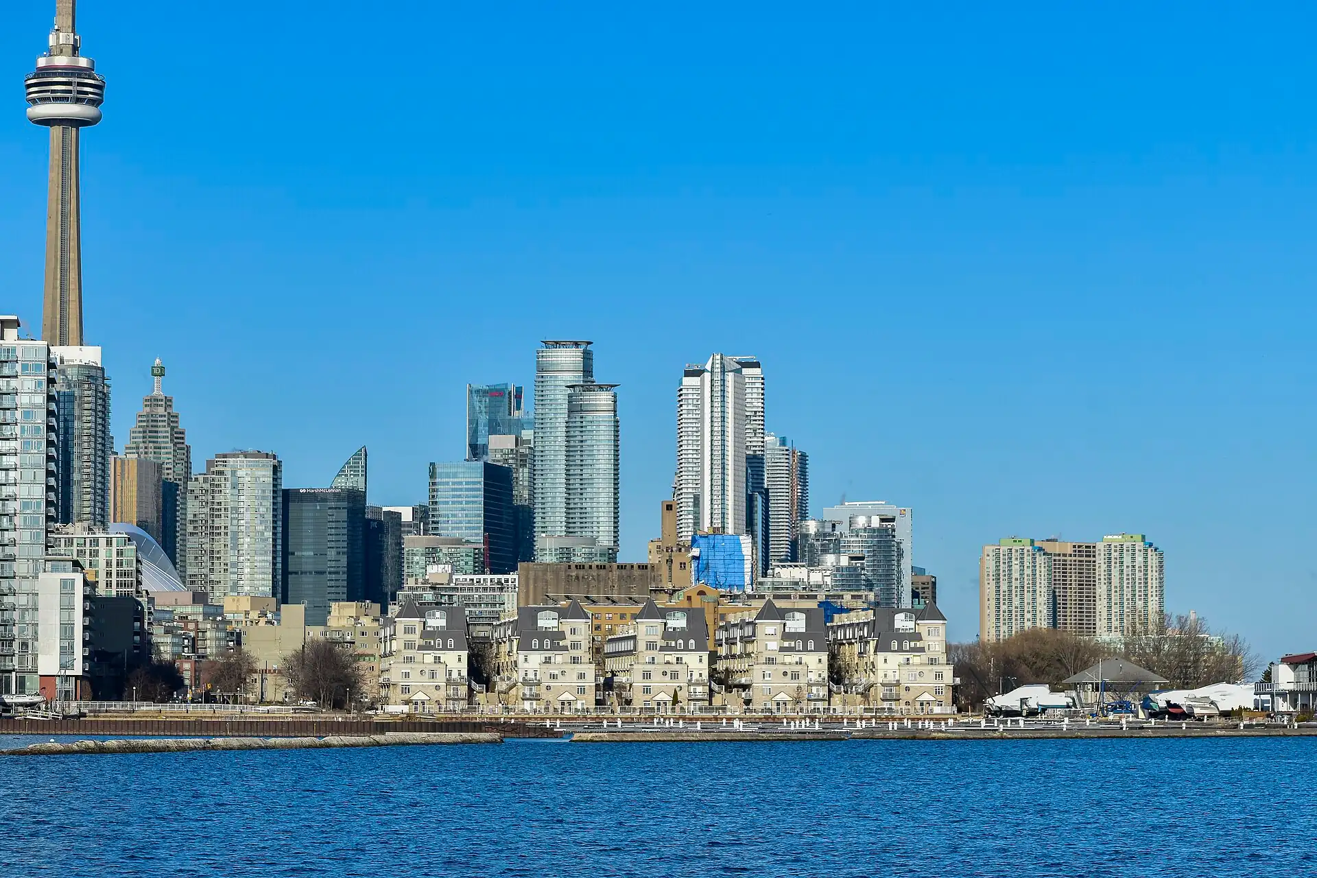
Which neighborhood fits you
Three questions, one recommendation, with the reasons.
Your best fit
- The CN Tower and the market are on foot.
- 24-hour desks are the norm.
Watch out: Higher prices; rooms fill for events.
Next best: Yorkville
Built from our 1–5 desk scores per area; your answers stay in this browser.
More on sleepingSleep by budget · Your area · With kids
Sleep by budget
| Band | Price | Where | Room types | What to expect |
|---|---|---|---|---|
| budget | C$45–65 (≈ US$35–50) dorm bed · C$140–200 (≈ US$110–150) double | Downtown, Kensington and Chinatown | Hostels, small hotels | Small rooms; shared bathrooms in the cheapest; noise on weekends. |
| mid | C$220–380 (≈ US$160–300) | Downtown, Yorkville | 3–4 star hotels | Lift, breakfast sometimes, 24-hour desk. |
| high | C$380 (≈ US$300)+ | Yorkville, Financial District | Luxury hotels | Large rooms, concierge and spa. |
Booking checks
- Book early for TIFF, Pride and holiday weekends.
- Ask for a high floor away from the street.
Which area is yours
| If you are | Sleep in | Because |
|---|---|---|
| First visit, 2–4 nights | Downtown core (Union Station) | The best transit link and walking access to the tower and market. |
| Museums and quiet nights | Yorkville | A short walk to the ROM and calm streets. |
First-timers: Union Station, the subway and the UP Express to the airport are at the door; choose a hotel on or near Front Street with a 24-hour desk.
Quieter and more upmarket: two subway stops from the ROM, with cafés and shops at the door and the subway to Union in about 10 minutes.
Areas are in our default order until you tick a priority.
Scores are 1–5 desk judgements per priority (2026).
With kids
- Toronto is easy with children: the subway is accessible and the museums are indoors. The CN Tower, the ROM, the Toronto Islands and the aquarium suit ages 4 and up.
- Dress for the cold: children lose heat fast. Bring a stroller with big wheels for slush.
PracticalMoney, essentials, safety and the pocket card
Practical
Money, essentials, safety and the pocket card
Money
What a day costs at three comfort levels, and how to pay.
- Budget
- C$80–140 (≈ US$60–110) excl. bed / day
- Mid
- C$140–260 (≈ US$110–190) excl. bed / day
- High
- C$260 (≈ US$190)+ excl. bed / day
- Transit card
- Tap a credit or debit card, or a PRESTO card, on subway, streetcar and bus; no separate ticket is needed for a short trip.
- Cash rule
- Cards work almost everywhere; carry a small amount of cash for markets and tips.
More on moneyCosts · Budget · Buy
What things cost
- Peameal bacon sandwich, market stallC$9–14 (≈ US$7–11)
- UP Express, Pearson to Unionabout C$10–13 (≈ US$8–10) (check)
- CN Tower, adultC$45–55 (≈ US$35–40)
- Toronto Islands ferry, adult returnC$9–10 (≈ US$7–8)
Trip budget
| Hotel double room1 × 4 nights × C$280 | C$1,120 |
| Food, local transport, entries2 × 4 days × C$210 | C$1,680 |
| Airport train (UP Express), both ways2 × C$26 · Tap a card; check the fare | C$52 |
| eSIM or tourist SIM2 × C$18 | C$36 |
| Buffer 10%Price creep, a taxi you did not plan, one splurge | C$289 |
| Trip total≈ C$397 per person per day, bed included | C$3,177≈ US$2,500 |
Film festival, Pride and holiday weekends: add 30–100%.
2026 estimate in Canadian dollars; flights and tours excluded. Your choices stay in this browser.
Prices of common things
| Dumplings, a plate | C$9–14 (≈ US$7–11) |
| TTC single fare | about C$3.35 (≈ US$3) |
| CN Tower ticket | C$45–55 (≈ US$35–40) |
2026 estimate; check locally.
Buy
- Bargaining
- There is no haggling in Toronto shops or markets; the price is the price. At a vintage or flea market a polite offer may work on used goods.
- Fixed-price check
- Sales tax (13% HST) is added at the till, not in the shelf price. Tourists cannot claim it back.
Markets and shopping streets
| Where | What | When | Haggle | Note |
|---|---|---|---|---|
| St. Lawrence Market | Food hall, peameal bacon, cheese, bread and produce | Tuesday–Saturday, times vary (check) | none | A weekday morning is the calm time. |
| Kensington Market | Vintage clothes, food counters, cafés | Most shops 11:00–18:00 (check)Most shops 11:00 AM–6:00 PM (check) | none on food, sometimes on vintage | Pedestrian Sundays are the last Sunday of the month in season. |
Shops by what they sell
| For | Where | Hours | Note |
|---|---|---|---|
| Maple syrup and Canadian food gifts | St. Lawrence Market and supermarkets | Shop hours | Check the grade and origin on the label. |
| Outdoor clothing and boots | Queen Street West and Yonge Street shops | About 10:00–20:00 | Sales in January and after Christmas. |
Changing money
| Where | Verdict | Why |
|---|---|---|
| Bank branches (RBC, TD, Scotiabank, BMO, CIBC) | use | Fair rate; bring your passport; office hours only. |
| Airport exchange kiosks | avoid | Poor rate; use an ATM instead. |
ATMs
- Per withdrawal
- Bank ATMs allow C$500–1,000 (≈ US$400–750) per withdrawal for a foreign card (check the screen).
- Fees
- Bank ATMs may charge C$3–5 (≈ US$3–4) for a foreign card; your home bank may add a fee. Decline the on-screen currency conversion.
Essentials and accessEssentials · Access
Essentials
- Plugs & power
- 120 V, 60 Hz; the same two- and three-pin sockets as the US (types A and B). No adapter needed for US devices; UK and EU visitors need one.
- Toilets
- Union Station, malls, cafés, museums and larger shops; public toilets are limited, so buy a coffee if you need one.
- Health
- Travel insurance with medical cover is a must: hospital care is costly for non-residents. Carry your prescriptions in the original packs.
- Accessibility
- The subway has accessible stations (check the TTC list); streetcars have low-floor vehicles on some lines; winter ice is hard on wheels.
- Laundry
- Self-service laundromats in most neighbourhoods; hotels charge per item.
- Emergency numbers
- 911 for police, fire and ambulance.
Pack
- Warm layers and a proper coat from November to April
- Grippy waterproof boots in winter
- A light rain jacket in spring and autumn
- A refillable bottle and sun cream in summer
- A small daypack for the museums
Accessibility
Toronto is workable on wheels in the central grid, but winter ice, some old subway stations and streetcar stops without ramps limit access.
- Pavements
- Wide on the main streets; snow and ice can block kerb ramps in winter.
- Subway
- Line 1 stations are increasingly accessible; check the TTC list before you go.
- Streetcar
- Low-floor vehicles on some lines; check the TTC page.
Sights, step-free or not
| Royal Ontario Museum (ROM) | step-free | Lifts and level floors. |
| Art Gallery of Ontario (AGO) | step-free | Lifts and level floors. |
| CN Tower | step-free | Lifts; the EdgeWalk is not accessible. |
| Kensington Market | with help | Narrow, uneven streets and steps at shops. |
Survive
Safety basics, the lines not to cross, and practical habits that save the day.
Safety
- Toronto is generally safe; keep valuables out of sight on transit and in crowded streets.
- Winter: dress in layers, wear grippy boots on icy pavements; frostbite is a risk below about -15°C (5°F) wind chill.Winter: dress in layers, wear grippy boots on icy pavements; frostbite is a risk below about 5°F (-15°C) wind chill.
- Emergency: 911 for police, fire and ambulance.
Red lines
- Tipping is expected: 15–20% in restaurants and bars.
- Do not photograph people at close range without asking.
Practical
- Toilets: malls, Union Station and cafés; public toilets are limited.
- Tap water is safe to drink.
More on staying safeStay safe · Stay healthy · Safety map · Solo & women · Etiquette · Cope · Scams
After dark, by area
2 flagged areas
St. Lawrence Market and Old Town
Take careKensington Market and Chinatown
Take care
Day = about 07:00–19:00. What to watch in each area, day and night →
Scams and red flags
Walk away if you see these
- Unlicensed drivers at Pearson and Union Station offering a ride: use the taxi rank, the UP Express or a ride-hailing app.
- Fake charity collectors with clipboards on busy streets: donate only through an official page.
- Ticket resellers outside events or the CN Tower: buy from the official operator; a "skip-the-line" ticket is a resold ticket.
- Card-skimmer risk at standalone ATMs: use bank ATMs inside a branch.
Stay safe
Crossing the road
- 01Look both ways: streetcars and cyclists share the road.
- 02Wait for the walk signal; turning drivers may not stop.
Hustles specific to this city
| Hustle | Where | The tell | What to do |
|---|---|---|---|
| Unlicensed drivers | Pearson and Union Station | A driver approaches you with an offer | Use the taxi rank, UP Express or a ride-hailing app. |
| Resold tickets | Outside attractions and events | A seller offers a skip-the-line ticket | Buy from the official operator. |
- Police
- 911; report theft at the nearest division for an insurance report.
- Winter safety
- Wear boots with grip and keep your phone warm; frostbite is a risk below about -15 °C (5 °F) wind chill.Wear boots with grip and keep your phone warm; frostbite is a risk below about 5 °F (-15 °C) wind chill.
Stay healthy
Air quality by month
| Jan | Feb | Mar | Apr | May | Jun | Jul | Aug | Sep | Oct | Nov | Dec |
|---|---|---|---|---|---|---|---|---|---|---|---|
| ok | ok | ok | ok | ok | mixed | mixed | mixed | ok | ok | ok | ok |
Air quality in Toronto is generally good; summer smog days and wildfire smoke can lift readings. Check a live index before outdoor exercise.
- Tap water
- Safe to drink.
- Cold
- Dress in layers and cover your ears and hands; a wind chill of -20 °C (−4 °F) is hazardous.Dress in layers and cover your ears and hands; a wind chill of −4 °F (-20 °C) is hazardous.
- Heat
- Drink water and rest in shade on humid days above 30 °C (86 °F).Drink water and rest in shade on humid days above 86 °F (30 °C).
Hospitals and clinics: see Cope.
Safety by area and hour
| Area | Day | Night | What to watch |
|---|---|---|---|
| Union Station and the waterfront | fine | fine | Pickpockets in crowds and on the streetcars. |
| St. Lawrence Market and Old Town | fine | caution | Quiet streets after dark; use a ride-hail. |
| Kensington Market and Chinatown | fine | caution | Crowded lanes; watch pockets and bags. |
| Yorkville | fine | fine | Traffic on Bloor Street. |
- Stay alert on the subway platform and streetcar at night.
- Use ride-hail or a licensed taxi after midnight rather than walking through quiet blocks.
Solo, women and LGBTQ+ travellers
Solo
- Very easy alone: cafés and restaurants have counters and shared tables.
- Book the CN Tower and museums online; solo slots are easy to get.
Women
- Toronto is generally safe; keep bags in front on crowded transit.
- Late at night use ride-hail or a licensed taxi.
LGBTQ+
- Canada legalised same-sex marriage in 2005; Toronto is welcoming and has a large Pride in June.
- The Church and Wellesley area is the centre of the community.
Etiquette in Toronto
- Tipping
- 15–20% in restaurants and bars, on the pre-tax bill; C$1–2 (≈ US$1–2) per drink at a bar; round up for taxis.
- Queues
- Queue at bus stops, tills and the subway; stand on the right of escalators.
- Personal space
- People keep their distance; a quiet voice on transit is normal.
- Tax
- 13% HST is added at the till in Ontario.
Cope
Hospitals and clinics that handle foreigners
| Where | Area | Use it for |
|---|---|---|
| Toronto General Hospital | University Avenue, near Queen Street | A large hospital with an emergency department; bring insurance details. |
| Mount Sinai Hospital | University Avenue | A hospital near the financial district; check for emergency access. |
Visa extensions
- Entry
- Most visitors need an eTA (electronic travel authorisation) or a visa; US citizens travelling by air need a passport. Check the Canadian government site before you fly.
- Stay
- Visitors are usually allowed up to six months; the officer sets the period.
Embassies and consulates
| Country | Address | Phone | Note |
|---|---|---|---|
| United States | US Consulate General, 360 University Avenue, Toronto | +1 416 595 1700 | (check) |
| United Kingdom | British Consulate-General, 777 Bay Street, Toronto | +1 416 593 1290 | (check) |
- Emergency
- 911 for police, fire or ambulance.
- Lost passport
- Report to the police, then to your consulate; carry a photocopy.
Apps and offline kitOffline kit
Offline kit
Set up before you leave, so Toronto still works with no signal or a dead roaming plan.
On your phone
- Maps: open the city in Google Maps, tap the place name, then Download offline map (or use an offline-maps app).
- Data: install an eSIM or buy a local SIM before the first taxi; the apps in this guide depend on it.
- Translation: download the local language for camera translation.
- Screenshots: booking confirmations, hotel address in the local script, and the emergency numbers.
This guide
Save the Toronto guide and its pages on this device; it opens without a connection.
Phrases that do the work
Money
Two-dollar coin
Toonie
TOO-nee
Money
One-dollar coin
Loonie
LOO-nee
Transit
Subway and streetcar transfer
Two-hour transfer
two-hour transfer
Food
Peameal bacon
Peameal
PEE-meel
Greeting
Hello (also heard in French)
Bonjour
bon-ZHOOR
Thanks
Thank you
Thanks (eh?)
thanks
Pocket card
Fill in, then print or save as PDF
Stays in this browser only; nothing is sent anywhere.
TorontoToronto
Pocket card · Voykit
My bed tonight
—
—
—
English is spoken throughout; show the street name and postal code.Please take me to this address
Emergency
- Police, ambulance, fire911
- Non-emergency police (Toronto Police Service)+1 416 808 2222
Embassy
Most embassies and consulates are near University Avenue and Bay Street; check the address before you go.
My embassy: —
Fare anchors (2026 estimate)
- Pearson → downtown, taxi or ride-hail: C$60–90 (≈ US$45–70), 35–75 min; traffic at rush hour
- Pearson → Union, UP Express: About C$10–13 (≈ US$8–10) (check), 25 min
- TTC fare, tap card: About C$3.35 (≈ US$3) per ride with a two-hour transfer (check)
Say or show
- Thanks (eh?) — Thank you (thanks)
English is the working language; French appears on signs and some packaging. Show the street name and postal code.
Deep diveHistory, reading, photos and every source
Deep dive
History, reading, photos and every source
Sources
- officialDestination Toronto (official tourism)
- secondaryWikivoyage — Toronto
Ask about Toronto
Loading…
Was this useful?